
Counties are the primary legal divisions of most states. In Louisiana, these divisions are known as "parishes." In Alaska, which has no counties, the statistically equivalent entities are census areas, city and boroughs (Juneau City and Borough), a municipality (Anchorage), and organized boroughs. The entire District of Columbia is considered equivalent to a county for statistical purposes. The primary legal divisions of Puerto Rico are termed "municipios" and are treated by the U.S. Census Bureau, for statistical purposes, as the equivalent of a county in the United States.
When you purchase Maptitude mapping software with the U.S. Country Package, it includes nationwide county boundaries with dozens of demographic variables so that you can create insightful and informative maps at a county level anywhere in the United States. With a few clicks of the mouse, you can create thematic maps that will allow you to quickly analyze data for your area of interest. In addition, Maptitude includes a number of predesigned county level maps in a Map Library.
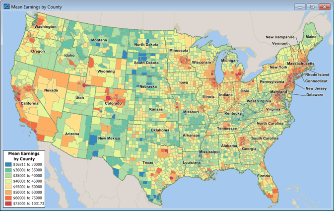
A Maptitude map of U.S. counties with a color theme showing median earnings.

