
Overview Help America Vote Act Featured Clients Other Products & Services Support Pricing
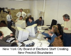 The NYC Board of Elections was in a bind. They had just a few weeks left
to redraw their 5,000 precincts. Three days after they selected Maptitude
P&E, we were on-site training their staff. In just five days they had nearly
completed the project!
The NYC Board of Elections was in a bind. They had just a few weeks left
to redraw their 5,000 precincts. Three days after they selected Maptitude
P&E, we were on-site training their staff. In just five days they had nearly
completed the project!
It goes without saying that the NYC BOE is extremely pleased with Caliper
Corporation's software and support. Of course, they have only scratched the
surface of what they can accomplish with Maptitude P&E. In addition to
reprecincting, they are now using Maptitude P&E to create precinct map
books, metes and bounds reports, street index files and reports, precinct
splits, and unique ballot styles for each election. They are able to geocode
and map voters, count voters and party registrants for each precinct,
precinct split, and ballot style, add new streets, edit geographic
boundaries (e.g., city annexations) and much more.
The New York City Board of Elections uses Maptitude P&E in its central
office as well as in New York's five boroughs. Perhaps their most
significant accomplishment to date has been eliminating the annual $1
million map production cost. Not only were the numerous election district
maps expensive to produce, but by the time they were ready they were either
out-of-date or it was too late in the election cycle for them to be of much
value. Today, using Maptitude, the NYC BOE is able to redraw their election
districts in a matter of days and create both PDF maps for their web site
and in-house printed maps. To see some of their Maptitude-created maps,
visit their web site, http://www.vote.nyc.ny.us/maps.jsp. Each map displays
the election districts in a particular assembly district.
The Orange County (California) Registrar of Voters office has embraced
Maptitude for Precinct and Election Management (Maptitude P&E) and given it
a key role in their preparation for the 2004 general election and future
elections. Using the special tools found in the software, they created
geographic layers for precincts, portions (precinct splits), ballot styles,
voting precincts, polling sites, language assistance, and voting precinct
clusters for polling site coordinators.
Click here to read
the complete case study.
The Johnson County (KS) Elections Office is using Maptitude P&E in a big way, with many additional plans for the near future. Here's a list of their current activities.
Internal mapping for daily system use:
Election oriented mapping:
Integration of Maptitude data:
Delivery and market scope.
Caliper created a census block geographic layer based on the
geographically-accurate county GIS map base. The elections office can use
the redistricting tools in Maptitude P&E to aggregate the blocks to create
precincts, county council, school, congressional, state legislative, and
other district layers. The end result will be that all relevant layers will
overlay perfectly, enabling Maptitude P&E to perform its "magic" of creating
street index files, precinct splits, ballot styles, metes and bounds
reports, etc. Caliper will aggregate the blocks to create a census tract
layer and attach the census data to the block and tract layers, enabling the
elections office to create maps showing detailed census data. Caliper is
also working with Election.com to create an interface between their VR
software, which is used by Johnson County Elections, and Maptitude P&E.
Read a case study by Connie Schmidt, Election Commissioner (PDF).
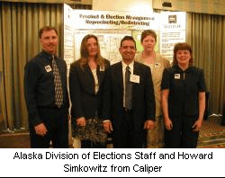 The Alaska Division of Elections had a lot of 200 mile-long problems. They
needed to create new precinct boundaries for the entire state and wanted to
use the Census Bureau’s TIGER geography as the base. The only problem was
that some of their census blocks were over 200 miles long, spanning the
entire length of bays and canals (and more than a few glaciers)! In addition
to needing to chop up these huge blocks into pieces that followed the
desired precinct lines, they also wanted to add new segments to the
underlying line layer that Maptitude P&E uses to automatically create the
metes and bounds report and street index file.
The Alaska Division of Elections had a lot of 200 mile-long problems. They
needed to create new precinct boundaries for the entire state and wanted to
use the Census Bureau’s TIGER geography as the base. The only problem was
that some of their census blocks were over 200 miles long, spanning the
entire length of bays and canals (and more than a few glaciers)! In addition
to needing to chop up these huge blocks into pieces that followed the
desired precinct lines, they also wanted to add new segments to the
underlying line layer that Maptitude P&E uses to automatically create the
metes and bounds report and street index file.
The solution was to use the multi-layer geographic editing tools in
Maptitude P&E. First, they added new segments to the line layer where they
wanted new precinct boundaries. Then they selected the appropriate segments
and had Maptitude P&E split the blocks into pieces with boundaries that
perfectly followed these segments. The central office in Juneau performed
the work and transmitted the results to the four district offices.
Caliper is working as a subcontractor to Diebold Election Systems to
implement Maptitude P&E at the El Paso County Elections office. There are
two main thrusts to the effort. The first is to move all of the precinct and
district boundaries from the Census TIGER maps to the more-accurate county
GIS map base. The second is to integrate Maptitude P&E with the Diebold
election software and the Election.com voter registration software.
In El Paso, precinct boundaries are defined by street segments, railroads,
water features, municipal boundaries, and invisible features. We obtained
Shapefiles for streets, railroads, water features, and municipal boundaries
from the county's Road and Bridge Department. We overlayed these layers to
create a single line layer, in Maptitude format, of line pieces. For
example, where a railroad segment crossed a street segment, we split both
segments in two at the point of intersection. We then used Maptitude P&E's
geographic editing tools to add the invisible features to the line layer,
such as the Franklin Mountains ridge line.
Next, we used the multi-layer geographic editing tools in Maptitude P&E to
select the lines that defined each precinct and started building the
precinct polygons.
Once the precinct layer is complete, El Paso will use the redistricting
tools in Maptitude P&E to aggregate precincts into congressional, state
legislative, and other district layers. They will define school districts
from split precincts. The end result will be that all relevant layers will
overlay perfectly, enabling Maptitude P&E to perform its "magic" of creating
street index files, precinct splits, ballot styles, metes and bounds
reports, etc.
Caliper Corporation has developed an interactive-mapping application for the Maryland State Archives and the State Board of Elections. The web-based application makes it easy for Maryland residents to access information about their representatives to the Maryland General Assembly and to the U.S. Congress. It is designed to show the precinct the voter is in as well as the polling place. This is just one of the many ways that you can deploy our software to improve the election process and qualify for HAVA funding.
The Rose Institute at Claremont McKenna College conducts and publishes
research primarily on California government and politics. Using computer
technology, students and faculty in the Rose Institute advance knowledge
about politics and help create services that make the political process more
democratic. Through the development of large computerized databases and
advanced geographic retrieval systems, students become involved in projects
focusing on such topics as redistricting, fiscal analysis, demographics,
survey research, and legislative regulatory analysis. (You can learn more
about the Rose Institute at
http://rose.claremontmckenna.edu.)
The Rose Institute uses Maptitude, Maptitude for Redistricting, Maptitude
for Precinct and Election Management, and Political Maptitude. Here is what
the Rose Institute has to say about Caliper Corporation in its 2005 report,
"Restoring the Competitive Edge: California's Need for Redistricting Reform
and the Likely Impact of Proposition 77":
"Their longstanding and generous support makes possible all of the Rose Institute's demographic, redistricting, and geographic information systems (GIS) research. Their outstanding, powerful and easy-to-use Maptitude software enables us to train our students up from GIS novices to expert users in only a few hours, and the software's extensive analytic capabilities provide the service and power needed for our work."

