
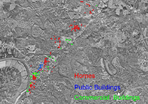
This month we showcase a Clarksville/Montgomery County (TN) GIS Center map created with an older version of Maptitude that highlights the utility of Maptitude in disaster response. The map shows the tornado path and location of damaged and destroyed structures.
See more map infographics Learn more about Maptitude
Featured Maptitude Mapping Software Map: January 2012

