Mapping Software and GIS Glossary

DEFINITION

What are Measures of Compactness?

A district that is not compact may be considered gerrymandered. For this reason, a number of measures of compactness have been devised to assess or defend  the districts in a plan. These measures aim to quantify how compact or dispersed a district is.

What are measures of compactness/measures of compactness definition

Software for Redistricting and Measuring Compactness

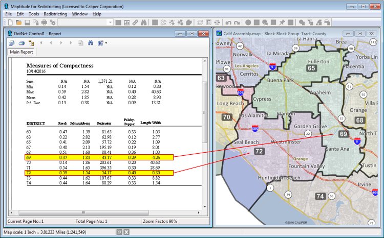
Maptitude for Redistricting is the easy to use, professional tool for political redistricting. Maptitude for Redistricting computes nine measures of compactness:

  • Reock – an area-based measure that compares each district to a circle, which is considered to be the most compact shape possible.
  • Schwartzberg – a perimeter-based measure that compares a simplified version of each district to a circle
  • Perimeter – a test that lets you compare plans where the plan with the smallest perimeter is the most compact
  • Polsby-Popper – a measure of the ratio of the district area to the area of a circle with the same perimeter
  • Length-Width – computes the absolute difference between the width (east-west) and the height (north-south) of each district
  • Population Polygon – computes the ratio of the district population to the approximate population of the convex hull of the district (minimum convex polygon which completely contains the district).
  • Minimum Convex Polygon – similar to the Population Polygon, but without regard to population within the areas
  • Population Circle – computes the ratio of the district population to the approximate population of the minimum enclosing circle of the district
  • Ehrenburg – computes the ratio of the largest inscribed circle divided by the area of the district

Learn More