
![]()
![]()
![]()
![]()
![]()
![]()
![]()
Maptitude is a robust and easy-to-use professional mapping tool that can be used within the energy industry. Maptitude provides all the features that your organization requires in order to uncover answers to your energy market questions.
The extensive capabilities of Maptitude allow you to geographically understand and analyze relationships among the varied energy sectors.
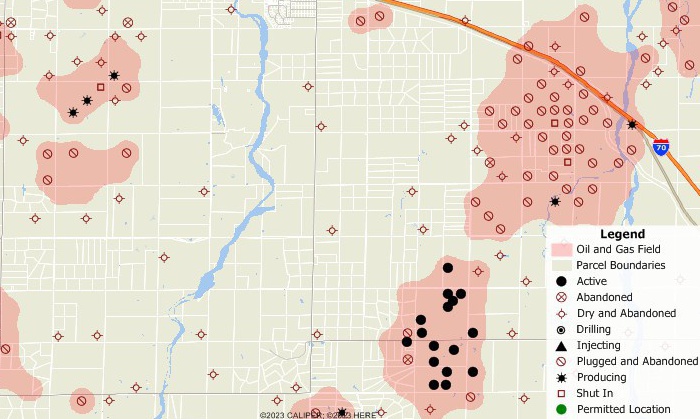
Oil and gas field and well locations with county parcels.
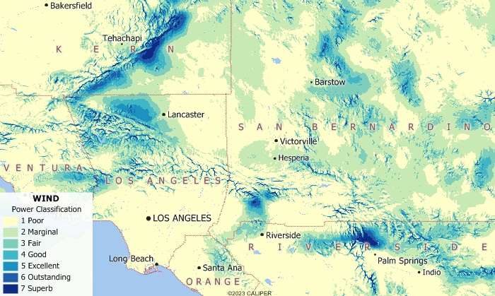
Wind power classification in the Los Angeles region.
Maptitude costs only US$695 and is packaged as a one-stop-solution, shipping with all the tools and data required by energy analysts and policymakers for site assessment, data sharing, and visualization.

Maptitude is an indispensable tool for site assessment and environmental impact studies. For example, Maptitude can assist in locating nuclear reactors by identifying sites away from areas of high population density and man-made hazards, while overlaying seismic, meteorological, geological, and hydrological map layers.
Renewable energy systems are vulnerable to weather and climatic conditions, but combining renewable energy sources into a hybrid system such as solar-wind helps mitigate these dependencies. Maptitude is well suited to mapping locations with favorable energy potential, and for geographically exploring related environmental and economic considerations. For example, Maptitude can map topography and proximity to electric transmission lines when exploring locations for a wind farm.
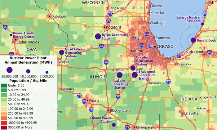
Annual nuclear facility MWh production and population exposure of midwest nuclear facilities.
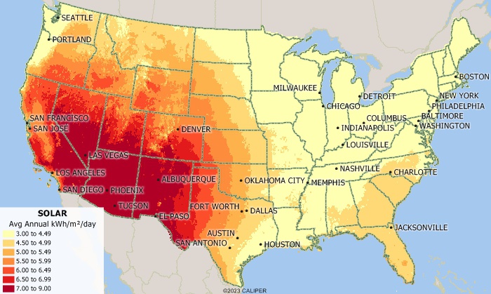
Average annual kWh/square meter/day for the United States.
Maptitude provides a platform that supports data sharing for community outreach, as well as for business data access, asset management, network information updates, customer identification, and report preparation.
Maptitude supports location queries and has one of the largest file format import/export libraries in the industry that encompasses GPS, CAD and GIS file types.
Transmission and distribution field technicians can use the GIS visualizations and accurate GPS support provided by Maptitude to assist with work order management. Maptitude can provide detailed national street maps (for the USA, Canada, and more...) that are useful when managing staff in the field, especially when they are on loan for emergencies from other states and countries.
Maptitude combines a comprehensive map database with an attractive and easy to use graphical interface for viewing and manipulating data. When combined with your own or 3rd party energy market data you can enhance network maps and business information with weather intelligence, topography, rights-of-way, and field data.
With Maptitude you can create polished reports with a single click, allowing direct sharing of geographic analyses. You can seamlessly switch map backgrounds to show aerial photo-imagery or terrain, adding realistic and relatable elements to presentations.
 |
“Maptitude has been an important tool for showing the geography of a variety of facilities and parameters, from rig trends by state, to patent trends by metro area, to the location of important infrastructure installations both onshore US and offshore GOM. Being able to illustrate and map these elements with Maptitude was essential for the analysis and, in addition, the software is backed up with outstanding support if needed.” Charlotte Batson |
√ Maptitude is the easiest-to-use full featured mapping software, and includes powerful tools such as multi-ring drive-time zones
√ Maptitude has no subscription fees, and supports secure off-line data storage
√ Maptitude provides fully customizable maps with unlimited point icons
√ Maptitude has unlimited pin-mapping/geocoding
√ Maptitude includes free mapping data and demographics covering everything from population statistics to business locations, postal/ZIP Codes, and more!
√ Maptitude includes a free Public Land Survey System (PLSS) download
 Check out our G2 Reviews
