You can use a subset of geography with Maptitude for Redistricting to create a plan with limited geography.
Once you have created your plan, you should determine the ideal value for your subset geography.
Next you will manually enter the ideal value in the Plan Settings so that the districts in your plan accurately reflect the values you are attempting to reach.
- Choose Redistricting>Settings>Plan Settings.
- Enter the Ideal Value on the General tab of Plan Settings.
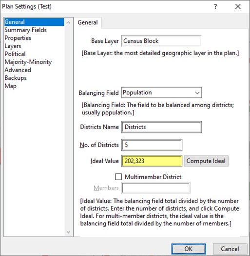
- Click OK.
The unassigned area can be hidden to make dataview look the way you want:
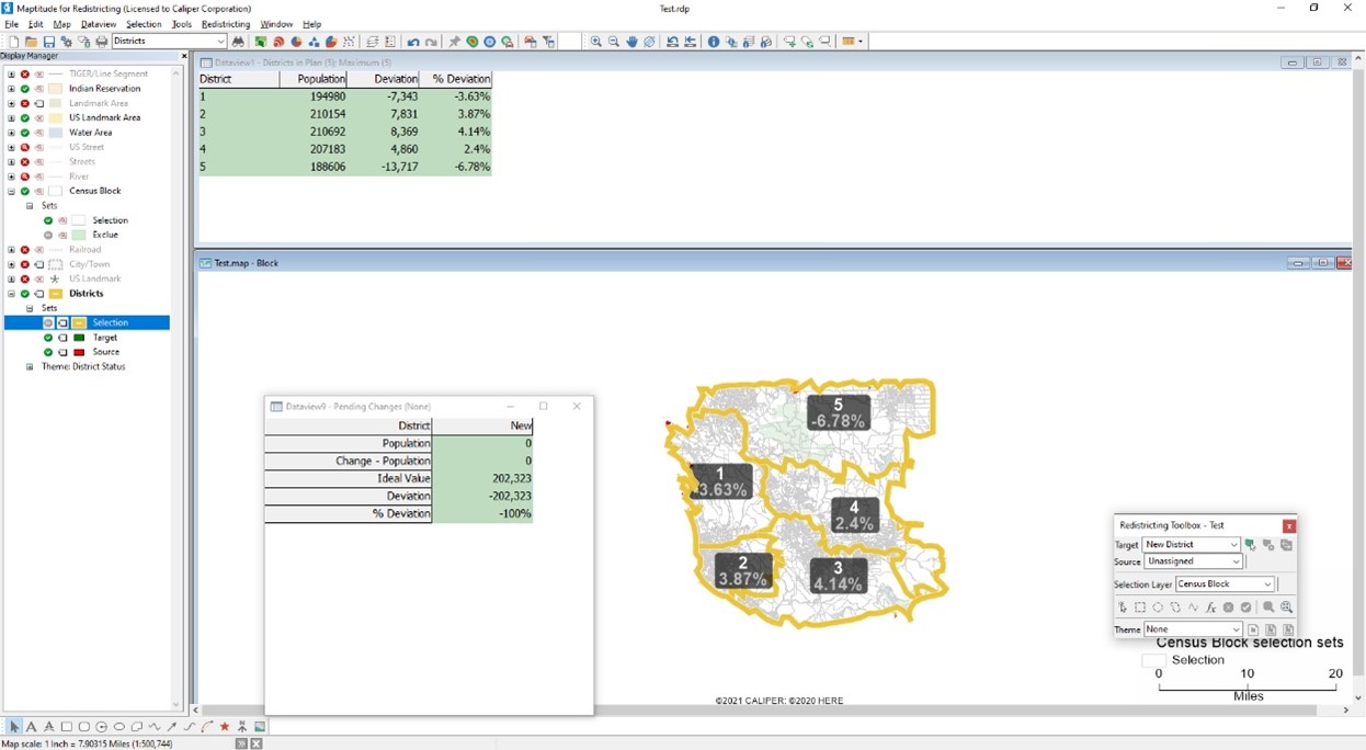
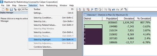
- When you are done with your plan, click on the Districts dataview and click and drag over the district numbers you created. For example, click on 1 and drag down to 5, making sure you do not highlight the district without a number.
- Choose Selection>Select by Highlight
- Use the Selection dropdown to change from All Records to Selection.
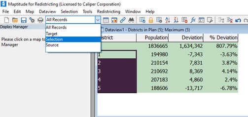
This limits the districts to exclude your unassigned area.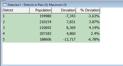
Next you should change your map so that the selected districts do not have a fill and the unassigned district is hidden:
- Click the + to expand Districts in the Display Manager.
- Click the + to expand Sets under Districts.
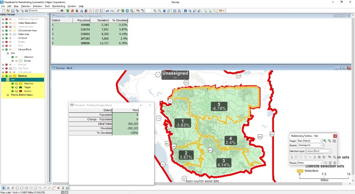
- Click the
 icon next to Selection so that it changes to
  .
.
The final step is to hide the Unassigned area on the map.
- Zoom your map out considerably so the mask covers a large area.
- Choose Tools>Reports>Mask.
- Choose Selection from the Selection dropdown.
- Click OK.
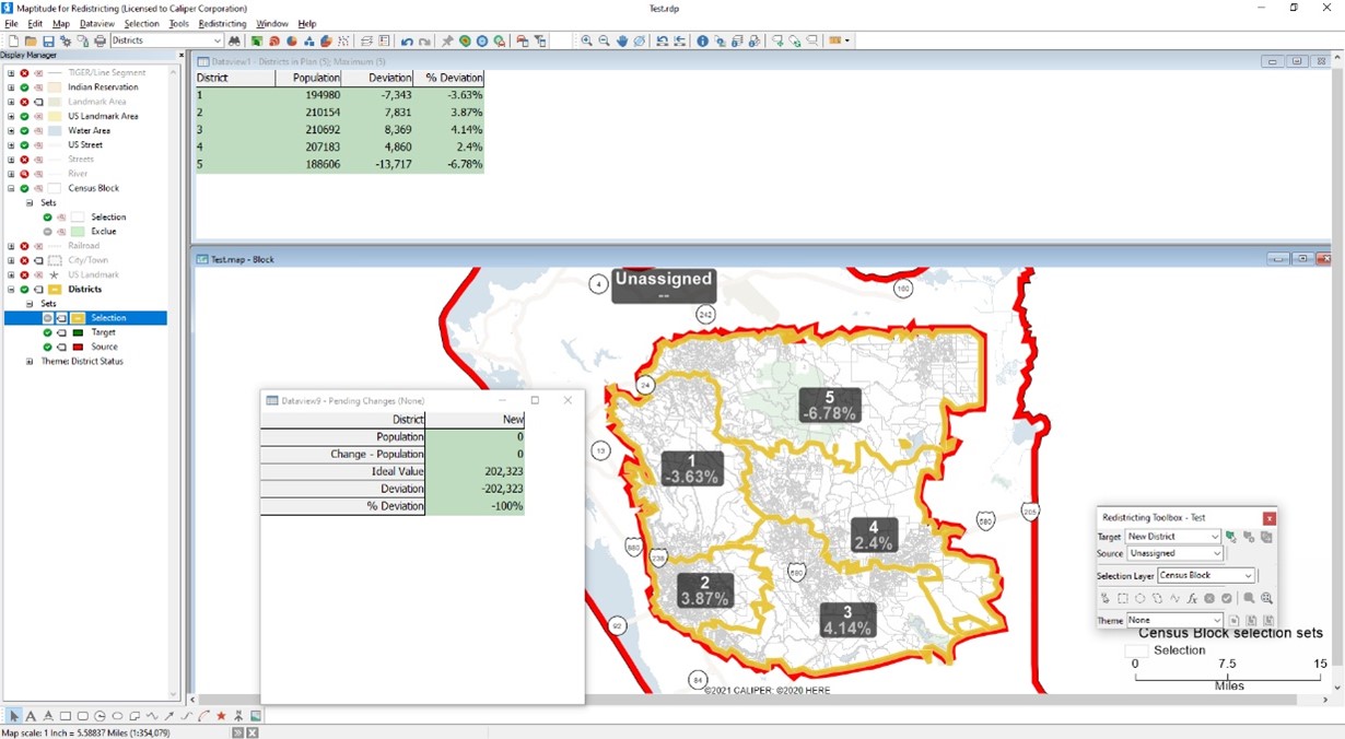
Maptitude for Redistricting hides everything on the screen that is outside of the districts you drew. You can zoom your map back in to the desired scale.