The standard tools in Maptitude for Redistricting make it straightforward to determine the total miles of roadway in a given district.
Select the District Used to Calculate Mileage
- Use Redistricting>Plan Manager to open a Maptitude for Redistricting plan.
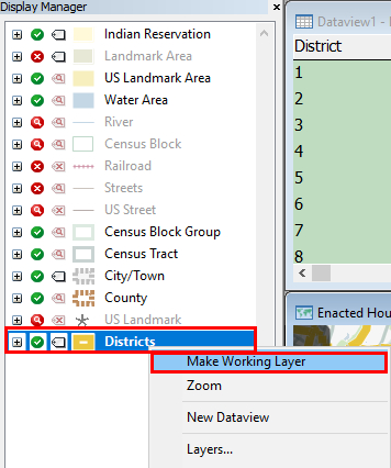
- Locate Districts in the Display Manager on the left side of the screen.
- Right-click on Districts and choose Make Working Layer.
- Choose Selection>Toolbar.
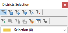
- Click
 in the Districts Selection toolbar to activate the Select by Pointing tool.
 - Click on the District you wish to use for calculating mileage.
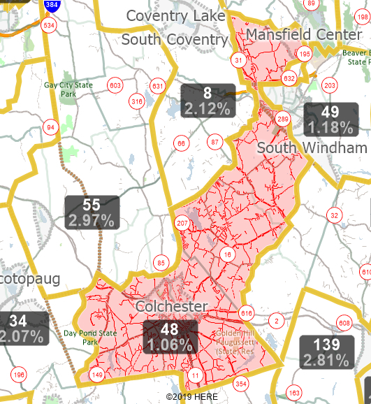
Maptitude for Redistricting selects the district.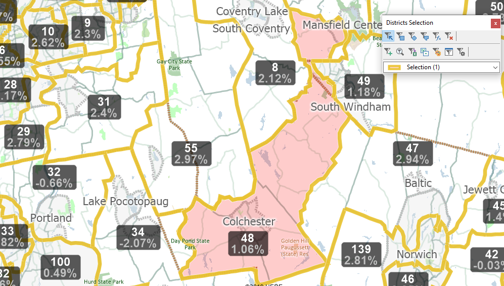
Selecting Streets in the District
- Locate Streets in the Display Manager on the left side of the screen.
- Right-click on Streets and choose Make Working Layer.
- Choose Selection>Select by Location.
- Enter settings as follows:
To Do This Do This Choose the based on layer Choose Districts from the Layer dropdown Choose the selection set Choose Selection from the Selection Set dropdown Select Street features Choose Inside from the that are dropdown - Click OK.
Maptitude for Redistricting selects the streets inside of the selected District.
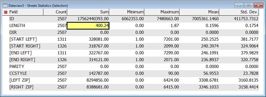
Calculate the Total Mileage of Selected Streets
- Locate Streets in the Display Manager on the left side of the screen.
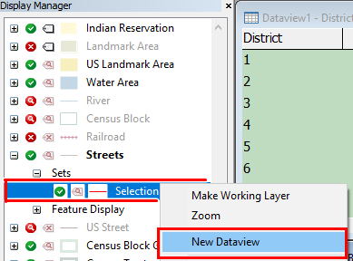
- Click the + next to Streets to expand the layer information.
- Click the + next to Sets to expand the sets.
- Right-click on Selection and choose New Dataview.
- Choose Dataview>Statistics>Summary.
Maptitude for Redistricting displays summary information for the selected streets. The Sum of the Length field displays the total distance of streets using the system’s default units (typically miles).