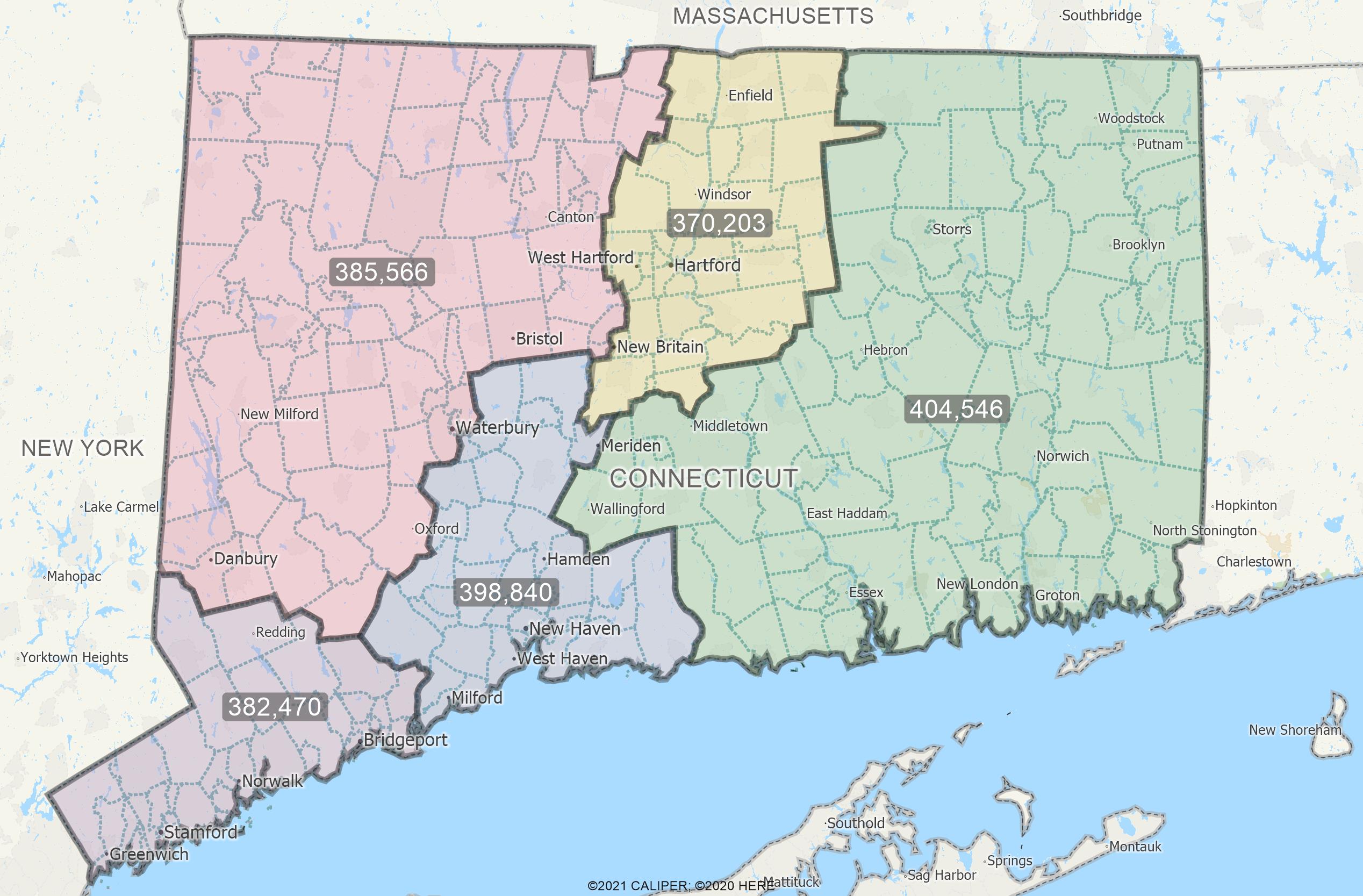
You can automatically create territories of equal size with sales territory mapping software.
Maptitude has an add-in that allows you to automatically construct territories balanced by a chosen demographic.
This article will explain how to launch the tool and use it to create your own balanced territories.

1. Make sure any instances of Maptitude are closed, then download the tool from this page.
2. Open Maptitude and from the Home Window choose New Map of the United States and click OK.
3. Highlight U.S. State, type CT in the Name box, and click Finish.
4. Make 5 Digit ZIP Code the working layer.
5. Go to Selection>Select by Condition
6. Choose [State Abbrev] from the Field List drop-down list, choose = from the Operator List drop-down list, and type “CT” in the Enter a Condition box to create the condition [State Abbrev] = “CT”.
7. Click OK to select all of the ZIP Codes in Connecticut.
8. Go to Tools>GIS Developers Kit>Add-ins>Balanced Territories Wizard
9. Change the Geography Set to Selection and click Next>
10. Choose the By choosing the number of territories option, enter 5 for the number of territories, and click Next>.
11. Click the Field Name drop-down list, type 16+ to limit the list to fields with “16+” in their names and choose [16+_In labor force]. Click Finish.
12. Make sure From my existing area layer is checked and click Next>. Click Next> again.
13. Click ![]() and choose Add Geography Layer Fields.
and choose Add Geography Layer Fields.
14. Enter 16 in the Filter box, choose [16+_In labor force] from the scroll list, click OK, then click Finish.
Maptitude will open the territory wizard with 5 Connecticut ZIP code territories balanced by Labor Force Population. For additional details about using the territory wizard, see the video tutorial on creating territories
Maptitude also has an ensemble simulated territories add-in that works similarly to this tool, except it contains some additional tests to determine compactness and deviation measures of the territories. Please see the Simulated Territories Add-In page for more information and to download the add-in (the above walkthrough works with both tools).