You can find the central location for a set of locations or areas using geographic analysis mapping software.
When you have a large number of points or areas, a helpful analysis can be to define a central point for your layer. There are a few ways we can define this.
Note: If you just need to find the center(s) of a given area, see the tutorial article on finding area centroids in Maptitude.
To try the steps in this article for yourself, you can use your license of Maptitude mapping software, or request a free trial of Maptitude.
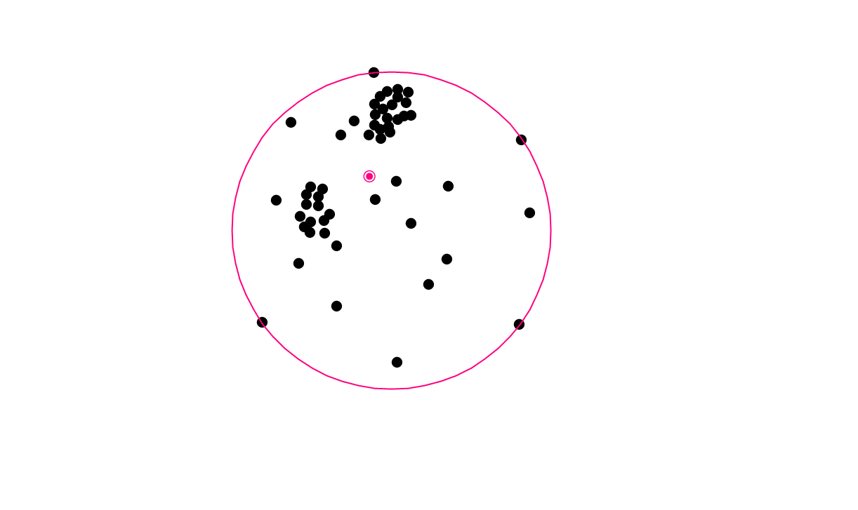
The geographic center of your layer is found by finding the smallest circle that contains all of your points or area centroids (called the Service Area) and then picking the center of that circle. This point has the property that it minimizes the distance to the furthest away point.

The mean center represents the point on the map that is found by averaging the coordinates of all the points, representing the average position. It also has the property such that the average straight-line distance to every point is minimized.
The weighted center is similar to the mean center but it allows you to choose a weighting field for each point. Points with a large value in this weighting field, such as stores with a particularly large sales volume will pull the center closer to them than points with a small value in the weighting field.
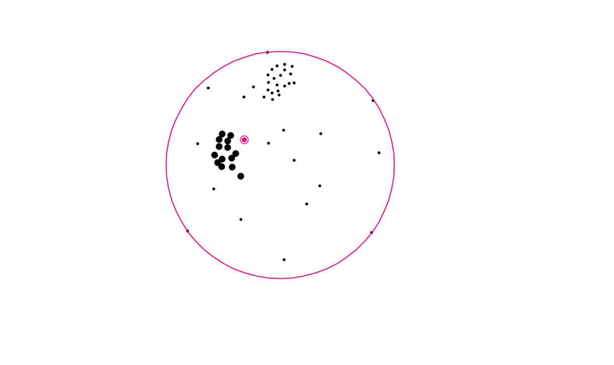
Note that in all three cases the Service Area circle is the same.
To find one of these central points for your layer or set
- Make your point layer the working layer
- Choose Tools>Analysis>Weighted Center
- Choose the selection set you want to find a center for, or choose All Features to use the whole layer
- Under Weighting Field:
- To get the geographic center choose None
- To get the mean center choose Coordinates
- To get the weighted center choose the weighting field you want
- Choose whether to save the results as:
- Freehand items will make the center and service area annotated drawings on top of the map
- Layers will save an area layer for the service area and a point layer for the center
“How do I find the weighted center of ZIP Codes?”
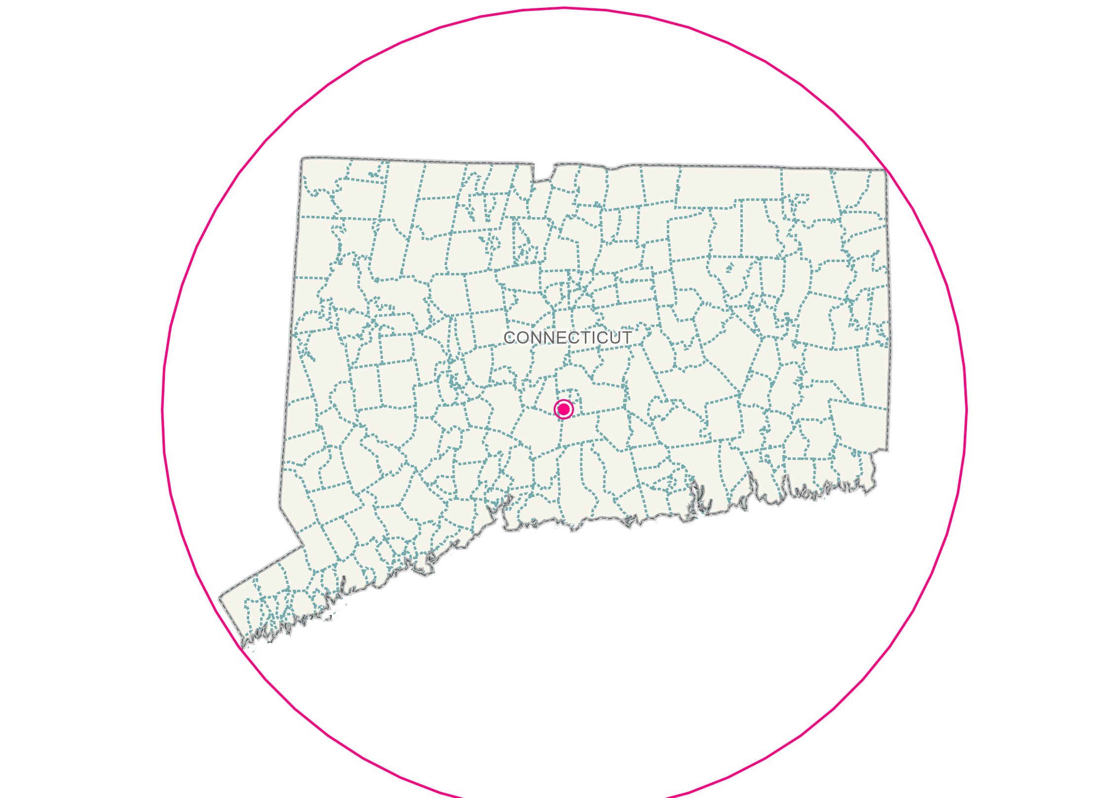
Here is a walkthrough of how you can use this tool with area layers such as ZIP codes:
- Make the 5-Digit ZIP Code layer your working layer
- (Optional) Make a selection of ZIP codes
- Go to Tools>Analysis>Weighted Center
- (Optional) Choose your selection from the Selection Set pulldown if you made one in step 2
- Choose one of the options from the Weighting Field pulldown
- Choose to Save the Results as either Layers or Freehand Items and click OK. Maptitude places a weighted center point for your ZIP codes and draws a circular service area around them.
For other geographic analysis options in Maptitude, please see the list of learning articles covering geographic analysis in Maptitude.