Maptitude comes with a detailed street layer for most country packages. In addition to showing the streets on the map, users sometimes wish to show the Street Intersections as well. This can be purely for a visual guide, or can allow you to count the number of intersections in an area.
In this article, we will walk through how to display the Street “Node” layer, and then to highlight the points in that layer that represent when two streets intersect.
Step 1: Turn on the Intersection Layer
In any map that contains a Street layer, there is also a second hidden layer called Intersection. To turn this on:
- Go to Map>Layers…
- Highlight Intersection and click Show Layer
- Click Close and the Intersection layer will be added to the map
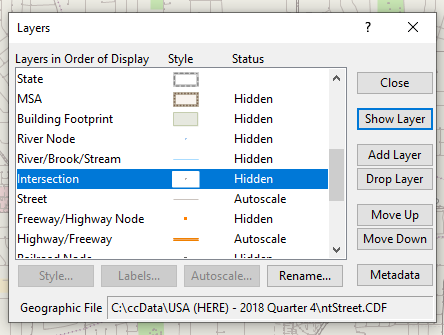
The name Intersection here can be slightly confusing, since this layer is actually the endpoint of every line segment in the street layer. This means that in addition to street intersections, it also contains:
- Dead ends
- Additional points in the middle of a long stretch of road
Step 2: Make a selection set to highlight only “True Intersections”
We can use the selection set functionality to highlight only those points in an area that are “true intersections” – i.e. those points that are the meeting of two or more streets (this is also known as a valency check):
- Make Intersection the working layer
- Zoom the map to the area for which you would like to find the intersections
- Go to Selection>Select by Condition
- Under Set Name type Intersections
- Check Select from visible features only
- In Enter a Condition type (or copy and paste from here):
arraylength(GetNodeLinks(ID)) > 2
- Click OK
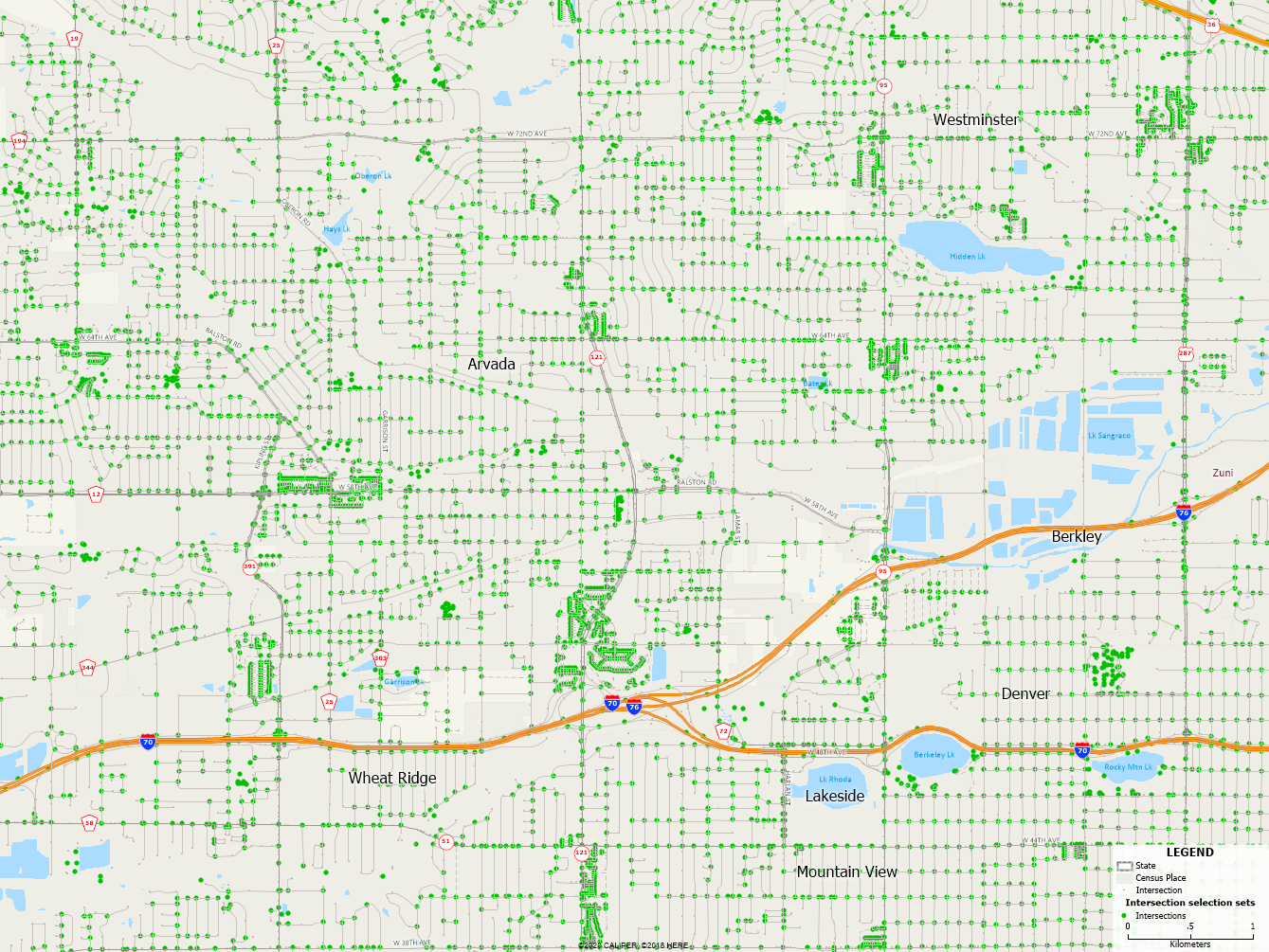
Maptitude will find and highlight all the points from the Intersection layer that are the meeting point of 2 or more streets. These points have been added to the Selection Set called Intersections. See this video for more help with using selection sets.