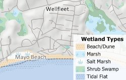
You can use any picture file, including those in formats such as GIF, ICO, TIF, BMP, JPG, PNG, and EMF, as the fill style for area features. The following steps outline how to use an image fill style:
- Chose New map of United States (or whatever country you are using) to create a general purpose map for your area of interest.
- If you have the U.S. Country Package, choose U.S. County as the area to display, type “Monroe FL” in the Name box and click Finish.
- In the Display Manager, expand the Landmark Area item, and then expand the Feature Display item beneath it.
- Click on the National Park style sample.
- Choose the Image… from the bottom of the Fill Style drop-down list.
- Browse for the Wooded_Swamp.png file and click Open.
- In the Image Fill Style Settings dialog box change the size to be 25% and click OK to return to the Style dialog box.
- Click OK. Maptitude displays then Everglades National Park with the wooded swamp image.