While making Maps in Maptitude you may have noticed that your maps can be a bit blurry. This can happen both when you’re looking at a layout in the program and when you export your map images. This article will explain how to deal with both.
Why are my layout maps blurry?
The view you are seeing is a print preview. The layout will save and print at higher resolution. You can right click the map image in the layout, choose “properties” and check Always Redraw Map, but this will slow down your interactions with the layout window.
Why are my printed maps blurry?
If you export an image using File>Export>Image, a window will pop up that allows you to choose where to save the file, the file type you are exporting to, and the image resolution.
Note: We recommend using PNG over JPG and BMP because it is lossless and compressed.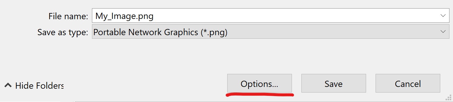
In this window, click the “options” button to open the resolution options:
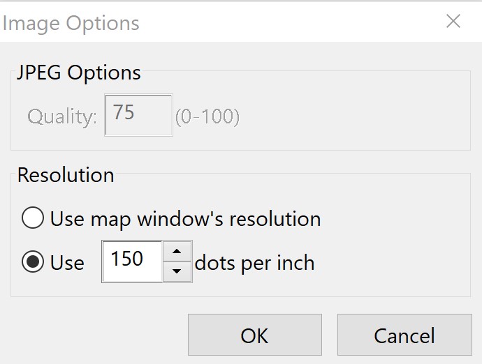
Here, you can manually specify the desired resolution of your image. Increasing the number of dots per inch will reduce the blurriness of your image, but it will also make your file size larger.
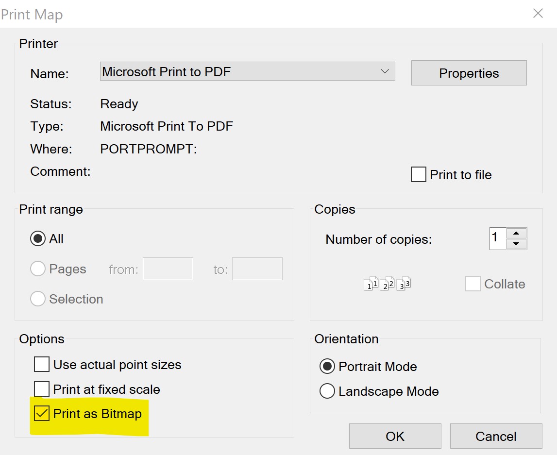
In addition, you can click the print button ![]() or choose File>Print and print to a PDF driver as raster, with “Print as Bitmap” checked, or as vector, with “Print as Bitmap” unchecked:
or choose File>Print and print to a PDF driver as raster, with “Print as Bitmap” checked, or as vector, with “Print as Bitmap” unchecked: