How Do You Optimize Delivery Routes?
You can optimize delivery routes using Maptitude route optimization mapping software. Discussion of route optimization settings in Maptitude.
How Do I Map Business Locations?
You can map business locations using Maptitude geographic information systems (GIS) software or Maptitude online mapping software. Steps to map business locations with Maptitude.
How Do You Create a Sales Map?
To create sales maps, you can use Maptitude sales mapping software.
How Do I Use Mapping Tools?
You can make use of mapping tools with Maptitude mapping software. Step-by-step tutorial on using mapping tools.
How Do I Move Alaska and Hawaii on a Map?
You can move Alaska and Hawaii on a map using Maptitude United States GIS mapping software. Step-by-step tutorial on creating a report with Alaska and Hawaii in separate maps.
What Is the Geocoding Precision Field?
Explanation of the Geocoding Precision field for Maptitude mapping software.
How Do I Add Sales Territory Mapping to Google Maps?
You can add sales territory mapping to Google Maps with Maptitude sales territory mapping software. Step-by-step tutorial on creating sales territories and export to Google Maps.
How Can I Do Sales Territory Mapping Using Excel Data?
You can do sales territory mapping using Excel data with Maptitude sales territory mapping software. Step-by-step tutorial on creating a sales territory map with Excel data.
How Do I Create a Map From LibreOffice Calc Spreadsheets or OpenOffice Calc Spreadsheets?
You can use Maptitude LibreOffice Calc data or OpenOffice Calc data mapping software to create maps from Excel data. Step-by-step tutorial on mapping data from LibreOffice Calc or OpenOffice Calc using Maptitude.
How Do I Create a Map From Google Sheets?
You can use Maptitude Google Sheets data mapping software to create maps from Google Sheets data. Step-by-step tutorial on mapping data from Google Sheets using Maptitude.
How Do I Create a Map From Excel Data?
You can use Maptitude Excel data mapping software to create maps from Excel data. Step-by-step tutorial on mapping data from an Excel file using Maptitude.
Why Am I Seeing a File Not Found Message?
File Not Found messages can appear if Maptitude is unable to find Country package layers or your own custom layers or images. The File Not Found message will show the last known location of the missing file. For example, the message may show that Maptitude cannot locate one of the country package files: C:\ccData\USA (HERE) …
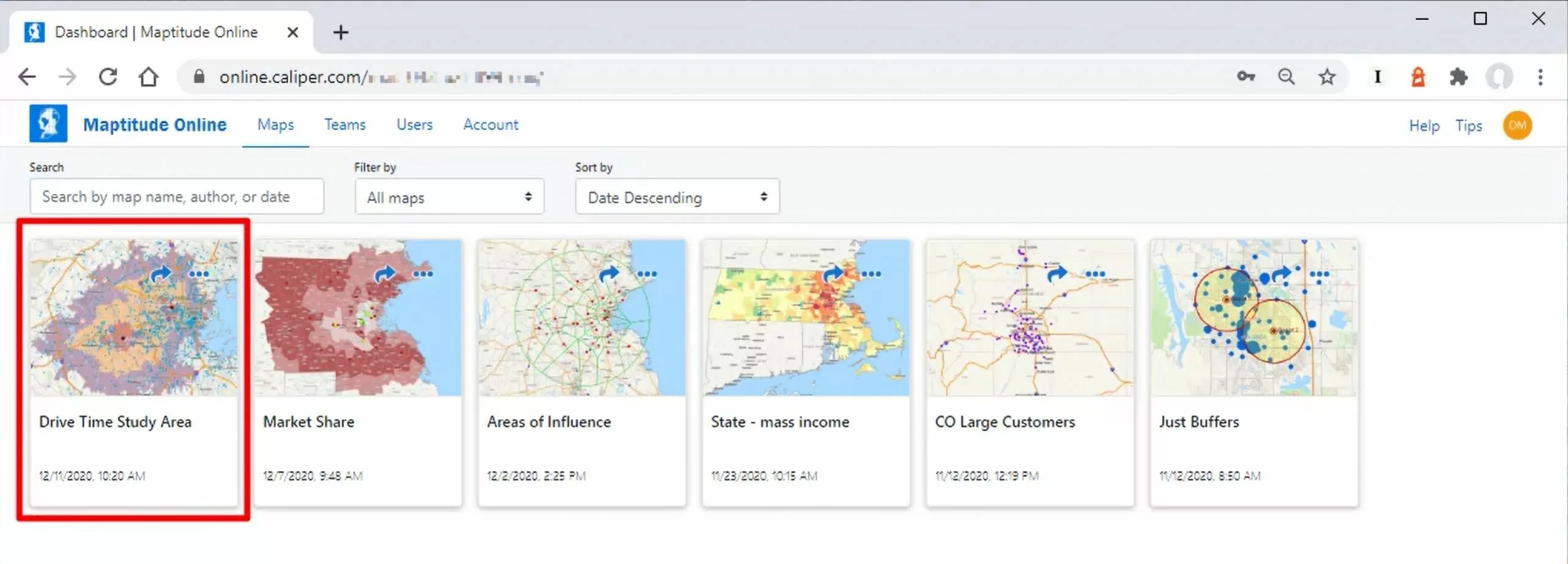
Mapping Your Data with Maptitude Online SaaS
A walkthrough of the Maptitude Online SaaS, as well how to map your own tabular data using the platform and share with others
Maptitude Webinar: New Features in Maptitude 2022
Maptitude Webinar: New Features in Maptitude 2022
How Can I Delete My Freehand Drawings?
A discussion of how to get rid of Maptitude drawing items, such as arrows or cardinal directions.
What do I do if a map or process takes a long time to load?
A discussion of why maps can load or draw slowly, and some best practices to avoid this and speed up your maps.
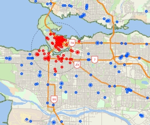
How Do I Map Businesses by ZIP Code?
You can map businesses by ZIP Code using Maptitude business mapping software. A discussion of the Maptitude ZIP Code Business Count data, where it comes from and some of the ways it can be used with GIS mapping software.
How Do I Make my Maps Look Nice?
How to make your maps look attractive and easy to read using GIS software
How do I choose a map background?
How to choose and appropriately style background images for use in your maps
What are the best map colors and layers?
A discussion of best practices when using colors in your maps and how to clearly communicate your data
How do I upload my data to Maptitude Online if I don’t have desktop Maptitude?
You can upload your data to to an online map using Maptitude Online mapping software. Steps to upload your data via the Create-a-Map Wizard without the desktop Maptitude application.
Where is my Toolbar?
How to find and restore any lost toolbars in Maptitude
How does the Maptitude licensing work?
A simple breakdown of how the Maptitude licensing and upgrade system works, as well how Maptitude Online differs from the desktop product
Maptitude Webinar: New Features in Maptitude 2021
Maptitude Webinar: New Features in Maptitude 2019
How can I get the mean/average of my data fields?
How to calculate the mean/average and other summary statistics for your data or any dataview in Maptitude
What do I do if my fonts look wrong?
How to fix incorrect fonts and symbols in Maptitude if they are missing or look strange
How do I change the default limits in Maptitude?
How to change your default limits and map units in Maptitude under your preference settings
How do I add existing layers to a map?
How to add existing layers to a Maptitude map, such as additional map layers or any free Caliper data layers
How do I calculate brand market share by region?
You can calculate brand market share by region using Maptitude sales mapping software. Step-by-step tutorial on calculating market share by area with Chipotle and Moes as an example.
How do I create a Bubble Map?
How to create a bubble map or size theme using Maptitude
How do I create large drive-time rings?
How to use different street layers to speed up routing calculations in Maptitude
How do I import an Excel file into Google Maps?
You can import an Excel file into Google Maps using mapping software. Maptitude can convert your Excel data into a format compatible with Google Maps.
Showing point locations using letter or number pattern themes
How to show point locations using letter or number pattern themes
Using image fill styles
How to use image fill styles for areas
Using company logos for point icons
How to use company logos for point icons
How to Upload Your Maps to Maptitude Online
How to upload and share your maps using Maptitude online
How Do I Find All the ZIP Codes Inside My Territories?
You can find all the ZIP Codes in your territory using sales territory mapping software. Step-by-step guide on finding the ZIP Codes in territories.
How can I switch the rows and columns of my data?
How to transpose tables in Maptitude
What is the Working Layer?
An explanation of the role of the working layer in Maptitude
Why are my maps blurry?
How to reduce map and layout blurriness by changing image resolution
How can I only show the hospitals from a particular health system?
How you can show only the hospitals from a particular health system
Why is my Google Satellite Layer drawing so slowly?
Why is does the Google Satellite Layer draw so slowly?
How can I export a list of points contained in a custom area or radius?
How to export a list of points contained in a custom area or radius
How do I add all the ZIP Codes in a state or county to a territory?
You can add to a territory or remove from a territory all the ZIP Codes in a state or county by using Maptitude sales territory mapping software. Step-by-step guide on adding all the ZIP Codes in a State or County to a territory.
How do I locate data by coordinate using table formats such as comma separated?
How to locate data by coordinate using table formats such as comma separated (csv).
How do I add layers to a map from energy market websites?
How users can add energy data layers to a map from energy market websites?
How to Add Country Labels in Different Languages
How to Add Country Labels in Different Languages
How can I change the Country Package I’m using?
How to change your country package or default country package, and combine maps
Creating a Map with Wide White Streets
How to change the displayed style for streets to be wide white lines.
How do I create overnight routes or routes with no fixed end time?
How to change your routes to allow overnight routes and routes with no fixed end time.
Translating Menus
You can translate the Maptitude menus into different languages using the translate menu add-ins on the Maptitude GISDK add-ins page.
How do I change the map unit language and measurements?
How to change a user’s default language and measurement units.
Why Can’t I Use the Live Link Functionality with my Data?
How to add an ID field to a dataset to make it compatible with the Live Link function.
How Can I Place Multiple Labels For One Location?
How to draw label callouts so that multiple labels can point to one location.
Copy and Paste Drawing Items Between Maps
You can right-click on one or more drawing items in a map and choose Copy, then go to any other open map and right-click and choose Paste to copy the items to the same location on that map.
How can I find the demographics for a group of ZIP Codes or other areas?
You can find the demographics for a group of ZIP Codes using Maptitude demographic mapping software. Step-by-step tutorial on extracting demographics for your area of interest.
Save Maps to PDF
Maptitude makes it easy to save a map into a PDF format. Simply, choose File>Export>PDF and your default PDF printer driver is used to create a PDF that is automatically oriented portrait or landscape.
How Can I Create Worldwide Territories?
You can create worldwide territories using Maptitude sales territory mapping software. Step-by-step tutorial on building worldwide territories.
How do I Highlight Street Intersections on my Map?
How to highlight all points in a Maptitude map where two or more streets meet
What types of data can I link directly to the source file to update automatically?
Help on when you can use the Update Linked Records feature in Mapitude
How Do I Track Demographic and Sales Data for My Territories?
You can keep track of demographic and sales data for your territories using Maptitude sales territory mapping software. Step-by-step guide on tracking data for territories.
How can I tell which of my points were not found by Address and how do I fix them?
How to view the Geocoding precision field to give you details on the success of the geocoding process
How do I find all the points of a given layer in an area?
Using the Info tool in Maptitude to search for nearby features
How do I Save the Contents of my Selection Set to Excel?
How to save the table of a selection set to Excel
How Can I find out where the Country Package data comes from?
How to get more information on the data sources for the Country Package data in Maptitude
How can I filter my data based on a Date field?
Making a selection set on a layer that conatins only dates in a given range
Why isn’t my data being recognized as Dates?
Why your data isnt being imported in the Date format, and how to fix it
What training or support do I receive with Maptitude?
What support you are eligible for with purchase of Maptitude
Why do some layers turn on or off as I zoom?
Why certain features of your map are only visible when you zoom in or out and how to override this behavior
Getting Started With Maptitude Mapping Software
Comprehensive list of available materials to help you get started with Maptitude
How Can I Find a List of all ZIP Codes within 10 Miles of my Data?
You can get a list of all ZIP Codes within 10 miles of your locations using Maptitude ZIP Code mapping software. Tutorial on exporting ZIP Codes.
How do I Use Hover Fields of My Own Data on an Area Layer?
Creating a copy of an area layer to use Hover Fields with
How Can I Add Data to My Territories?
You can add data to your territories using Maptitude sales territory mapping software. Step-by-step guide on adding data to your territories that is already aggregated to the Territory level.
How Can I Build Territories using 6-digit Canadian Postcodes?
You can create territories using 6-digit Canadaian Postcodes using Maptitude sales territory mapping software. Step-by-step guide on creating territories using 6-Digit Canadian Postcodes.
How do I Use the Home Window?
All the information you need to get started with the Home Window in Maptitude 2019
How do I Open a Map I Created in a Previous Version of Maptitude?
How to open a map from a previous version of Maptitude and save it as a workspace
What is a Workspace File and How do I Use it?
Information about the Workspace file types, the advantages of Workspaces over maps, and help using Workspaces
How do I map the age of householder by household income data included with Maptitude?
How to use the household income by age of householder data in Maptitude
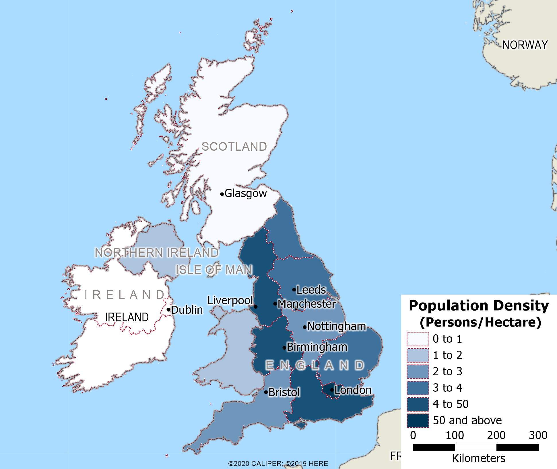
Using Maptitude with the UK & Ireland Country Package
This video shows how to map and analyse your data using Maptitude and the United Kingdom Country Package.
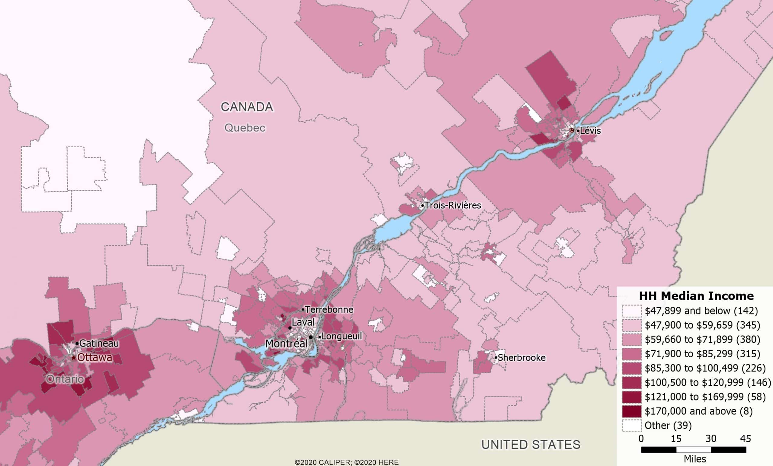
Using Maptitude with the Canada Country Package
This video shows how to map and analyse your data using Maptitude and the Canada Country Package.
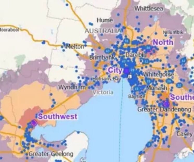
Using Maptitude with the Australia Country Package
This video shows how to map and analyse your data using Maptitude and the Australia Country Package.
Change the Style of your Selection Set
To change the style of the active selection set, click the Change the style for this selection set button on the Selection toolbar.
See the Points on your Map Clearly
When creating a thematic map, if your points are clustered close together, you may want to set the style of the layer to be less than 100% Opacity so that overlapping symbols are clearer.
Delete Selection Sets
You can delete a selection set by right-clicking on a selection set in the Display Manager and choosing Remove.
Rename Your Selection Sets
You can display the Rename Selection Set dialog box by right-clicking on a selection set in the Display Manager and choosing Rename.
Using your Mouse’s Scroll Wheel to Navigate Maptitude
If your mouse has a scroll wheel you can zoom in by rolling the scroll wheel away from you, zoom out by rolling the scroll wheel toward you, and pan by holding the scroll wheel down and dragging the map to a new location.
Adding Navigation Tools and Running Totals to the Selection Toolbar
You can add tools to let you navigate through selection sets or keep running totals for a certain field of a selection set by clicking Options in the Selection Toolbar and checking the appropriate boxes.
Export Data to Excel
You can export demographic overlay data and other information to Excel by choosing the layer to export, making it the working layer, and clicking the Export to Excel button on the Standard toolbar.
Change the Default Style of the Drawing Tools
You can change the default style used by the drawing tools by choosing Edit>Preferences and clicking the polygon, line, or point sample buttons on the Freehand/Layout tab.
Working with Maptitude Selection Sets (Filters)
Using the selection tools, selecting features by location or condition, combining selection sets, and computing statistics
Areas of Influence and Network Partitions
Creating catchment areas based on proximity to features in a point layer based on straight-line distance or driving-distance.
Basic Maptitude Concepts
An introduction to basic Maptitude concepts including toolbars, help, shortcuts, context-sensitive menus, the working layer, and workspaces
How do I create a color theme map?
You can create color theme maps with Maptitude thematic mapping software. Step-by-step tutorial on creating color theme maps.