Maptitude Help / Managing Geographic Files / Lines of Sight
Creating a Lines of Sight Layer
Lines of sight are a line layer in which the lines either avoid obstacles or are drawn only within the area covered by obstacles. For example, you can create lines of sight between buoys in a body of water either by avoiding a land area layer or by staying within a water area layer. In either case, lines would connect all of the buoys and circumvent islands and peninsulas. You can use a lines of sight layer to find the shortest path to visit a series of buoys that must be serviced, even when there are islands or other obstacles in the way, or find the shortest distance by boat from one landing to another.
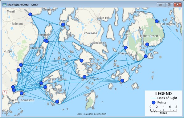
 To Create a Lines of Sight Layer
- Choose a point layer from the drop-down list on the Standard toolbar.
- Choose Tools>Editing>Lines of Sight to display the Lines of Sight dialog box.
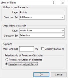
- Choose to service all point layers or a selection set from the Selection Set drop-down list.
- Choose the area layer and features to use for obstacles from the Obstacles Are In Layer and Selection Set drop-down lists.
- To limit links to a maximum length, type a maximum value in the Max. Link Size edit box.
- To eliminate links that are not on the shortest path between points, check the Simplify Network box.
- Choose whether to create the lines of sight outside or inside the obstacle area layer from the Relationship of Points to Obstacles radio list.
- Click OK.
Maptitude creates the lines of sight and adds the layer to the map.
©2026 Caliper Corporation