

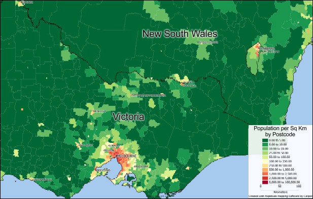
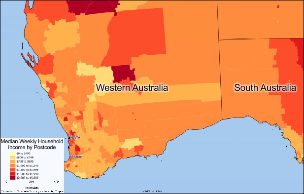
NEWTON, MASSACHUSETTS (USA) - Caliper is excited to announce the release of 17 free postcode maps in PDF format. Population density, income, and postal boundaries are included for several states and cities in Australia, and can be accessed here: https://www.caliper.com/map-software/free-mapping-software.htm#australia.
Postcodes are frequently used to create sales territories, manage franchises, visualize revenue, and explore target markets and demographics. They are a convenient and familiar geographic unit that easily link geography to information about individuals and businesses. All postcodes in Australia have four digits and are placed at the end of Australian addresses.
The postcode maps were created with Maptitude mapping software, and are available for immediate use. For those that require postcode mapping beyond what a PDF can offer, Maptitude mapping software comes with over 700 fields of Census data for postal areas, suburbs, statistical areas, and urban areas. Maptitude also comes with a full suite of sophisticated yet intuitive mapping analysis tools that allow you to gain insight into your business data in ways not possible with spreadsheets or PDFs.
If you have any questions about Maptitude or data availability contact Caliper.
Caliper Corporation develops state-of-the-art Geographic Information Systems (GIS) software. With a focus on usability, Maptitude is designed to be a cost-effective, professional postcode mapping software product. Maptitude enables organizations to leverage their location-based data to improve decision making and planning, while minimizing expenditure through competitively priced solutions.
Caliper is a privately held corporation and is a leading developer of mapping, redistricting, transportation, and GIS software.