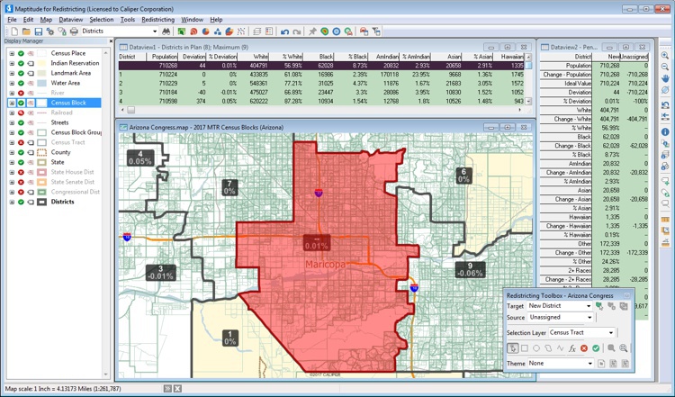
Maptitude for Redistricting is the professional tool for political redistricting. It is used by a supermajority of the state legislatures, political parties, and public interest groups. Designed with the help of redistricting professionals, state legislatures, and political parties, Maptitude for Redistricting has the features redistricters want and is easy to learn and use.
Build custom, balanced territories with Maptitude redistricting software
Caliper Corporation has continued to improve Maptitude for Redistricting software. The newest version represents a major leap forward with advanced features, the latest Census geography and data, one-button conversion of existing plans to the latest TIGER geography, new and enhanced reports, a state-of-the-art interface, open access to industry-standard file formats, interoperability with Google Maps and Google Earth, an updated manual, video tutorials, context-sensitive Help, web solutions, and more. Whether you are a current user or new to Maptitude for Redistricting, you will welcome this new version of the software as you prepare for the upcoming round of redistricting.
Maptitude for Redistricting includes all of the features in Caliper’s Maptitude Geographic Information System (GIS) software. Maptitude is full-featured mapping and GIS software that has established new standards for performance and value for over two decades. It provides a complete set of mapping and spatial analysis functions, sophisticated geocoding, tools for complex data manipulation, and a large collection of nationwide geographic data.

“Maptitude for Redistricting has a low learning curve and is perfect for creating districts strategically. The wide range of features is an added bonus. Tech support is superb.”
Keiana Dunn
Center for Law and Social Justice

“There are an increasingly large number of products on the market. I have used several of these with mixed results. Maptitude for Redistricting is the all-in-one, easy to use, most accurate product available.”
Jonathan Cervas
Post-Doctoral Fellow, Carnegie Mellon University
All redistricting products work with ArcGIS Shapefiles and File Geodatabases.

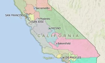
California Democratizes Redistricting with Maptitude for Redistricting
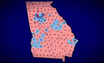
Efficiency Gap and other partisan competitiveness reports
Check out the district measures and reports that have always been included with Maptitude for Redistricting!
Testimonials: Read what others have to say about Maptitude for Redistricting