Maptitude Help / Introducing Maptitude
Introducing Maptitude®
Maps communicate information that is related to space and location in a remarkably efficient way, reducing volumes of information to a single, clear visual presentation. A weather map lets you know in an instant whether it will be cloudy or sunny, how warm or cold it will be, and whether it will rain or snow. Traffic maps let you know in seconds what route you should take to avoid an accident or steer clear of construction. In politics, history, advertising, and recreation, maps are a part of our everyday lives because they tell us so much of what we want to know.
Maptitude provides the tools, maps, and demographic data you need, with commands and special functions that let you tie in the data you use every day in your work. The MapWizard® automatic mapping tools creates brilliant and informative maps with a single mouse click. Even more importantly, Maptitude provides ways for you to use the maps you create to analyze and understand how geography affects you and your business.
About Maptitude
Maptitude Geographic Information System for Windows is the intelligent mapping solution for business, government, and education. Maptitude is a powerful combination of software and geographic data that provides everything you need to realize the benefits of desktop mapping and geographic analysis with a single, easy-to-use package. Using Maptitude you can:
- Create beautiful map displays
- Enhance reports and presentations with maps, charts, and page layouts
- Reveal geographic patterns that cannot be seen in database tables and spreadsheets
- Answer questions about the location and characteristics of map features (points, lines and areas)
- Create geographic data and share information with your work-group, department, or organization.
Maptitude includes extensive geographic and demographic data so you can get started as soon as you install the software. A basic global map is provided with every Maptitude license along with a detailed Country Package that includes a wealth of data unavailable in any other product, including an up-to-date street layer with addresses for pin-mapping (geocoding) and travel time information for computing routes and drive-time rings.
Create-a-Map Wizard™ mapping tools can make a map at any scale from all the countries in the world to the local streets around an address, landmark or intersection. The Map Librarian manages numerous categories of pre-designed maps. You can open one or more of these maps for a selected location.
Maptitude lets you create maps using your own data. You can read data in many formats including Excel, dBASE, Access, Oracle, and text files, and you can access data from spreadsheets and database management systems using Open Database Connectivity (ODBC). You can link your data to features on a map or locate data on a map using street address and Postal/ZIP Code or by simply pointing to the correct location. In a few easy steps, you can color code Postal/ZIP Codes using sales data, and display the locations of customers or other points of interest.
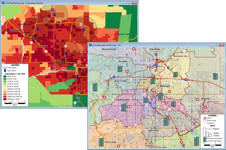
Maptitude enhances your projects and decision-making by making it easy to ask and answer questions about geographic data. Where are the census tracts with the highest population density? How many people live within one mile, two miles, and three miles of this site? Where are potentials for growing my business? How many comparable properties are located in my neighborhood? What is the shortest route between delivery points? Maptitude provides the answer to these and many other questions in maps and dataviews that show selected map features, report data values and display new features.
Maptitude is licensed in several different ways (see our website). Maptitude is network-aware and network-enabled. You can share tabular data, geographic files, maps, dataviews, charts, and layouts. Full control over read-write permissions is supported. Maptitude allows simultaneous editing of geographic and attribute data files by multiple users, a powerful feature in an enterprise wide GIS implementation. Maptitude also supports direct editing and access to corporate geographic databases (e.g. an Oracle Spatial database).
Topics in this section:
©2026 Caliper Corporation