Mapping Software and GIS Glossary
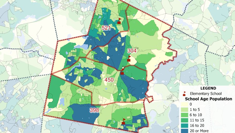
School redistricting is the process of redrawing neighborhood school district boundaries to address these changes and produce an equitable distribution of students among different schools. In most communities, the distribution of school-aged children changes over time as new housing developments are built and as existing housing stock turns over. In addition, as communites grow or shrink, they may require reallocation of students when new schools are built or existing schools are closed.
Maptitude Mapping Software is an incredibly powerful and versatile mapping tool that is an ideal solution for managing and redrawing school districts. With its intuitive layout and wide range of features, users can quickly and easily create, view and analyze district boundaries. It features powerful tools for drawing, editing, and sharing maps, as well as a range of data analysis and reporting options. With Maptitude, users can easily create and manage custom boundary maps, and the software even allows for the automatic realignment of district boundaries when new geographic data is added. Additionally, users can quickly share maps with others via the web, making it easy to collaborate on school district boundary management. Maptitude is an invaluable tool for managing and sharing school district boundaries.
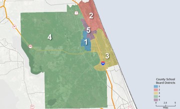
The problem of school redistricting is related to that of political redistricting, and Maptitude is the dominant software product in that industry (see Maptitude for Redistricting clients). The Maptitude product suite has many tools for school planners including a comprehensive redistricting system. The software includes both manual and automated redistricting functions.
In 2013, my company made a decision to move from ArcView to Maptitude because of ESRI’s annual licensing fees and the high expense for their extensions. At first, my GIS analyst was concerned about such a sudden change, but he was able to get proficient in only about a week. My firm serves school districts around the country, providing maps and demographic data to help with enrollment planning. Since changing to Maptitude, several clients have commented that the maps are easier to read, and provide more information than we used to be able to provide under ArcView. It was a good move. I just wish I had done it sooner.
![]() Preston Smith
Preston Smith
Principal Owner
Business Information Services, LLC
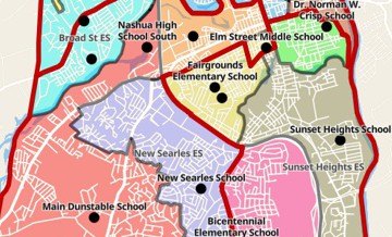
Redrawing school districts with Maptitude school redistricting software
Maptitude is widely used to conduct site, territory, and boundary research. For example, new schools can be considered in locations where there is a gap in provision, and research can be conducted to assess the current and future demand. By cross-referencing data from multiple sources, such as birth rates and demographics, it is even possible to prioritize certain locations to better inform real estate decisions.
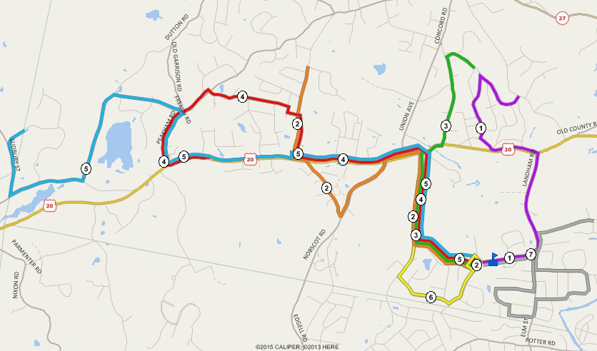
Bus routing tools enable the development of bus routes and schedules for bus shifts. Transit is a specialty of Caliper Corporation, with capabilities within our products that greatly exceed those of other planning packages. Caliper provides the only software that has a realistic mapping-based representation of bus systems. Our products provide special data structures for handling bus routes and to store, display, edit, and analyze them. An important feature is that bus routes can be directly mapped onto the streets so that interactions between traffic and buses can be treated explicitly. Moreover, stops need not be located at street intersections, but instead can be located where they really are and on the correct side of the street. The software automatically generates addresses for the bus stops, but the user can also override the software-generated address and interactively enter a house location on the map.
Planning for school redistricting and for opening, expanding, and closing schools is one of the hardest jobs facing a superintendent and school board. Robust and easy-to-use tools are needed. Maptitude provides a way to make this process straightforward and accountable.
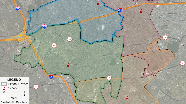
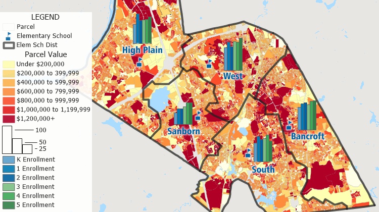
Mapping school districts is an essential tool for school administrators, policymakers, and real estate professionals. With Maptitude, users can create dynamic and informative maps of school districts to help them make data-driven decisions. The powerful GIS features in Maptitude allow users to visualize and analyze various data sets such as school demographics, student performance, and funding levels. Users can easily create custom map reports that show school locations, attendance zones, and transportation routes. This information is invaluable for real estate agents who need to know which neighborhoods are in high demand due to their proximity to quality schools. Policymakers can use Maptitude to identify areas where additional resources may be needed to improve school performance. Maptitude is an essential tool for anyone interested in mapping school districts.
 |
“We have properties all over the city. To define by say a council land area or a school district are great options. We also drive from lot to lot and since I am not from Jacksonville originally that is a great time saver! We also must keep some properties in a certain parameter for grant requests and this can help me do that! — You know how you know in your head what you want in a product and you begin to believe that there is no affordable product that can do that for you? Well, Maptitude showed me "it can be done, and it can be affordable"! Thank you!”
|
This interactive map shows the percent of the population in grades K-12 in each Census Tract and the locations of public schools in the lower 48 United States
Get access to school district territory tools and many more advanced features by signing up for a free trial today!
I would estimate that we save at least $2,000 to $3,000 per redistricting project using Maptitude because the software is easier to use. Over a year’s time that would be $10,000 to $20,000. That doesn’t account for the thousands of dollars in savings in licensing fees that we now save with Maptitude versus ESRI. In a tight economy like we are in now, that is the difference between making a profit on some projects and not.
![]() Preston Smith
Preston Smith
Principal Owner
Business Information Services, LLC
Learn more about Maptitude to see how you and your team can use Maptitude for your school redistricting needs!
If you need consulting services on any aspect of school redistricting or district planning, contact the Maptitude Team (sales@caliper.com | +1 617-527-4700) to discuss your requirements.
Home | Products | Contact | Secure Store
