Maptitude is powerful mapping software that helps you:
Desktop GIS: Read on for Maptitude Windows desktop mapping software for PC or Mac computers.
Online Mapping Software: Visit Maptitude Online for a Cloud-based GIS software-as-a-service (SaaS) accessible via any browser.

|
“I've been using Maptitude for more than 15 years. It is simply the best tool available for businesses that need a market planning mapping and data resource. It can do everything I need it to do - from the very simple to the complex. It integrates nicely with other programs and file types making analysis and presentation very easy. I highly recommend Maptitude to firms who need a function-rich GIS mapping solution. It is the best!”
|

|
“Pros: Cost. Much easier to reach a purchasing decision. I loved the integrated country data package so I didn't have to download census layers and other info - it was all built in.”
|
Maptitude mapping software includes the richest feature set and highest performance of any mapping software, without the high price tag. Starting at just $795 and including a free GIS data package, Maptitude delivers unbeatable value.
![]()
![]()
![]()
![]()
![]()
![]()
![]()
![]()
![]()
![]()
![]()

Maptitude mapping software stands out from other GIS and map making solutions with its powerful yet easy-to-use tools, making it the ideal choice for users of any skill level — from beginners to GIS professionals:
Choosing the right mapping solution can be time-consuming. Fortunately, Maptitude has emerged as the clear choice for all types of organization, offering a seamless experience and a wealth of features. Here's what some satisfied users have to say:
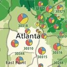
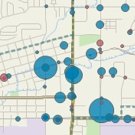
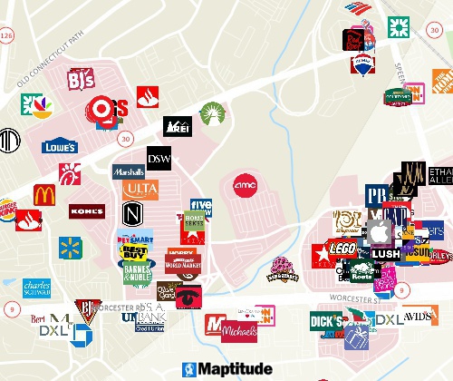
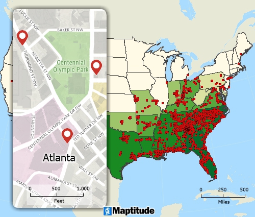
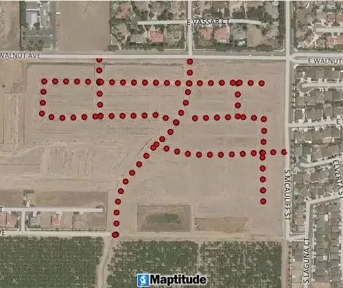
Create pin maps by address, postal code, coordinate, and more for unlimited numbers of records
Filter features based on location and geographic attributes as well as conditional data attributes
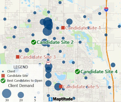
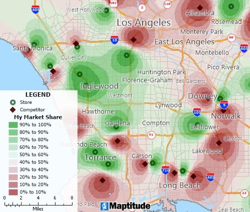
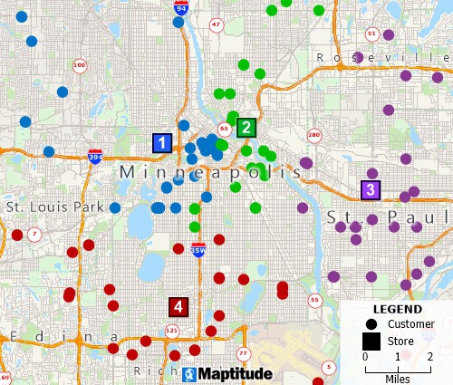
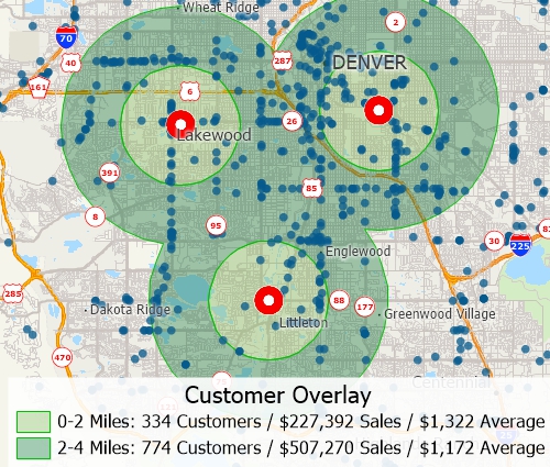
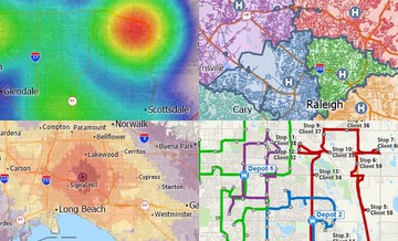
Facility location mapping tools can find suitable locations for expanding your business
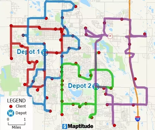
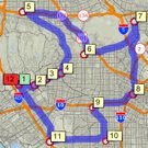
Optimize routes for several vehicles needing to reach many destinations for deliveries and pickups in fixed time windows
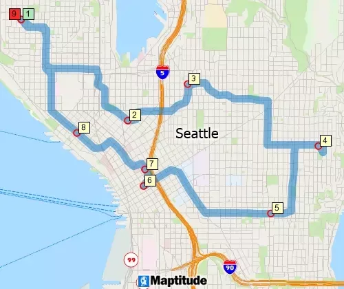
The shortest path calculations allow for minimizing the cost of the path as an ordered/unordered route
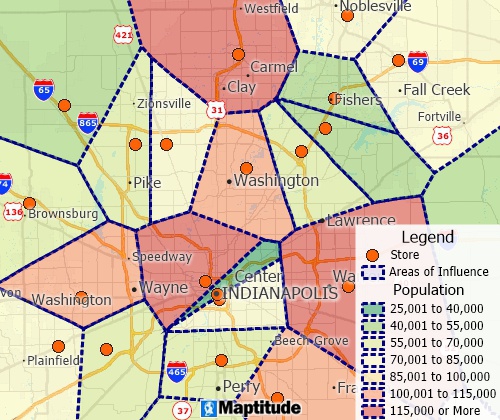
Thiessen polygon/Voronoi diagram map tools can create straight-line distance territories
SaaS applications such as Maptitude Online allow you to share your geographic data as device independent and mobile-friendly interactive maps.
GPS support includes the ability to read/animate/import GPS data and create line and point layers from GPS data
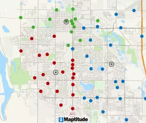
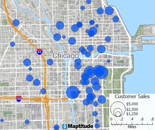
A clustering tool groups points or areas into compact clusters, while placing optional constraints on the clusters such as maximum size or a balanced total field, such as Sales or Population
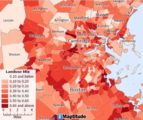
Measure walkability and land use mix, to assess equitable access to services, amenities, and jobs
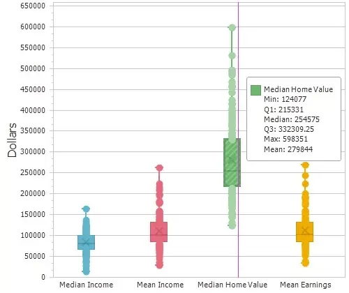
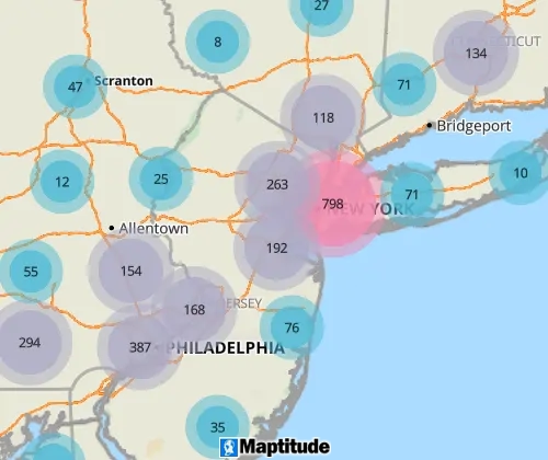
Compute summary statistics (sum, min, max, mean, standard deviation), compute spatial autocorrelation, and create box plots, histograms, and radar charts
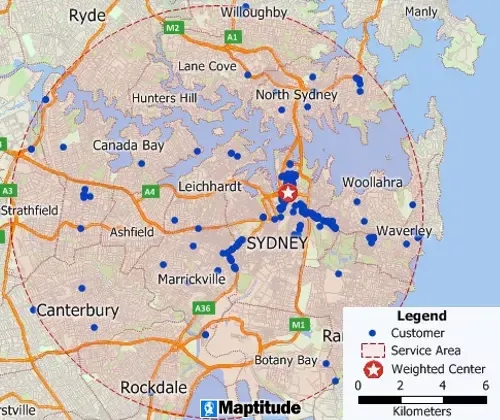
Weighted center calculations allow the identification of centers of "gravity" among points
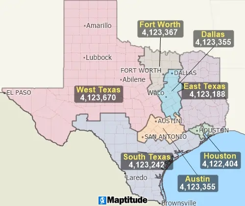
A balancing tool automatically creates territories that are balanced by a specific demographic
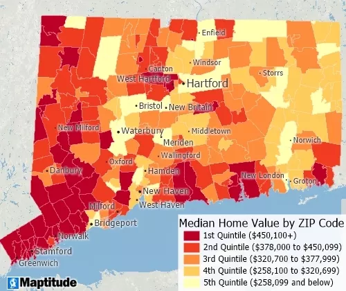
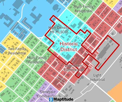
Classify data with quantiles, equal weight, equal interval, standard deviation, nested means, arithmetic or geometric progression, optimal breaks, categories, and manual classification
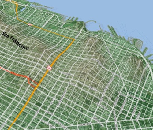
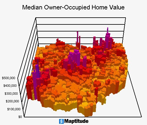
Analyze and display surfaces on a two-dimensional map or as a 3D map and export as Digital Elevation Models (DEMs) or Triangulated Irregular Networks (TINs). Create surface profile charts and contour maps, and determine terrain shortest paths, viewsheds, and lines of sight. You can also build detailed 3D models and record fly throughs.
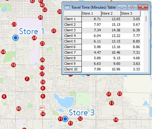
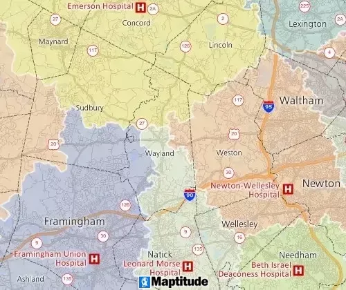
Measure areas and distances, find closest features, and compute drive-time or distance tables
Geographic overlay is supported and allows attribute assignment between layers for aggregating point data or for aggregating and disaggregating attribute data based on percentage overlap of areas
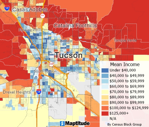
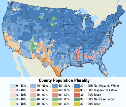
Includes detailed Census demographics to the Block Group level that can be used to esimate the characteristics around features, within territories, or within drive-time rings
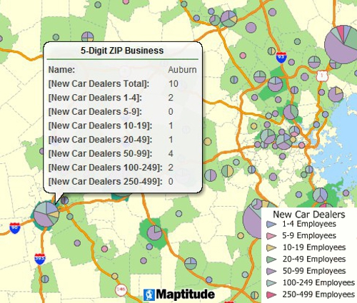
Includes detailed HERE and Caliper datasets of business locations and business count data by ZIP Code
Supports dozens of database and spreadsheet formats plus GIS and CAD formats including Esri Shapefiles, MapPoint PTM files, Google KMZ, and Oracle Spatial
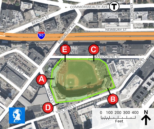
Customize a map legend, add a north arrow, draw callouts lines and shapes, add a title, show a great circle, or add images and logos
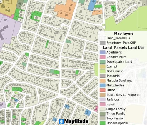
Create, update, and maintain features, including points, lines, polygons, and attributes. Conflation, clip/dissolve/merge/intersect/union, converting points-lines-areas, simplifying, automatic topology handling are all included.
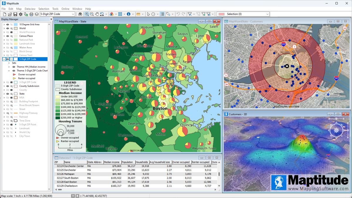
Maptitude is an intuitive and Wizard-driven mapping software that streamlines your business development tasks. Answer a few simple questions and Create-a-Map Wizard™ makes presentation ready maps for any area from local, to national, and international. With a few clicks of the mouse, MapWizard® automatic mapping technology helps you map and visualize your data and to create thematic maps where each element can be customized, including colors, styles, and labels.
Once you understand the patterns hidden in the numbers, share your maps to tell your stories. Create map reports and images for presentations. Copy and paste your maps into applications such as Office, print them, or produce wall-size posters. You can also upload your analysis to Maptitude Online to share with others or to publish on the web.
Maptitude mapping software starts at only US$795 and includes a FREE country package of GIS data ($695 value*) that comes with everything you need to immediately start benefiting from the power of location intelligence. Access up-to-date streets, addresses, and postal boundaries, and pin-map (geocode) unlimited numbers of locations. Real travel time data is used for computing routes and drive-time rings, better reflecting the reality of your markets. Extensive demographics, business, and point-of-interest (POI) data are included.
Maptitude will meet your needs whether you need desktop GIS software with secure off-line data storage or if you require an online mapping platform. Maptitude is also the only map software that does not require a subscription!
Mapping software, particularly in the context of Geographic Information Systems (GIS), refers to software programs or functionalities that enable the creation, manipulation, and analysis of spatial data. These tools allow users to visualize and understand geographic patterns, relationships, and trends by transforming tabular or geographic data into intuitive and revealing map visualizations. Examples of mapping tools in GIS include geocoding, analysis tools, and geoprocessing, which help users communicate information about space and location efficiently by reducing large volumes of data into clear visual presentations.
Mapping software provides features to transform raw location-based information into clear, easy-to-understand visual maps. These tools help businesses and organizations improve operational efficiency and support strategic planning across many industries, including retail, logistics, and business development. By visualizing geographic data, mapping software enables more informed decisions and better resource management.
1. Most geospatial, image, and table formats
2. You can connect to external service APIs such as Microsoft Bing, HERE, what3words, and Google Maps to geocode, analyze driving, public transportation, or walking travel times, or real-time travel by arrival time, departure time, and date.
3. The GISDK included with Maptitude has more than 850 GIS functions which can be called from Windows applications written in C# or any other .NET language, R, and Python.
4. Map background tiling services from USGS, OpenStreetMap, and other web imagery sources.
5. The Maptitude Google Maps toolbar allows you to see your current Maptitude map location in any of the different Google Maps views including Street View.
Maptitude supports a wide variety of map types to meet different business and analytical needs. Users can create:
These map types help organizations better understand their operations, customers, and opportunities at both local and global scales.
 Check out our G2 Reviews Check out our G2 Reviews4.7/5 of 148 reviews |
|
Learn more about Maptitude to see how you and your team can make informative and insightful maps!
Schedule a Free Personalized Demo
*Contact Caliper by email or +1 617-527-4700 for Europe Country Package pricing.


Home | Products | Contact | Secure Store