Travel time is the most realistic way of describing market areas and access to services. A franchise may want to define their territories based on the time required to reach their customers. Emergency services may want to map their response time coverage for an area. The drive-time zones tool in Maptitude supports these types of analysis based on the creation of realistic catchment areas, and with a single click can create a professional demographic report.
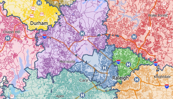
The territories in this map are based on the drive-time to the nearest hospital
Use Maptitude to create drive-time rings and determine which areas can be accessed within a particular drive-time or drive-distance. You can also calculate the market characteristics and demographics around your locations, and estimate the duration of services such as repair or delivery calls. You will also be able to better describe the convenience of your locations in terms of time rather than as a crude straight line measurement. For a facility, you can better identify potential customers within five minutes rather than within two miles. Takeout delivery businesses can quickly determine those destinations within their drive-time trade/service areas.
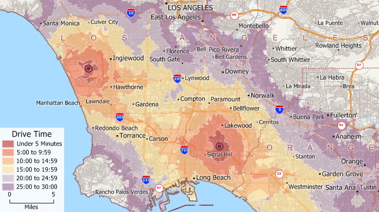
Drive-time rings in 5-minute intervals from two locations in greater Los Angeles
Whether you're managing franchise territories, optimizing delivery zones, or analyzing customer access to services, Maptitude gives you the insights needed to make informed, location-based decisions.
With Maptitude, you can visualize and understand your market in terms of travel time, not just geography, ensuring better planning, improved service, and more effective outreach.
Maptitude supports a wide variety of drive-time mapping applications across industries by turning location data into clear strategies by showing who you can reach and how quickly you can get there. Common use cases include:
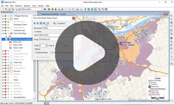
With Maptitude, you can build detailed, insightful, and accurate drive-time maps in just a few clicks, with no GIS expertise required. Follow these steps to get started:
With Maptitude, you can create travel-time catchment areas in minutes, covering ZIP Codes, counties, and local regions, backed by high-precision analytics used by professionals worldwide.
Selecting the right drive time mapping software can be challenging. Fortunately, Maptitude stands out as the top choice for organizations needing drive time analysis, radius mapping, and travel time insights. See how businesses and professionals successfully leverage Maptitude for smarter location-based decisions:

|
“I have access to traffic counts, local businesses, demographic information, drive times, and aerial imagery, all at the tips of my fingers. The program is easy to use, as well.”
|

|
“Maptitude has all kinds of nice features. Routing and drive-time radius are by far the greatest.”
|

|
“Best Mapping software available. Exceeded our expectations. Provides clear maps with plenty of customization to tailor our maps to fit our clients' needs. Excellent drive-time mapping and very simple customer database plotting.”
|
This interactive drive-time map lets you see the median income for U.S. ZIP Codes and proximity to major U.S. airports.
Learn more about Maptitude mapping software to see how you and your team can benefit from driving time mapping!
 Check out our G2 Reviews
Home | Products | Contact | Secure Store

