Mapping Software and GIS Glossary
A drive-time ring encloses an area in which all of the streets are within a certain time of one or more origins.
With drive-time rings you can identify areas that are more than 15 minutes from a hospital or fire station, estimate how many people live within 20 minutes of one of your stores, or determine which portions of a city require a school bus ride.
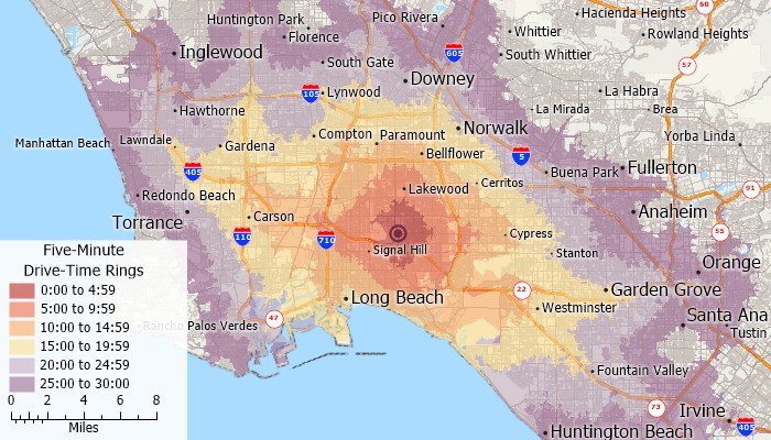
Maptitude Mapping Software gives you all of the tools, maps, and data you need to analyze and understand how geography affects you and your business. With the Maptitude you can create drive-time rings at any time interval you want and estimate the demographic attributes of the rings.
Learn More Free Trial Free for Students/Teachers
![]()
![]()
![]()
![]()
![]()
![]()
![]()
![]()
Home | Products | Contact | Secure Store
