See how Maptitude transforms complex location challenges into clear, actionable insights. Our case studies showcase real clients across industries—from healthcare and government to retail and logistics—using Maptitude to gain a competitive edge.
With decades of GIS expertise, Maptitude empowers you to turn geographic data into measurable results. Scroll down to see how Maptitude has delivered success for organizations like yours.


As the CKE Restaurant Holdings, Inc.'s two popular restaurant brands, Carl's Jr. and Hardee's, grow in the U.S. and in several international markets, managing franchise territories has become more complex. CKE relies on Maptitude to simplify territory identification and allocation, and to improve franchisee satisfaction.

The Glass Guru, a fast-growing home services franchise, needed a more efficient way to plan and manage its sales territories as it expanded across the United States. The Glass Guru uses Maptitude to streamline territory planning, gauge market penetration, identify growth opportunities, and improve franchisee satisfaction.
The San Antonio Kidney Disease Center needed to see where patients lived based on different criteria and sometimes on subsets of that criteria. They needed to be able to contrast one set versus another very quickly and they needed a simple way for the physicians to be able to use the data.
GeoDataVision, a banking compliance consulting firm based in Connecticut, needed a more efficient way to integrate disparate demographic and lending datasets and to visualize risk exposure across different communities.
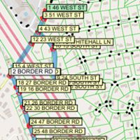
An Assessor's Office needed to schedule thousands of inspections per year to comply with state law and make the best use of limited staff time.
MapPoint and Maptitude have provided location-intelligence tools since the early days of mapping software, but MapPoint is being discontinued by Microsoft. Maptitude is the clear successor and is meeting and exceeding the expectations of former MapPoint customers such as Coverpoint.

Aricia Logistics Consulting uses Maptitude for logistics network development to be able to service customers and determine how many locations are necessary to meet customer needs.
As population growth and changes led to an imbalance in the workloads of police districts in the San Francisco Area, the San Francisco Police Department (SFPD) needed to redraw the police districts, taking into account a large amount of data, such as the number of calls for service, number of incidents, response time, population, and the location of key infrastructure.

As a Field Marketing company eXPD8 has 3,000 merchandisers covering stores over the entirety of the UK and Ireland for a wide range of clients. With such a large area to cover it is essential to assign calls efficiently to the closest employees to reduce both fuel consumption and travel costs.

Alex Arifuzzaman discusses how he uses Maptitude in several analytics courses at the MBA Marketing Department in the Schulich School of Business.

DFA uses Maptitude to be able to convey the results of their finance and property analysis in a compelling and easily understood manner.
The United States Census Bureau required a complete address list in order to collect a questionnaire from every address. To support the 2010 Census, the Census Bureau implemented a Maptitude-based solution, named MAF/TIGER Partnership Software (MTPS).

Home | Products | Contact | Secure Store