Maptitude Geographic Information System (GIS) software is the intelligent mapping solution for business, government, and education. Maptitude is a powerful combination of software and geographic data that provides everything you need to realize the benefits of desktop mapping and spatial analysis with a single, easy-to-use package. Priced at only US$795, Maptitude is the best buy for those looking for mapping software.
In addition, Maptitude includes one FREE Country Package of your choice (a US$695 value). Choose the United Kingdom Country Package to get United Kingdom maps and detailed demographic data for ouput areas, local government areas, counties, and more.
Maptitude mapping software for United Kingdom.
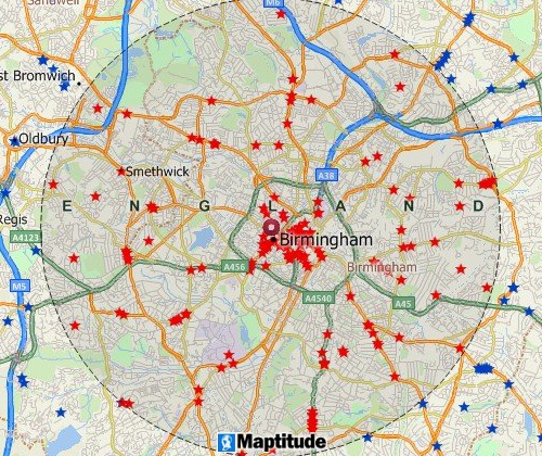
Locate your customers with Maptitude United Kingdom mapping software
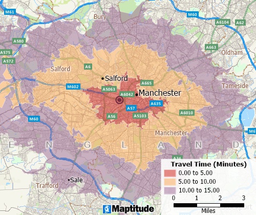
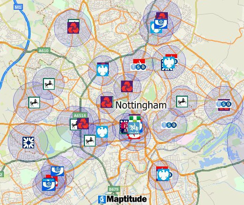
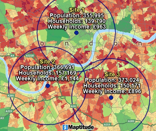
Perform drive-time analysis
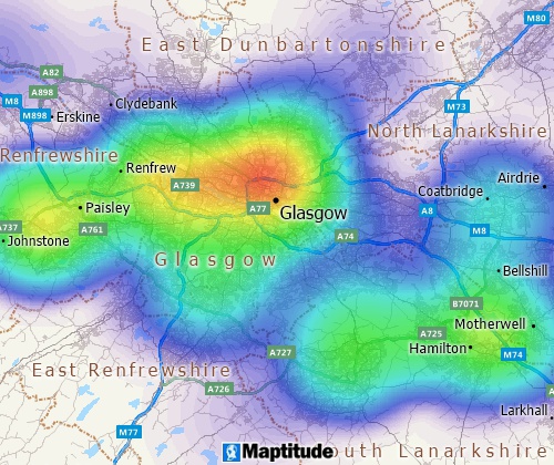
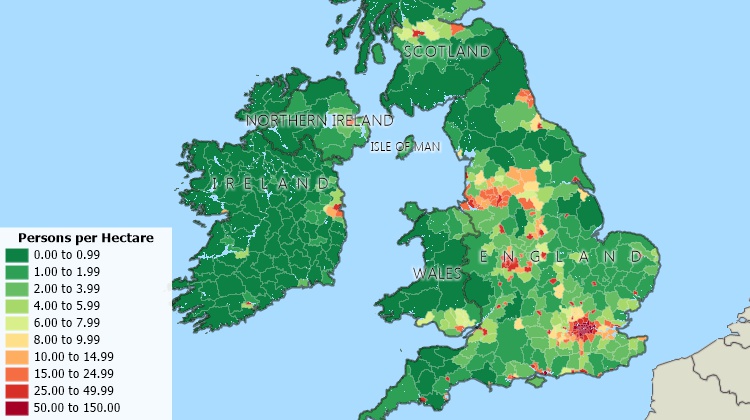
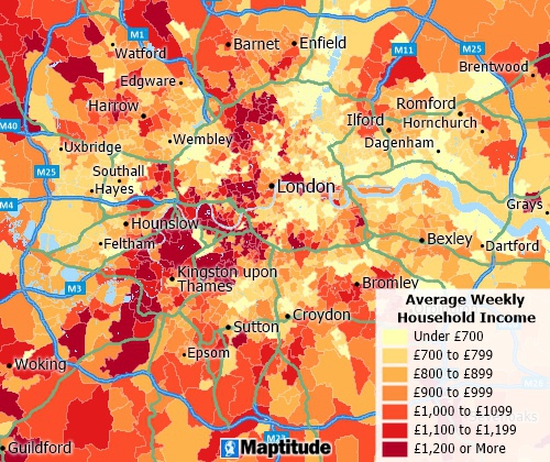
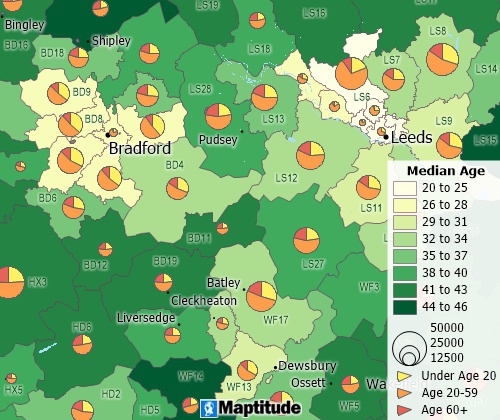
Visualise spatial patterns
The United Kingdom Country Package requires Maptitude 2026 or later and it is available to existing Maptitude users for US$695.

|
“We have found Maptitude to be a really useful piece of software. It allows us to quickly and easily represent various data geographically, and the ease of functionality and ability to layer data makes it really user friendly. It has, among other things, helped us develop our sector-leading delivery service and understand areas that require focus from our sales teams.”
|
The United Kingdom (UK) Country Package for Maptitude includes extensive geographic and demographic data so that you can get started as soon as you install the software. The following geographic files are included:
| Nationwide HERE United Kingdom Geographic Data Layers |
|---|
|
| Other Included United Kingdom Data |
|---|
|
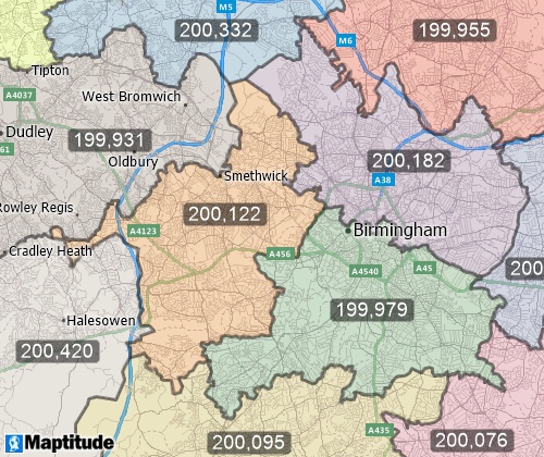
Create balanced territories
Maptitude map software UK
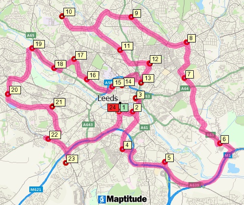
Find optimised routes serving multiple stops
Demographic data from the 2021 UK Census describing population, households, marital status, age, country of birth, race, language, national identity, religion, disability, vehicles, heating, housing units, housing occupancy, housing tenure, travel to work, occupation, employment, and highest level of qualification are included for the following layers:
The postcode area, district, and sector layers have 2021 data for Population, Male, Female, and Households.
No data are available yet from the 2022 Scotland Census.
Includes demographics to the Output Area level
Analyse locations with Maptitude United Kingdom map software
Create many types of thematic maps

|
“Maptitude is excellent for doing geographic analysis projects looking at: where existing customers are and new ones might be (including using the built-in demographic data); identifying hot-spots, patterns and trends that can't be seen in Excel. It is really helpful with network design tasks - which sites are best: centers of gravity; visualizing size of flows between distribution centers; allocating volume to different depots.”
|
For more information on Maptitude please visit the Maptitude
Overview Page or request
a
live demo now.
Home | Products | Contact | Secure Store
