Since 1995 the Maptitude mapping software has made it easy to access a wealth of United Kingdom Census data. You can quickly visualise Census demographics using a suite of wizard-driven tools. Maptitude also provides a map library that contains numerous pre-designed maps listed by Census category. These include thematic maps of demographic, income, and housing data.
For the United Kingdom, Maptitude contains over 1700 fields of Census demographics describing population, age, marital status, living arrangements, ethnicity, nativity, race, religion, health, economic activity, employment, housing, households, transit, and vehicles. The data are provided for Postcodes, Districts, England Counties, England Parishes and Wales Communities, Local Government Boundaries, Greater London Constituencies, Output Areas, Middle Super Output Areas, Super Output Areas, Police Force Boundaries, Provinces, Wards, and Westminster Constituencies. Learn more about the included data on the United Kingdom Country Package page.
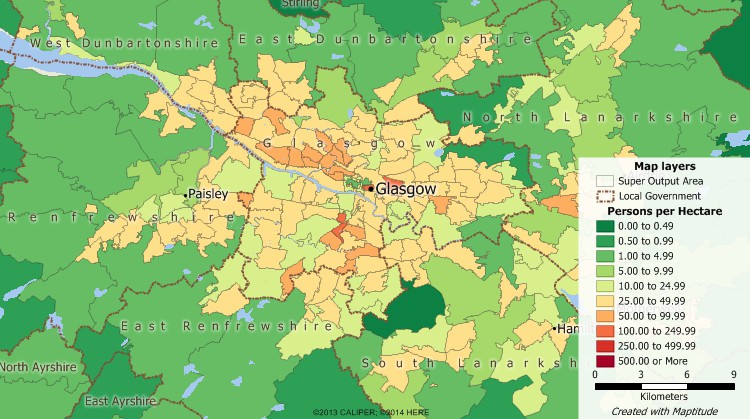
Maptitude census data map of population density using United Kingdom census data included with Maptitude.
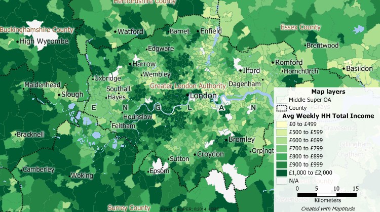
Maptitude census data map of income using United Kingdom census data included with Maptitude.
Use the provided Census data with the analysis tools in Maptitude to make more informed and strategic business decisions and identify growth opportunities. With Maptitude, you will be able to define markets, compare sites, locate and better understand your customers, create territories, and target your audience. Maptitude costs just US$795 and includes a FREE Country Package so you can start your United Kingdom Census data mapping as soon as you install the software.
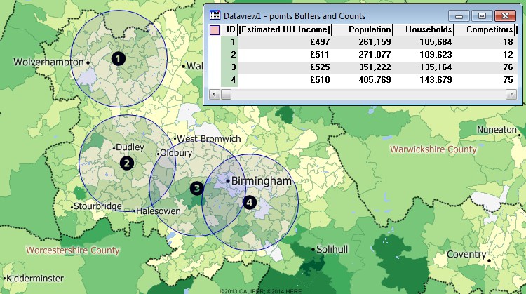
Use the Maptitude tools to evaluate locations using the United Kingdom Census data.
 |
“Maptitude is excellent for doing geographic analysis projects looking at: where existing customers are and new ones might be (including using the built-in demographic data); identifying hot-spots, patterns and trends that can't be seen in Excel.”
|
Home | Products | Contact | Secure Store
