9 December 2025
Maptitude is a powerful sales territory mapping software, trusted
by Fortune 50 companies, that helps businesses to create,
manage, and optimize their sales territories. Maptitude integrates
your sales data with geolocation data to provide valuable insights
into markets, customers, and competitors, ultimately improving sales
efficiency, productivity, and profitability.
Free
Trial
Request Demo
Why Choose Maptitude for Sales Territory Management?
- Create custom sales territories using a
wide range of criteria, such as geographic boundaries,
demographic data, sales revenue, and customer locations. Tailor
each territory to match your unique business goals.
- Design balanced and efficient territories
using intuitive tools that ensure workload equity and optimal
coverage, helping your sales team reach the right customers
without overlap or missed opportunities.
- Analyze sales performance and market trends
to uncover insights that inform strategy. Visualize customer
density, track key metrics, and make data-driven decisions about
where to focus your efforts.
- Easily share and collaborate on sales territory maps
in real-time through interactive web maps, images, and PDFs,
fostering seamless team communication and alignment.
These are just a few of the features Maptitude offers. From
drive-time analysis to advanced reporting and customization options,
Maptitude gives you everything you need to optimize your territory
planning and boost sales performance.
Maptitude Sales Territory Mapping Software Features
Maptitude includes a wide range of features that make it ideal
for sales territory mapping, including:
- Comprehensive geographic and demographic data: Maptitude
includes a wide range of geographic and demographic data from the
Census and other sources. This data can be used to create sales territories that are targeted to your specific customer base.
- Interactive data visualization: plot
customer data and sales trends on heat maps and interactive maps
for comprehensive performance analysis.
- Powerful territory design tools: The Maptitude territory design
tools make it easy to create sales territories that are balanced,
efficient, and effective. You can create territories based on a
variety of factors, including geography, demographics, sales, and
customer locations.
- Territory creation and alignment: manage
territories based on ZIP Codes, counties, states, demographics,
sales potential, and customer behavior to tailor strategies to
business goals.
- Advanced geospatial analysis tools: The Maptitude geospatial
analysis tools can be used to map sales by location to identify
patterns and gaps. This information can be used to make better
decisions about how to allocate your sales resources.
- Geo-analytical optimization: leverage advanced spatial analytics to plan, design, and realign territories for optimal coverage and efficiency
- Flexible
reporting and sharing options: Maptitude can generate a variety of
reports and maps that can be shared with your salespeople and other
teams as
interactive online maps or as report files.
- Route optimization: algorithms to plan
efficient sales routes, reducing travel time and costs for
representatives.
- Performance monitoring and measurement:
track key metrics like sales volume, revenue, quota attainment,
and customer satisfaction to evaluate territory and rep
performance.
- Data import and integration: upload data
from various sources such as Excel, Google Sheets, CRM systems
like Salesforce (coming 2026) and Microsoft Dynamics 365, and ERP systems for
seamless workflow integration.
- Lead management: import, track, and
generate leads based on ideal customer profiles to enhance sales
prospecting and follow-up.
Free
Trial
Request Demo
Benefits of using Maptitude for sales territory mapping
- Improved sales efficiency: Maptitude can help you to create
territories that are more efficient and effective. This can lead
to increased sales and improved customer service.
- Optimized resource allocation: Maptitude can help you to
allocate your sales resources more effectively. This helps you
to save money and improve your bottom line.
- Enhanced customer targeting: Maptitude can help you to
target your sales efforts more effectively. This leads to more
revenue and improved customer loyalty.
- Improved market coverage: ensure all potential customers are
reached, minimizing coverage gaps and avoiding overlaps.
- Enhanced decision-making: provide data-driven insights
and geographic visualization for smarter prospecting and
strategic planning.
- Business growth: identify high-potential areas, expand into
new territories, and increase market penetration effectively.
- Reduced administrative burden: streamline territory
management tasks, allowing sales reps to focus more on selling.
CASE STUDY
 How CKE Grew Their Business with Maptitude
CKE relies on Maptitude to simplify territory identification and allocation. This improves
franchisee satisfaction by providing insightful market intelligence.
Free
Trial
Request Demo
Success Stories: How Organizations Optimize Sales Territories with Maptitude
Choosing the right sales territory mapping software can be
challenging. Maptitude is the go-to solution for organizations
looking to streamline territory management, boost sales performance,
and make data-driven decisions. Here’s what our satisfied users have
to say:

|
“We use Maptitude extensively for
running complex Territory Alignment scenarios.
The depth of the product, its total utility and
functionality is immense. Import-Export capability with
Excel is seamless. It is easy to work with and Maptitude
support is second to none. My complements to the
Maptitude team: They have created a solid product and it
is one of the best software investments we have made as
an organization.”
| |
Esat Angun
Director - Sales Operations, Octapharma, USA |
|
 |
“Maptitude just works!
We now build our franchise territories with ease. Our organization has benefited from our ability to strategically plan out prospective territories, gauge market penetration of our active franchise territories, and begin to identify what our top performing territories have in common.”
|

|
“A wonderful territory mapping program and then some!
Ease of moving territories, obtaining census data and
plotting territories to that data. Beautiful interface
and several ways to customize the product and exports.
The ability to pull in my older MapPoint files and data
was a huge plus! Great video tutorials that help you get
started as well.”
| | Aaron Wesson
Spartan College of Aeronautics & Technology |
|

|
“Maptitude is helping our organization
plan our field service territories and control
our travel and response time.”
| |
Jim Berry
Technical Service Engineering Manager, Xerox |
|
 |
“Great Map Software. Works perfectly for our needs.
Building territories are simple and we just used the heat map functionality to adjust our service routes. Pros: Fair Price - a great amount of data is included with the software and their support is awesome. Cons: not much - fairly intuitive to navigate. Maptive, Mapline...were a lot more expensive and have to purchase additional data.”
Michael Ruotolo
VP of Franchising, Bull Bag
|
|
 |
“Maptitude makes my job easier!
Simple territory creation & data loads. Customer Support
team is amazing with this company!”
Mark Harrington
Director of Marketing, Hard Rock Casino Cincinnati
|
|
 |
“One of the most valuable aspects for targeting and alignment tasks is the use of tracking fields, which allow stakeholders to
see in real time how changes to geographies can affect sales opportunities. This capability significantly accelerates the decision-making process. I also appreciate being able to monitor multiple metrics simultaneously, so I am not limited to visualizing the impact of just one variable at a time.
Being able to quickly and accurately assign ZIP
Codes or counties is essential for meeting our target and alignment needs within the field sales team.”
Rich Vellucci
Associate Director Business Analytics and Insights, ImmunityBio Inc. |
|
Free
Trial
Request Demo
How to use Maptitude for sales territory mapping
- Import your sales data: Maptitude is a Wizard driven application
that simplifies even the most complex tasks, and imports data
from a variety of sources that include Excel, CSV, and
shapefile.
- Create a territory map: Once you have chosen your
data, you can use the Maptitude territory design tools to create
custom sales territories.
- Create sales territories: You can merge
smaller areas into territories and compute the attributes for
each one. This can be done from an existing table of territory
assignments or interactively, by clicking on the map. For
example, you can group ZIP Codes or States together to create
sales territories. There is also an
automatic territory creation tool that simulates thousands
of plans to find the most compact and well-balanced ones for
you. Your territories can even overlap if you require shared
areas.
- Analyze your sales data: The Maptitude analytics produce
Excel territory assignment reports, demographic reports, map
book territory handouts (layouts), and workload index reports
that compare territories to identify mismatches in salesforce
capacity and customer coverage.
- Share your territory
maps: Maptitude can automatically create professional geographic
reports for your territory assignments. You can share your
territory plans as interactive
Maptitude Online maps, or in
many
formats including those for PDF, Excel, and Google Maps.
Tips for using Maptitude to get the most out of your sales territory mapping experience
Free
Trial
Request Demo
Create custom sales territories based on key business metrics
The Maptitude Territory Wizards make it easy to create sales
territories that are tailored to your specific needs. You can
consider a variety of factors when designing your territories, such
as:
Geography:
You can create territories that are based on
geographic boundaries. Use Maptitude to create sales territories out
of postal codes, ZIP Codes, counties, or states, or any other type
of area, to calculate the demographic characteristics of your custom
territories, and to attach your own data to them.
Demographics:
You can create territories that are based on demographic data, such as population,
households, income levels, or age distribution, or any of the variables
that are included with the sales territory mapping software.
Revenue:
You can create sales territories that are based on your
historical revenue data or any of your own business key performance
indicators. This can help you to ensure that your territories are
equal and that your sales teams are focusing on the most profitable areas.
Customer distribution:
You can create territories that are based on your
customer locations. Maptitude provides unlimited geocoding of
addresses, ensuring that your sales, delivery, and marketing teams
can reach all your customers efficiently.
Free
Trial
Request Demo
Maptitude Sales Territory Management Tools
Maptitude is easy to use and helps you to create
and track optimized sales territories.
Some of the key features of Maptitude include:
- Sales territory balancing: Maptitude helps ensure that your territories are equally
balanced by population characteristics such as income or by business
data such as revenue. The Territory Manager supports auto-balancing
or tracking multiple running totals. You can mix automation with
manual point-and-click territory edits for results tailored to your needs.
- Territory merging and splitting: You can easily merge or split
territories as needed. In addition, you can set rules for which
areas can be chosen and whether they can overlap. Complete undo/redo
support ensures you have the confidence to explore any boundary
configuration.
- Sales territory optimization: Maptitude can help you to
optimize your territories for efficiency and effectiveness. Whether
you want to simulate creating equal and compact territories for
what-if scenarios, or for comparison with your existing boundaries,
Maptitude can help. Use demographics, drive-time, or other factors
to define your areas.
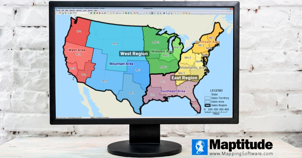
- Sales territory hierarchies: Many businesses have a hierarchical territory
structure, with territories, districts, and regions for different
levels of management. Whether you have one level for your hierarchy
or many, Maptitude has the flexibility to manage and report on each
map layer and the associated data.
Whatever your needs, from basic to complex, the Maptitude toolkit
will help you to achieve your territory planning sales goals.
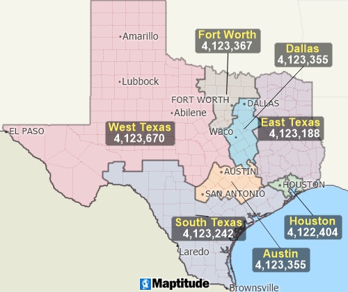
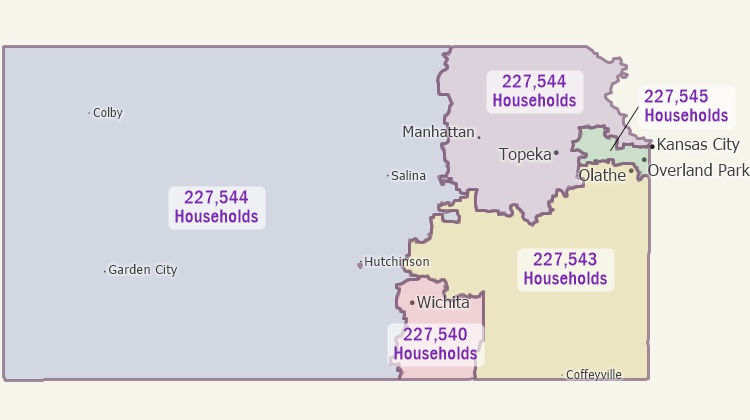
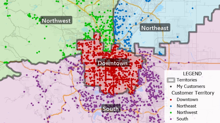
Use Maptitude sales territory management software to automatically create balanced territories
from groups of features
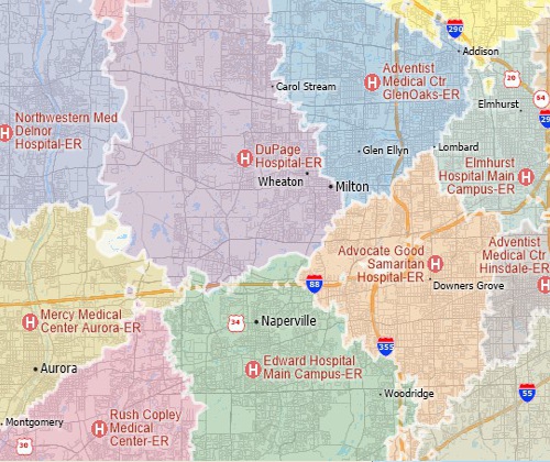
Maptitude includes a territory mapping tool for creating street-based territories.
This map shows the shortest travel time zones to various
hospitals
Free
Trial
Request Demo
Maptitude is the best sales territory mapping software
Maptitude is a powerful sales territory mapping software that can
help businesses to improve their sales efficiency, optimize their
resource allocation, and enhance their customer targeting. If you
are looking for a sales territory mapping solution that can help you
to achieve your sales goals, then Maptitude is the right choice for
you.
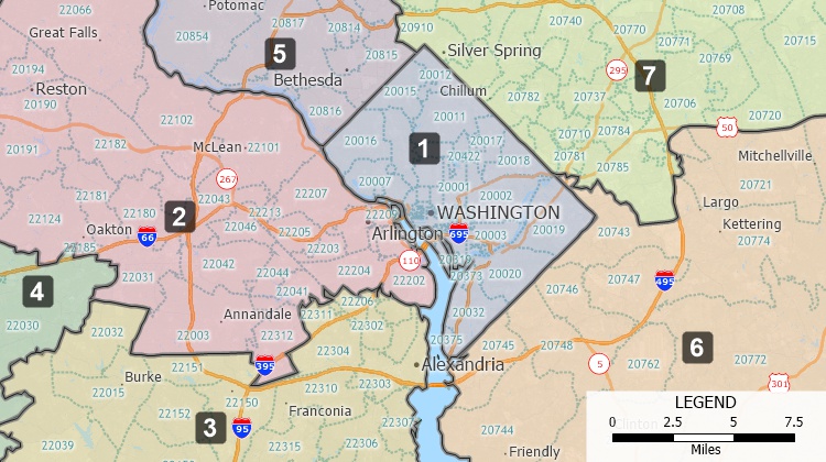
Try an interactive territory map now!
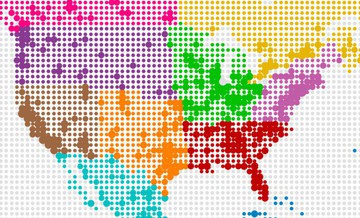
Create your own custom territory maps
like these balanced, 5-million population territories based on
ZIP Codes! Try the full-featured version of Maptitude with a
1-month risk-free trial.
Free
Trial
Request Demo
Maptitude Territory Mapping Videos
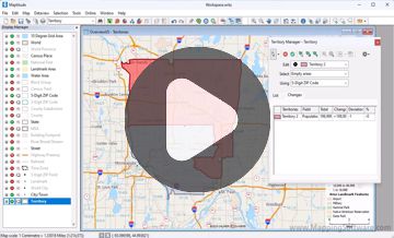
Creating territories interactively with Maptitude
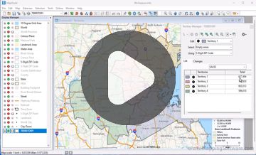
Creating territories from a table with Maptitude
Creating territories from a layer with Maptitude
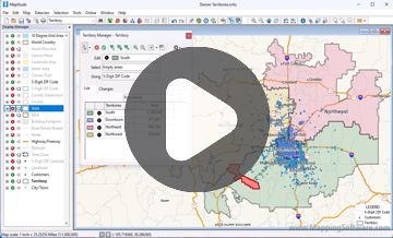
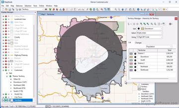
Modifying territories with the Territory Manager
There's no better territory mapping software at any price. Why spend more for less?
Get Started with Maptitude Sales Territory Mapping Software
Learn more about Maptitude to see how you and your team can benefit from sales territory mapping software!
Free
Trial
Request Demo
Buy
Now
 Check out our G2 Reviews