Mapping Software and GIS Glossary
Geospatial clustering is the process of organizing a set of geographical features into groupings named "clusters". Features inside a cluster are highly similar, whereas the clusters are as diverse as possible. Clustering's purpose is to generalize and expose a relationship between spatial and non-spatial attributes. Clustering tools automatically group points or areas into compact clusters, while placing optional constraints on the clusters such as maximum size or a balanced total field, such as sales or population.
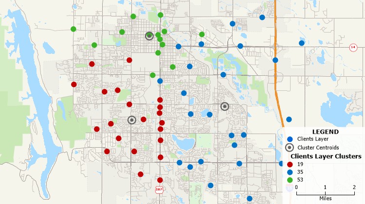
Group features into compact clusters and identify the centers of those clusters.
Maptitude Mapping Software gives you all of the tools, maps, and data you need to analyze and understand how geography affects you and your business.
How can I split my list of stops into equal size clusters for routing?
Learn More Free Trial Free for Students/Teachers
![]()
![]()
![]()
![]()
![]()
![]()
![]()
![]()
Home | Products | Contact | Secure Store
