TransModeler has a unique GIS architecture that integrates traffic simulation models with a geographic information system (GIS) that has been extended to store, maintain, and analyze transportation and traffic data. TransModeler provides you with an efficient tool for compiling, maintaining, and utilizing traffic data in simulation and other forms of analysis. TransModeler allows you to keep important city or regional traffic information such as traffic counts, lanes, and speeds in spatially accurate databases that can be readily accessed and updated as well as directly applied in traffic simulation and travel demand forecasting. You can store and simulate traffic signal timing plans for multiple scenarios and times of day. In addition to using TransModeler as a simulator, you can use it as an enterprise or metropolitan-wide database system for traffic and related data.
TransModeler achieves a new level of geographic accuracy in terms of capturing the location and geometry of road networks. It also brings unprecedented ease of use and lower costs for developing simulation networks from GIS data, planning networks, and aerial photography. A powerful network editor facilitates interactive development of simulation networks and project scenarios.
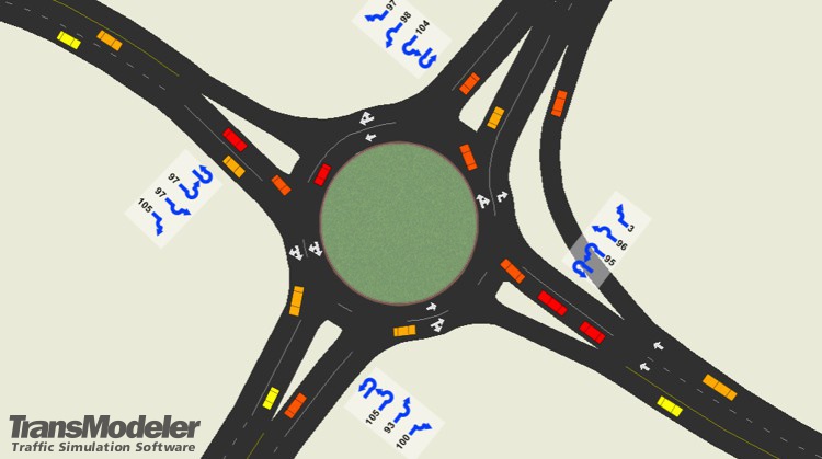
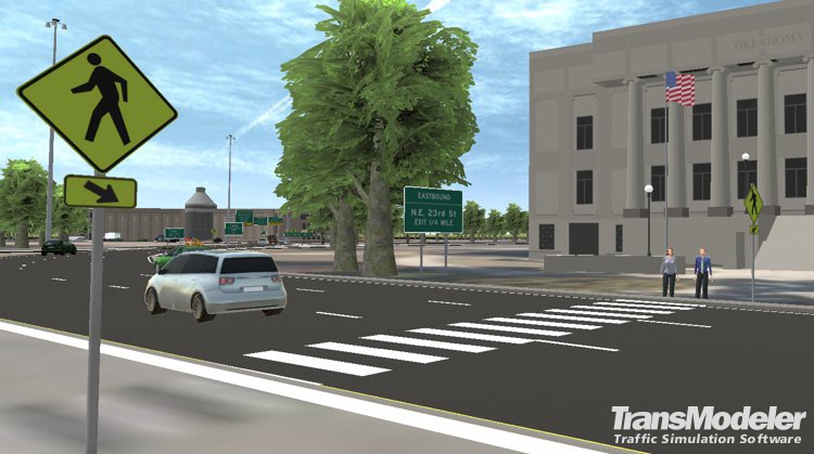
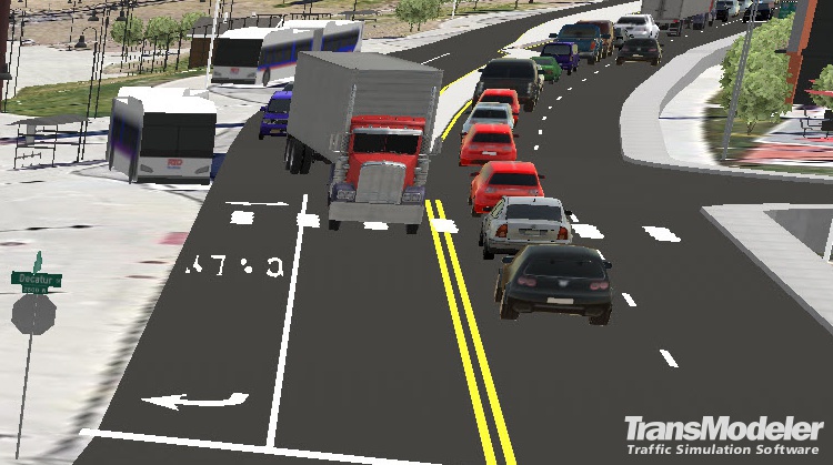
TransModeler is also a powerful visualization system for traffic that produces stunning and insightful 2-D and 3-D animation of complex traffic systems by displaying traffic flows, signal operations, and overall network performance. Animations observed during a simulation can be saved and replayed after a simulation run has been performed, or recorded to movie files. TransModeler’s advanced graphics include the use of GIS tools to produce informative maps and charts that further enhance the presentation of simulation results to decision makers.
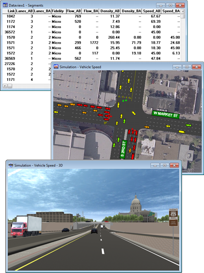
TransModeler uses specialized geographic databases to represent the various elements of traffic networks. Network features, such as streets and intersections, are layered in specialized geographic databases designed to achieve speed and efficiency for computationally intensive simulation projects. Network attributes are stored in mappable tables for easy data input, data management, visualization, and error checking. Dynamic attribute fields update during a simulation to reflect time-varying conditions, and can be tabulated or displayed in thematic maps to illustrate the evolution of speed, density, flow, and so on as the simulation progresses.

Road editing tools in TransModeler make it easy to model non-standard geometries and novel intersection and interchange designs. TransModeler automatically creates many elements of the road network for you, saving you time and money, and has shortcuts that make routine editing tasks easy. With the Road Editor you can create a host of network features in two clicks or fewer:
Home | Products | Contact | Secure Store