

 Caliper Corporation’s Transography™ U.S. data products and data
processing services provide unprecedented levels of insights and
accuracy for transportation modeling and analysis and many related
applications. The Transography offerings draw from and fuse numerous
diverse sources of information from cell phone apps, connected vehicle
data, real time monitoring of travel speeds, proprietary network and GIS
data, and demographics to offer both custom and standard solutions for
transportation data needs. We use our GIS, transportation modeling,
computing, and data science expertise together with top-quality big data
to produce the finest data products available.
Caliper Corporation’s Transography™ U.S. data products and data
processing services provide unprecedented levels of insights and
accuracy for transportation modeling and analysis and many related
applications. The Transography offerings draw from and fuse numerous
diverse sources of information from cell phone apps, connected vehicle
data, real time monitoring of travel speeds, proprietary network and GIS
data, and demographics to offer both custom and standard solutions for
transportation data needs. We use our GIS, transportation modeling,
computing, and data science expertise together with top-quality big data
to produce the finest data products available.
Some of what the Transography service offers include the following:
The national networks come with a rich set of attributes considerably beyond those typically provided by navigation vendors and services. These include functional class, number of lanes, and estimated average daily traffic for roads. For rail, the network comes with type of service, ownership, and trackage/haulage rights. The street networks come with address ranges for geocoding. The lane level networks are simulation ready for TransModeler and are provided with appropriate intersection detail. The street networks come with address ranges that are suitable for geocoding.
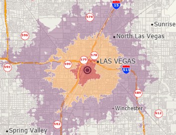
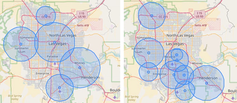
Costco (left) store and Von's (right) store market areas in Clark County, Nevada
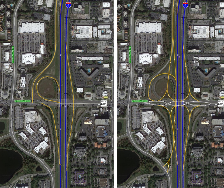
Before and after a future interstate project development
Caliper Corporation’s Transography transportation data service exists to propel transportation models and the decisions that rely upon them to new levels of accuracy, reliability, and validity. There is no one way to process Big Data, no one way to filter Big Data, and no one way to expand Big Data to represent all travel. In fact, each application may pose unique challenges. The Transography data products are curated by expert travel, traffic, and freight modelers to serve modelers and decisionmakers in the best possible way. We make use of advanced algorithms, machine learning, and unique additional data to improve its accuracy and utility. Transography data products are available to Maptitude, TransCAD, and TransModeler users, and most can be also be provided in other formats. The data are also available optionally with the Maptitude SaaS and TransCAD online to the users of your choosing within your organization .
Caliper is now your preferred source for Big Data tailored to your needs and provided in the formats that are most useful. Be it location-based data from cell phone apps or connected vehicles, our Transography service can provide data to improve business processes and forecasting models of all types at very competitive prices.
If you have already licensed data from some primary sources, Caliper can process that data for you using our efficient cloud-based pipelines. We have expertise in processing data from cell phone app data vendors, Wejo, ATRI, HERE, and INRIX. We can deliver data in Caliper and many other popular formats.
Pay only for what you need and receive a further discount when the data are used by Caliper in a consulting or research project for your organization.
For more information, please contact Dr. Vince Bernardin, Jr., Vice President of Travel Demand Analytics.