
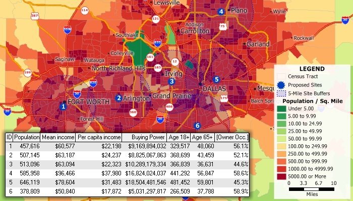
Find the best site locations
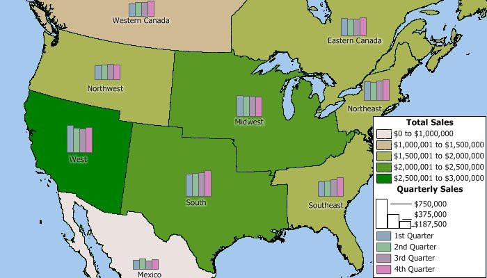
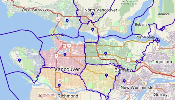
Create custom sales territories
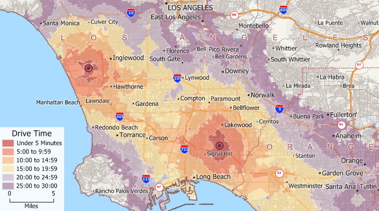
Create drive-time or distance rings
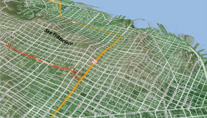
Use aerial and satellite images for geographic editing and reference
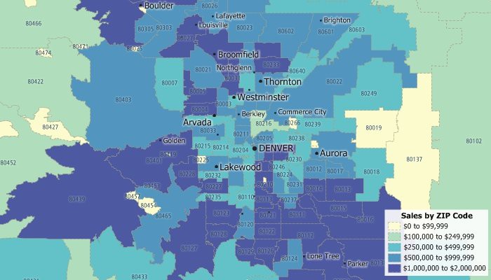
Analyze sales and customer data by postal code or ZIP Code
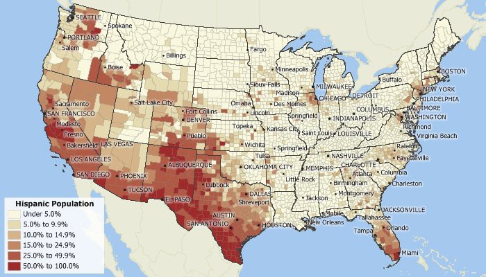
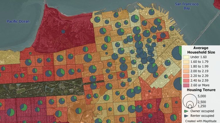
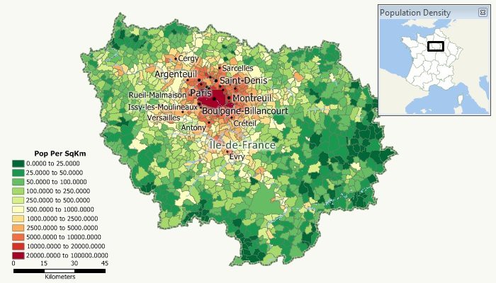
Perform nationwide Census demographic analysis
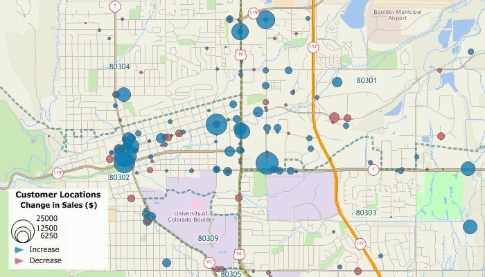
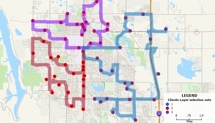
Locate your customers and facilities
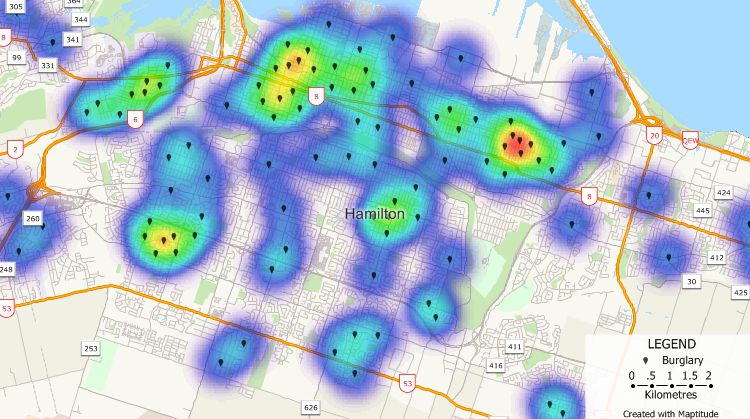
Find the density of any type of location data such as customers or crime hot spots
Create territories based on drive time or distance
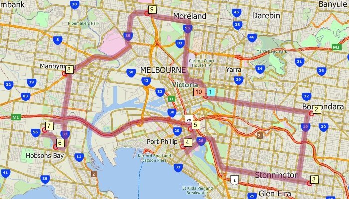
FInd shortest paths and routes
Identify optimized routes for multiple deliveries
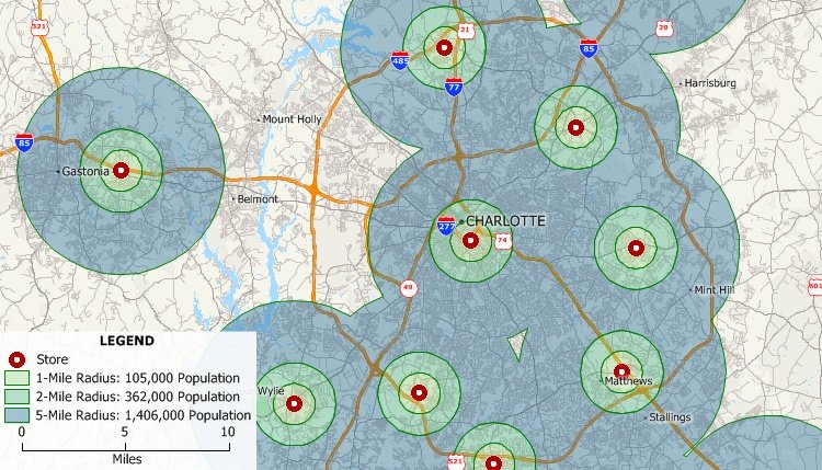
Create radius maps to visualize market penetration
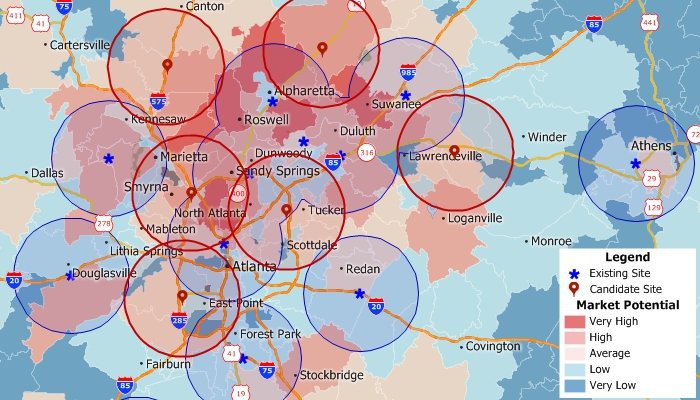
Determine market potential and target growth opportunities
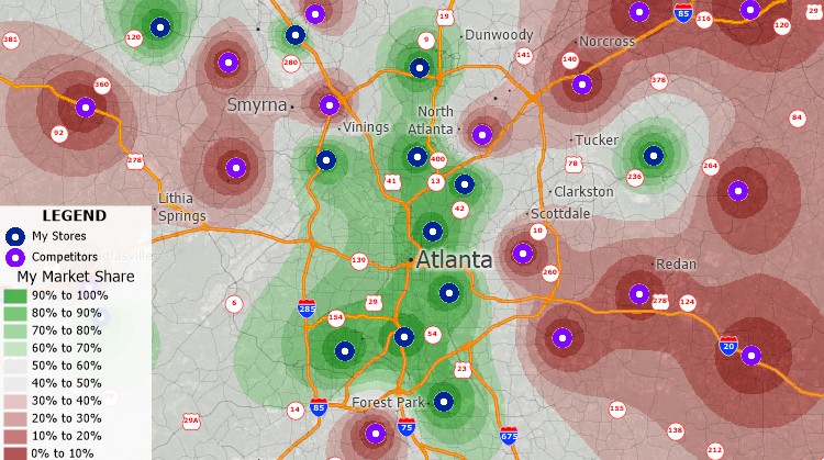
Estimate your market coverage versus the competition
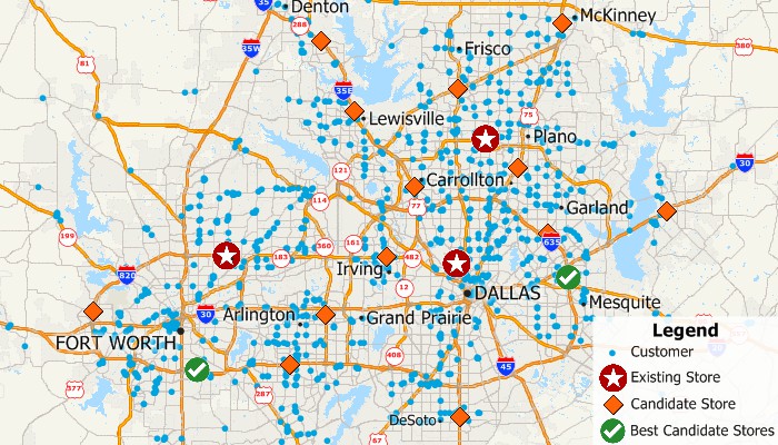
Identify the best locations for facilities
Use geographic data from other GIS and CAD Sources
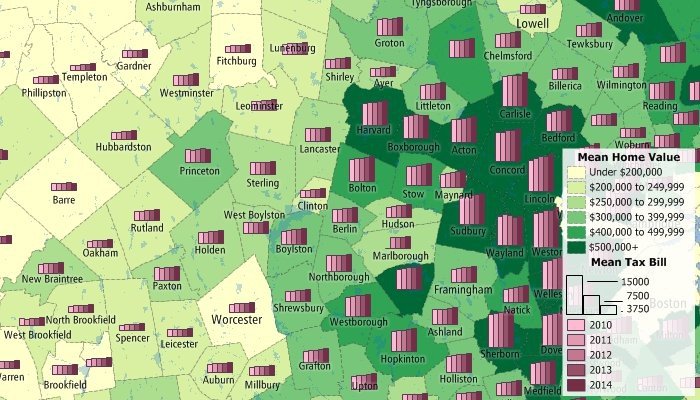
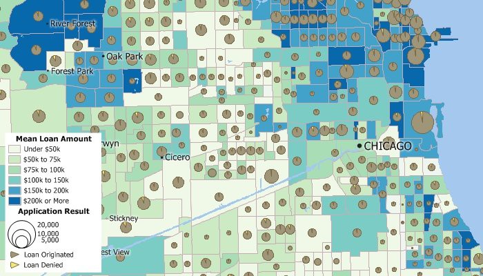
Analyze real estate trends
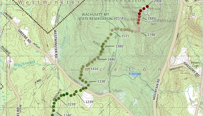
Visualize three-dimensional surfaces
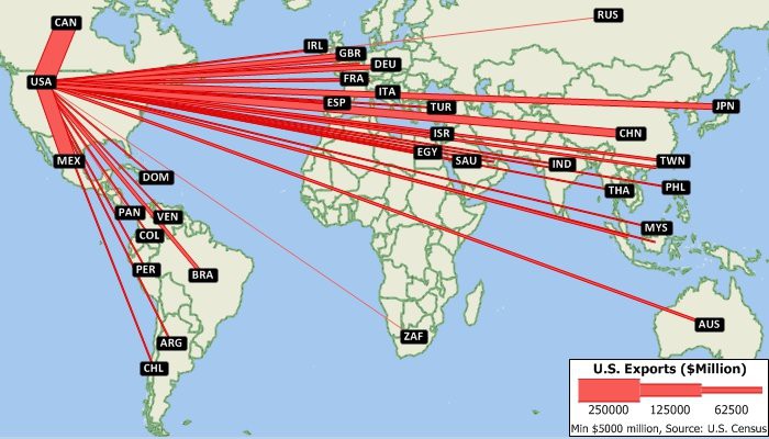
Visualized flows of goods or people
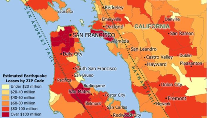
Assess risk and insurance underwriting
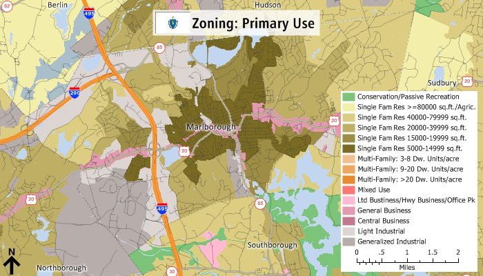
Create zoning and other government maps
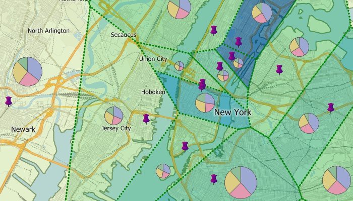
Determine areas of influence
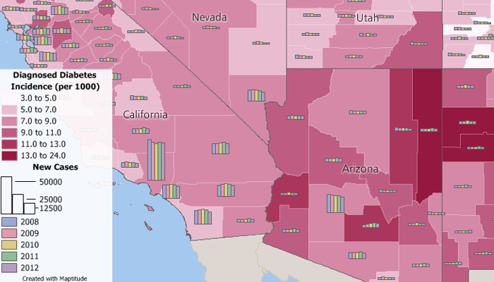
Analyze public health data
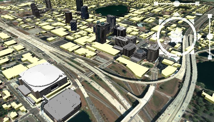
Add 3-D models to surface maps for added reference
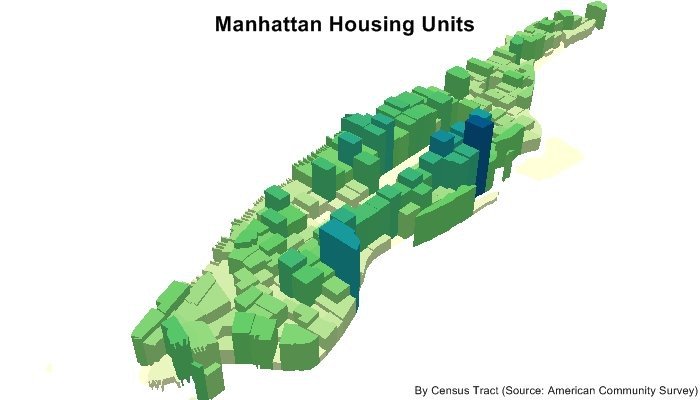
Visualize data with color and 3D prism maps
Verify regulatory compliance
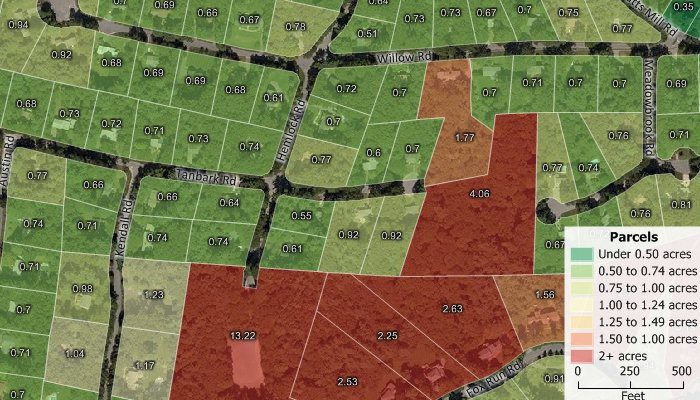
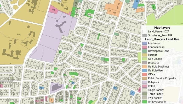
Create parcel maps and map parcel data
Use any logo, pushpin icon, image, or font for your locations
Display only your area of interest such as a single state or a sales territory
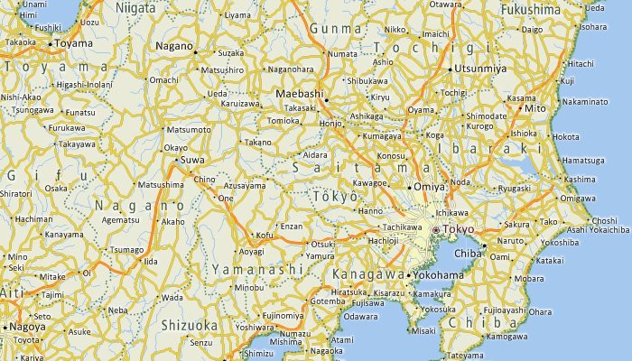
Find locations anywhere in the world
Track and display your GPS location
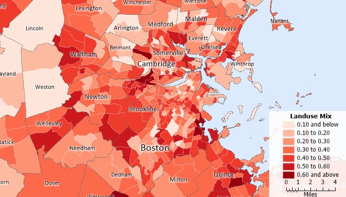
Measure land use mix

