
Working with Map Styles in Maptitude for Redistricting
Modifying the style of point, line, and area features
Customizing a Maptitude for Redistricting Map Legend
How to customize a Maptitude for Redistricting legend
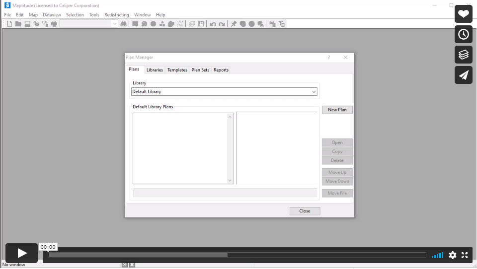
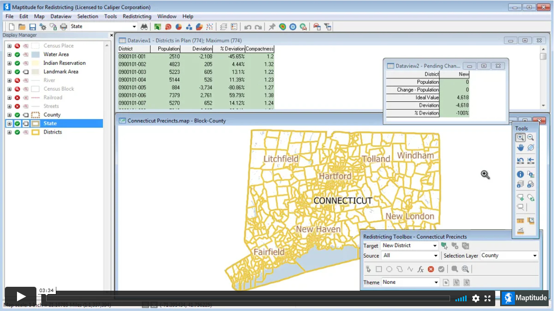
Demonstration of Maptitude for Redistricting
Demonstration of Maptitude for Redistricting
Locating Your Incumbents
How to map incumbents
How can I customize District Layouts?
How to customize a district layout
Working with Maptitude for Redistricting Selection Sets (Filters)
Using the selection tools, selecting features by location or condition, combining selection sets, and computing statistics
Using Other Geographic File Formats in Maptitude for Redistricting
Using files stored in other geographic file formats (e.g., Esri Shapefile, Google Earth KMZ file) in Maptitude for Redistricting
Using the Maptitude for Redistricting Display Manager
How to change the contents, styles, and labels in a map with the Display Manager
Moving Around a Maptitude for Redistricting Map
How to zoom in and out on a map, pan a map, use the map locator, and find a particular location on a map
NCSL Technology webinar featuring Maptitude for Redistricting
NCSL Technology webinar featuring Maptitude for Redistricting
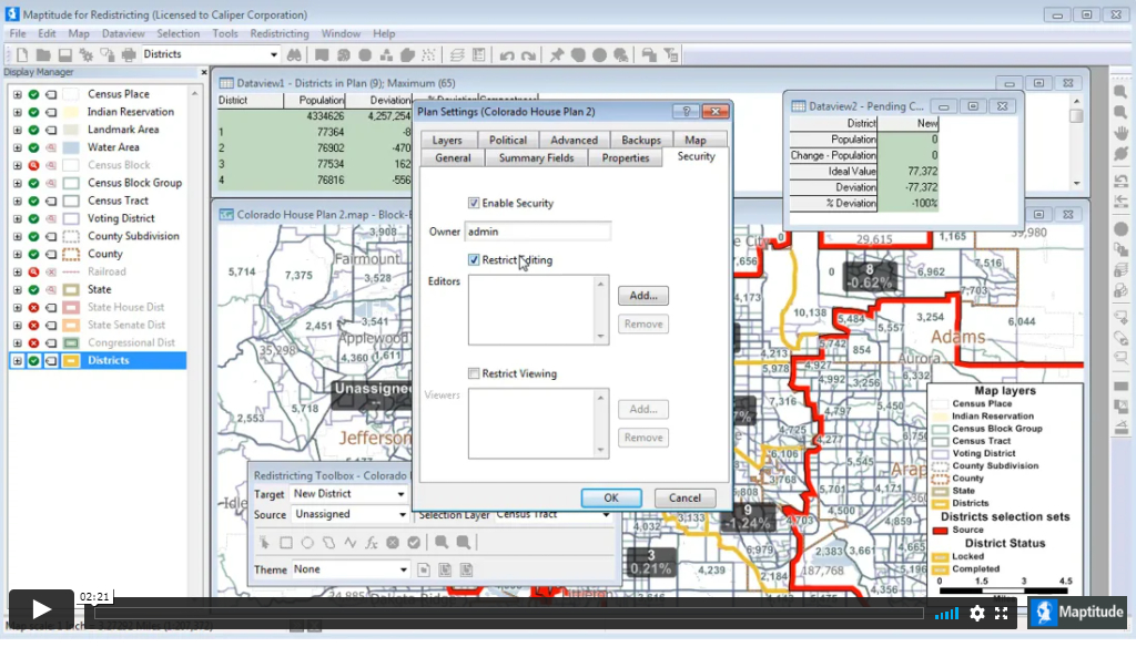
Plan Security
How to secure a Maptitude for Redistricting plan library and specify which users have editing and viewing rights to each plan
Using a Custom Hierarchy
How to use your own geography and a custom hierarchy to create a plan in Maptitude for Redistricting
Importing a Plan Using an Area Layer
Importing a Plan Using an Area Layer
Importing a Plan Using an Equivalency File
Importing a Plan Using an Equivalency File
Merging Sub-Plans
How to merge sub-plans for different geographic areas into a master plan in Maptitude for Redistricting
Exporting to an Equivalency File
How to export a redistricting plan to an equivalency file in Maptitude for Redistricting
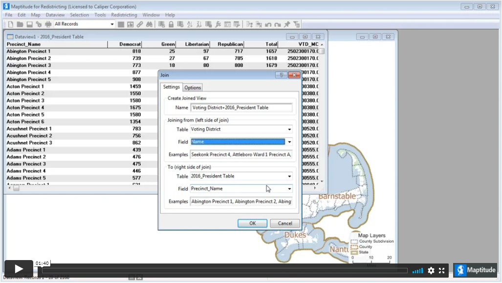
Disaggregating and Aggregating Data from a Map Layer
How to disaggregate and aggregate data from a geographic file in Maptitude for Redistricting | 2:17 minutes Click here for information about comparing election and voter registration data from different elections.
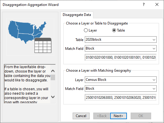
Disaggregating and Aggregating Data from a Table
How to disaggregate and aggregate data from a table in Maptitude for Redistricting | 2:16 minutes Click here for information about comparing election and voter registration data from different elections.
Grouping Reports into Report Sets
How to group reports together into report sets and how to modify report sets in Maptitude for Redistricting
Exporting a District Layer
How to export a Maptitude for Redistricting district layer and modify it for use in another plan