
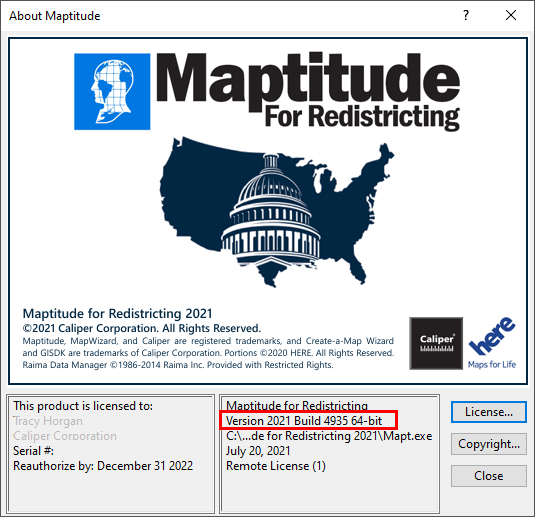
As we improve the Maptitude for Redistricting software, new “builds” of the software are released with incremental improvements. You can see which build of the software you are using by going to Help>About… from the main toolbar.
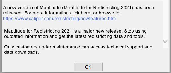
If you have Maptitude for Redistricting 2021, you can get the latest version of Maptitude for Redistricting 2021 by going to Help>Check for Updates and clicking on the link:
Below are the release notes for different builds of Maptitude for Redistricting:
| Build Number | Ship Date | Release Note |
| 4935 | 7/22/2021 | Initial Release |
| Enhancements to the Redistricting Toolbox, including automatically updating the selection layer drop-down to include area layers added to the plan after initial creation | ||
| Usability Improvements to Disaggregation/Aggregation wizard including filtering and handling 2020 census geography | ||
| Added ability to specify Majority-Minority districts and check that they comply with minimum target values | ||
| Usability improvements for Plan Manager including automatically adding plan libraries when new data are installed | ||
| Usability enhancements to Plan Settings dialog | ||
| Enhancements to Themes tool in Redistricting toolbox including the ability to save themes to a file, load themes from a file, and use different theme files for each plan | ||
| Added a Majority-Minority report and Ensembles report | ||
| Added a plan integrity tool to check to see if incumbents have been moved out of their district | ||
| Extended capabilities of Communities of Interest tool to use user-supplied layers of communities | ||
| Added ability to Print Map Book to a series of PDFs or a single continuous PDF document | ||
| Enhanced automatic district layouts to include District Long Names | ||
| Ability to automatically label district boundaries with street names | ||
| 4940 | 8/9/2021 | Extended the capabilities of the Plan Manager including improved ability to add and manage libraries with identical names |
| Enhanced the Communities of Interest tool to allow GEOJSON files to be used as a community layer | ||
| Usability enhancements to the Select by Rectangle tool in the Redistricting Toolbox | ||
| Usability improvements to Plan Settings including a warning message when adding all the summary fields to a plan | ||
| Improved the ability to handle maps that include layers with identical names | ||
| Usability improvements to the Autodistrict tool | ||
| 4945 | 8/16/2021 | Improvements to file browsing including opening the most recent library location when creating a new plan |
| Enhancements to the Create a New Plan Wizard to streamline the plan creation process | ||
| Usability improvements to the Travel Contiguity tool | ||
| Usability enhancements to several reports including improved support for Block-VTD-MCD-County hierarchies when running the Error Check report | ||
| 4950 | 8/21/2021 | Enhancements to the Compare Two Plans tool including better support for copied plans |
| Added the capability to see the exact time and date a plan was created and last modified in the Plan Manager | ||
| Usability improvements to the Plan Manager including listing the file path of the current library in the Plans tab | ||
| Usability enhancements to Summary Fields under Plan Settings | ||
| 4955 | 9/14/2021 | Improved the stability of the Maptitude Download Manager |
| Usability enhancements to the Plan Manager including removing duplicate library entries and improved behavior of the move up and move down buttons | ||
| Usability improvements to the label district boundary tool | ||
| Extended the capability to specify and handle multi-member districts in a plan | ||
| Improved the unassigned area check and non-contiguous area check to highlight all the areas that are unassigned and non-contiguous | ||
| Usability enhancements to the Redistricting Toolbox including a warning when users close a plan with an unsaved selection | ||
| Usability improvements to the Autodistrict Refinement tool | ||
| 4960 | 9/21/2021 | Added the capability to find political subdivision splits under Plan Integrity tools |
| Usability enhancements to the plan creation process, including improved sorting behavior of Summary Fields and improved handling of multimember district counts | ||
| Usability improvements to user-created Field Sets | ||
| 4965 | 11/8/2021 | Usability improvements to the Redistricting toolbox including increased selection speed and better behavior when selecting Census Blocks using the City/Town layer |
| Usability enhancements to the Community of Interest tool when using the Selection toolbar to define communities | ||
| Added the capability for Map Books to show District Long Names | ||
| Improved the multi-member Population Summary report to allow additional summary fields to be included | ||
| Usability enhancements to the Label District Boundary tool | ||
| 4970 | 1/4/2022 | Added the Minority Voting Age Population report, which highlights the number and percentage of minorities among the voting age population of each district |
| Usability enhancements to the plan creation process, including improved handling of CSV equivalency files | ||
| Improved the handling of plans with a Block-only hierarchy in the plan components report |
||
| Usability improvements to the population summary reports and automatic district layouts |
||
| Usability enhancements to the Plan Publisher add-in |