Maptitude Help / Moving Around a Map / Changing the Map Scale and Center
Changing the Map Scale and Center
A Maptitude map is dynamic. You can focus in on any specific area you want, and change the map so that the features you want to see are shown at the size you want to see them.
The scale of a map is the relationship between the size of each feature on the map and its actual size on the surface of the Earth. Large scale maps make each feature look larger, and show a smaller geographic area. Small scale maps make each feature look smaller, and show a larger geographic area.
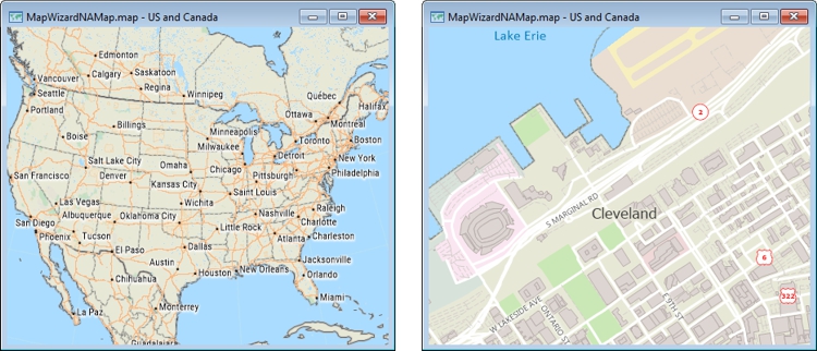
A small scale map (left) and a large scale map (right)
The center of a map is the location of the middle point of the map. Taken together, scale and center define the area that is included in a map, also known as its extent.
There are a number of ways that you can move around a Maptitude map:
- Click on a map using the Zoom In
 , Zoom Out
  , or Pan
  tools
tools - Use the Edit-Find command to have the map display a specific location such as an address, city, state/province, postal code, country, or coordinate
- Zoom to map features that you have highlighted in a dataview
- Use an overview window
- Set the scale to a specific number of miles/inch (or kilometers/cm) or a specific ratio
- Synchronize the scale of a map to another map
Each time you change zoom or pan, Maptitude remembers the previous settings. You can retrace each change all the way back to the extent that was used when the map was created or last saved.
 |
For a video tutorial see: (Internet connection required) |
 To Return a Map to the Previous Scale and Center
 Undo Zoom on the Standard toolbar.
Maptitude undoes the most recent zoom or pan action. You can repeat this step to continue to retrace each change.
To Restore the Original Scale and Center
 Undo All Zoom on the Standard toolbar.
Maptitude draws the map with the scale and center that was used when the map was created or last saved.
©2026 Caliper Corporation