| Mapping, GIS, & Transportation Software Solutions |
| Mapping, GIS, & Transportation Software Solutions |
Caliper provides comprehensive GIS application development services based on TransCAD for the Web and Maptitude for the Web. We specialize in designing, implementing, and integrating GIS applications. We develop:
Caliper provides enterprise add-ins and extensions to our core desktop GIS applications, TransCAD, Maptitude, and TransModeler. These desktop applications can include custom thematic mapping, redistricting, and geographic editing following complex business rules, market analysis, transportation planning and modeling, political mapping, and custom geographic reports. Examples of custom applications developed by Caliper include:
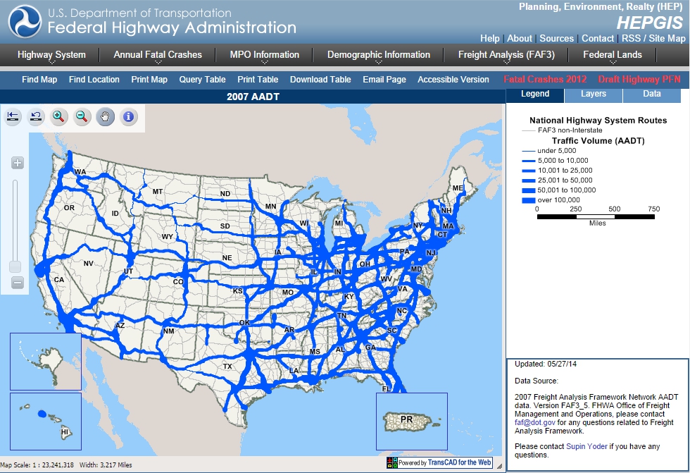
The Federal Highway Administration HEPGIS web site shows many demographic, highway, MPO, and freight flow maps.

The Massachusetts High Technology Council MassTrack web site shows how communities rank in terms of factors of interest to high-tech industries.
If you are developing a web site or a new online service and you would like to integrate geographic information, we can provide a custom web service that you can easily integrate, or mash-up into your site. When we develop a custom web service, we design it using unobtrusive Javascript and Ajax. You don't need to be an expert in GIS to program our web services.
Our GIS web services can provide many different geographic functions including custom thematic map creation, selection of database records by location, geocoding, reverse geocoding, geo-tagging, and reporting Census demographic or legislative district information by location.
We support creating APIs in a variety of formats, including REST, SOAP, JSON, RSS, or your own custom XML. We can provide application development services in a variety of server-side languages including Python, PHP and ASP.NET (VB.NET and C#).
On the client-side, we integrate our Javascript library with jQuery, Dojo, and the Google map API.
We can host the web service for you or deliver a web service platform that you can host on your own servers.
Caliper provides turnkey geographic web application development services, including map user interface design, client-side programming using unobtrusive Javascript and server-side programming in PHP, Python, or ASP.NET (VB.NET and C#).
We can either host your application on our servers or provide you with an application that you can host on your own.
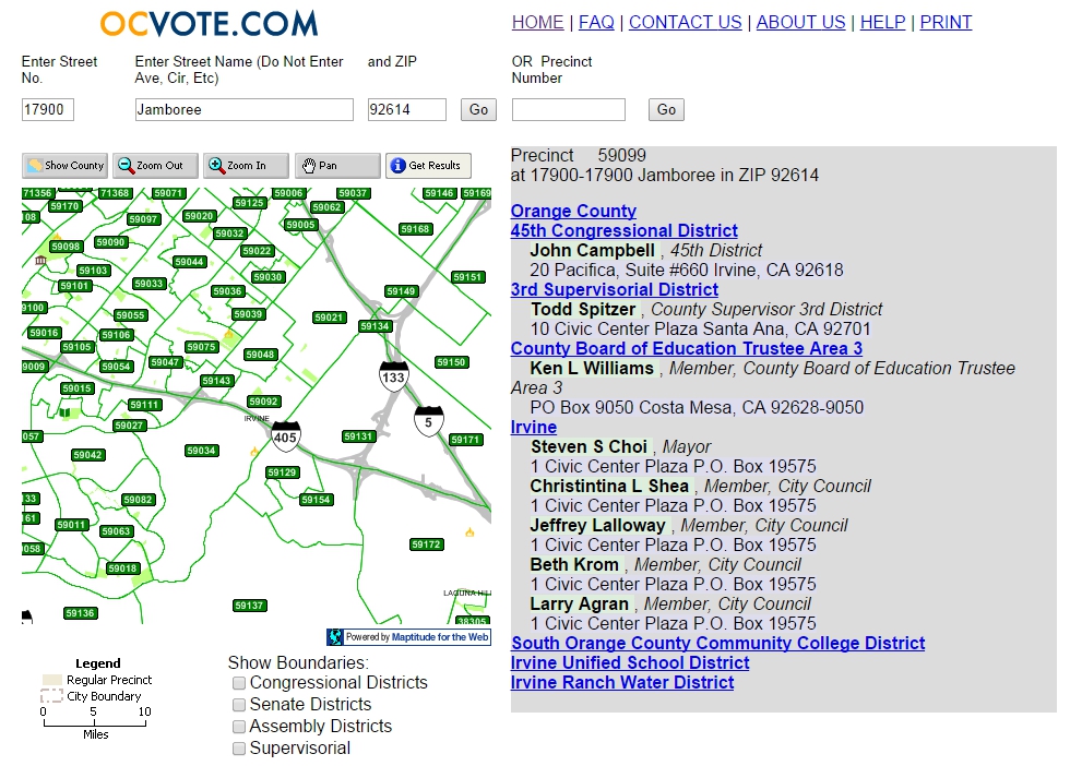
The Orange County OCVote web site displays election and voter information.
Caliper provides consulting services for the design of data used in geographic applications. We support many database formats, including Microsoft SQL Server and Oracle, and the most popular geographic file formats.
We support data conversion, geocoding, and geographic editing of very large databases (millions of records). We support tagging database records with longitude, latitude, postal code (ZIP Code), legislative districts, and Census FIPS codes.
Web Servers: Apache and Microsoft/IIS
Databases: Oracle, SQL Server, MySQL
Server-side languages:
Python,
PHP,
ASP.NET (C#, VB.NET)
Client-side languages: HTML, Javascript (Ajax,
jQuery,
Dojo)
For more information or to get a quote, please contact us at +1 617-527-4700 or email info@caliper.com.
Home | Products | Contact | Secure Store