
A geodatabase is an integrated collection of spatial data that is expertly organized and managed as a single, cohesive unit. This all-encompassing repository serves as a powerful tool for storing, managing, and analyzing various types of spatial data, ranging from geographic features to attributes and relationships. By providing a centralized and structured data environment, geodatabases enable seamless data retrieval and facilitate efficient decision-making processes.
Unusual technology requirements can cause an organization’s GIS implementation plan to fail. Unfortunately, GIS systems are notorious for complex file management issues1. Ideally, single document management should be supported. Maptitude implements single document file management via the workspace (*.wrkz) geodatabase file format.
In addition, Maptitude can directly read, and display point, line, and area features stored in tables in an Esri personal geodatabase. Each table stores points, lines, or areas. Each record has a unique numeric ID, a shape field containing one or more coordinates, and attributes that describe the map feature. An Esri personal geodatabase is stored in Microsoft Access (.mdb) database. Maptitude recognizes Microsoft Access files that contain Esri personal geodatabases and opens a table as a map layer.
Maptitude mapping software uses the workspace (.WRKZ) geodatabase and included geodatabase file support for many other formats including Esri personal geodatabase and file geodatabase
An Esri file geodatabase is a collection of files stored in a folder with a name of the form filename.gdb. Like an Esri personal geodatabase it is designed to have only one writer of the same data at a time but can have many readers of the same data. There is no 2GB size limit as with an Esri personal geodatabase; each feature class can be up to 1TB, and many feature classes can be in one Esri file geodatabase.
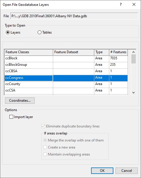
Maptitude can also directly read, and display point, line, and area features stored in feature classes in an Esri file geodatabase. Feature classes can be grouped into feature datasets. Each feature class stores points, lines, or areas. Each record has a unique numeric ID, a shape field containing one or more coordinates, and attributes that describe the map feature. Maptitude only displays the first point for multi-point records.
Maptitude Mapping Software gives you all of the tools, maps, and data you need to analyze and understand how geography affects you and your business.
Learn More Free Trial Free for Students/Teachers
1 Gimond, Manuel. n.d. Chapter 3 GIS Data Management | Intro to GIS and Spatial Analysis. Mgimond.github.io. https://mgimond.github.io/Spatial/gis-data-management.html.

