
If a terrain is flat, you can see all the way to the horizon. If a terrain has hills and valleys, you can see som parts of the terrain, the viewshed, and other parts are hidden.
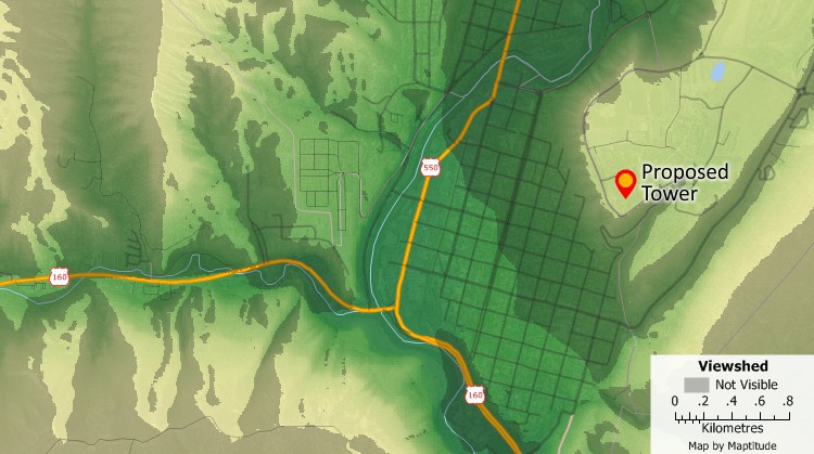
Shaded areas in the map indicate areas outside the viewshed of a proposed tower. The tower will not be visible in these shaded areas.
Maptitude Mapping Software gives you all of the tools, maps, and data you need to analyze and understand how geography affects you and your business. Maptitude includes tools for calculating the areas that you can and cannot see from a specific location.
Learn More Free Trial Free for Students/Teachers

