
Remote sensing is a technology that facilitates the collection of data about the Earth's surface from a distance, typically through satellites, aircraft, or drones. This non-invasive method enables the acquisition of essential information, including topography, land cover, vegetation health, and environmental changes, without direct physical contact with the target area. By employing various sensors, such as LiDAR and multispectral cameras, remote sensing plays a pivotal role in environmental monitoring, disaster response, agriculture, and natural resource management. The data gathered through remote sensing allows scientists, researchers, and decision-makers to assess landscapes at a large scale, understand trends over time, and address critical global challenges related to climate change and sustainable development.
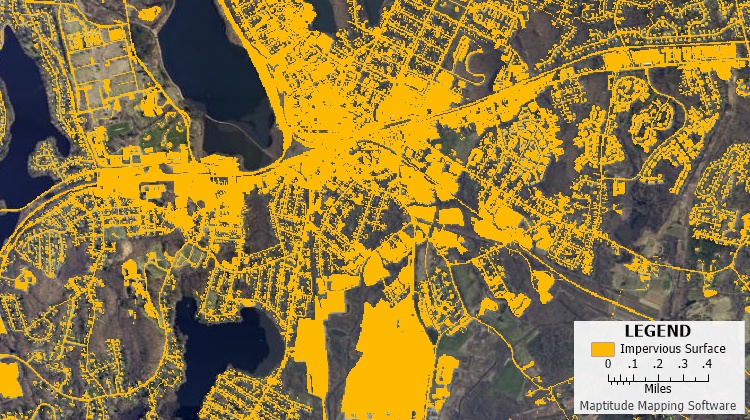
Maptitude Mapping Software gives you all of the tools, maps, and data you need to analyze and understand how geography affects you and your business. Maptitude can map a variety of remotely sensed raster data formats and displays satellite and aerial imagery from a variety of services.
Learn More Free Trial Free for Students/Teachers
1 Gimond, Manuel. n.d. Chapter 3 GIS Data Management | Intro to GIS and Spatial Analysis. Mgimond.github.io. https://mgimond.github.io/Spatial/gis-data-management.html.

