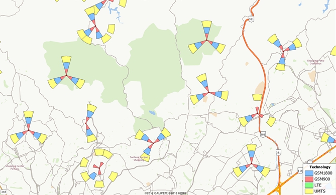
The Sectorization Add-In provides an easy way to show angular coverage of
antennae of different technologies. This tool assumes you have a point table
of antennae that contain azimuth and technology information. This is
particularly useful to show coverage overlaps and gaps in a cellular phone
communication network.
To install:*
- Download and install a
free trial of Maptitude mapping software, or use your own
license of desktop Maptitude.
- Download the file
sectorization-addin.exe.
- Open the file or choose the Run command from the Start menu, and
browse to the sectorization-addin.exe file in the folder where you
downloaded the file.
- Click OK and follow the step-by-step instructions to install the
add-in.
*The Sectorization add-in works only with latest version
of Maptitude.
To Use the Sectorization Add-in:
To Create New Sectors
- Open your antenna layer in a map and make it the working
layer.
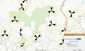
- Choose Tools>GIS Developer's Kit>Add-Ins
and click Sectorization to open the
Sectorization dialog box.
- Choose whether to create sectors for All Features
or a selection set in the first drop-down list.
- Choose the field that contains the kind of technology of
each antenna (e.g., GMS900, GMS1800, etc.) from the Technology
drop-down list.
- Choose the field that contains information about the antenna
azimuth (angular deviation from the North) from the Direction
drop-down list.
- Click Choose Technologies to choose the
technologies that you want to display.
- Adjust the sectorization parameters: Bore Length (and units)
and Bore width (degrees).
- Click OK. Maptitude asks for a file name
for the output sectors layer. Enter a name and click OK.
Maptitude creates the sectors, adds the new layer to the map, and
adjusts the map scale to show all the sectors that were created. You
may want to zoom in to see a detailed display of a small area.
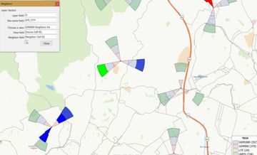
To Load an Existing Sectors Layer
- Choose Tools>GIS Developer's Kit>Add-Ins
and click Sectorization to open the
Sectorization dialog box.
- Choose the Load Existing Sectors tab (This
tab will be displayed by default if the working layer is not an
antenna or sector layer).
- Click Load and choose the file that
contains your sector layer and click OK. The
Choose the Technology Field dialog box is displayed.
- Choose the field with the technology information from the
drop-down list and click OK.
- The sector layer is added to the map and the Create
New Sectors tab will be activated.
- Click OK to close the dialog box or go to
step 3 below to modify the bore length and bore width of the
sector layer you just added.
To Modify Bore Length and Bore Width of Sectors
- Open a map that contains your sectors layer.
- Choose Tools>GIS Developer's Kit>Add-Ins
and click Sectorization to open the
Sectorization dialog box.
- Choose whether to create sectors for All Features
or a selection set in the first drop-down list.
- Choose the field that contains information about the antenna
azimuth (angular deviation from the North) from the Direction
drop-down list. (The Technology drop-down list
and the Choose Technologies button are
disabled. Changes will be applied to all technologies.)
- Adjust the sectorization parameters: Bore Length (and units)
and Bore Width (degrees).
- Click OK.