This video shows how to map and analyse your data using Maptitude and the Canada Country Package. | 6:34 minutes
Maptitude Canada Mapping Software
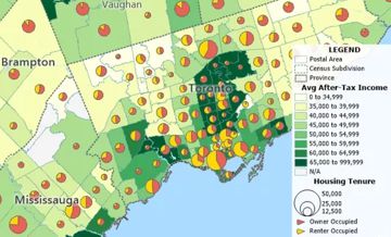
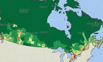
Maptitude Canada Country Package
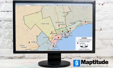
Best Territory Mapping Software Canada
Home | Products | Contact | Secure Store
Copyright © Caliper Corporation