Maptitude Geographic Information System (GIS) software is the intelligent mapping solution for business, government, and education. Maptitude is a powerful combination of software and geographic data that provides everything you need to realize the benefits of desktop mapping and spatial analysis with a single, easy-to-use package. Maptitude includes one free Country Package of your choice (a US$695 value).
Priced at only US$795, Maptitude with the India Country Package is the best buy for those looking for India and world mapping software.
Maptitude mapping software for India.
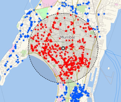
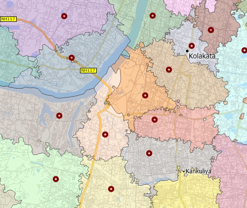
Locate your customers with Maptitude India mapping software
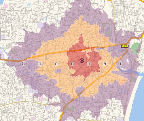
Perform drive-time analysis
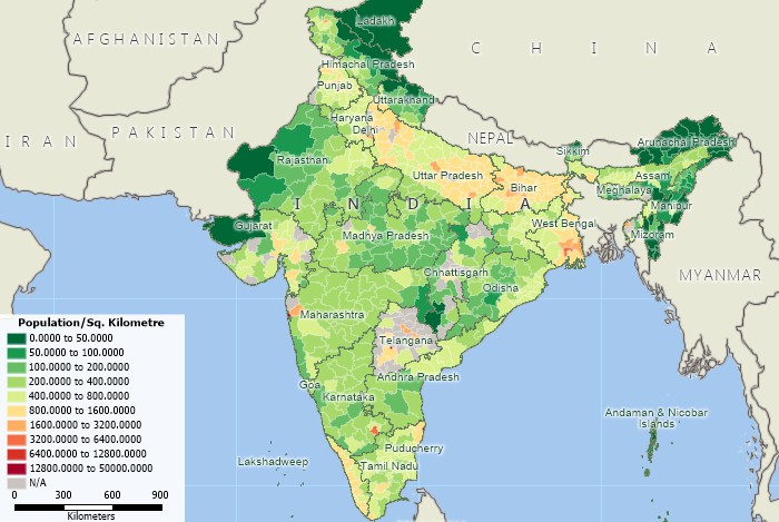
Visualise spatial patterns
 |
“It was a great experience to learn and utilize the Maptitude GIS software in my research. There are endless opportunities with Maptitude which are yet to be explored in the area of a sustainable supply chain especially in the realm of renewable energy and aviation biofuels. I look forward to conducting further research with the utilization of Maptitude GIS software for the betterment of the world and our ecosystems, with a green, renewable, and promising future ahead.”
|
The India Country Package requires Maptitude 2013 or later and it is available to existing Maptitude users for US$695.
The India Country Package includes extensive geographic data so that you can get started as soon as you install the software. The following geographic files are included with the Maptitude India Country Package:
| Nationwide HERE India Geographic Data Layers |
|---|
HERE data are from October
2012. |
Create catchment areas and territories
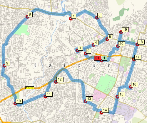
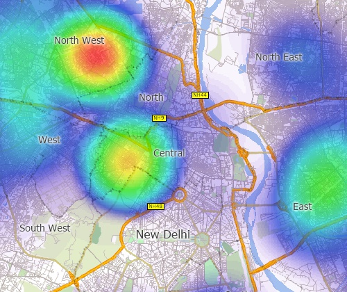
Find optimised routes serving multiple stops
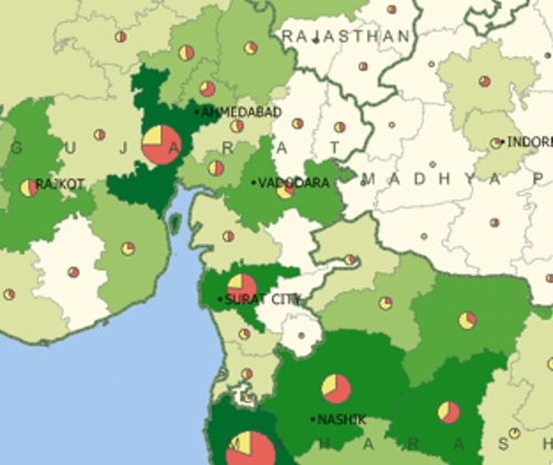
Create many types of thematic maps
For more information on Maptitude please visit the Maptitude Overview Page or email a request for a live demo now.
Home | Products | Contact | Secure Store
