A buffer is an area that surrounds one or more map features. The size of a buffer can be a specified width (e.g., 5 miles from a store, 1000 feet from a school, 1km from a highway) or variable based on some attribute (e.g., contains 10,000 households).
With a GIS you can build buffers and estimate the demographic attributes for those buffers. For example, you could find out the population and average income of people that live within 5 miles of a site that you are considering for a store, or you can find the number of people within 1/2 mile of a proposed bus route and what their average car ownership is.
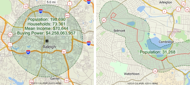
The map on the left shows a 5 mile buffer around a point location and the estimated attributes for that buffer. The map on the right shows a 1/3 mile buffer around a bus route and the population within that buffer.
Maptitude Mapping Software gives you all of the tools, maps, and data you need to analyze and understand how geography affects you and your business. Build buffers around point, line, or area features and compute the demographic attributes for the buffers.
Learn More Free Trial Free for Students/Teachers