An attribute is a data value associated with a particular feature in a GIS layer—for example, the name associated with a particular street, the population of a particular city, or the median household income of a postal code area. Each feature in a GIS layer (each point, line, or area) can have its own, unique set of attributes.
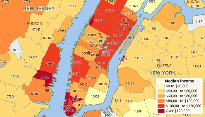
Use the attribute data assoicated with map layers in a GIS to chreate choropleth maps, label map features, and much more.
Maptitude Mapping Software gives you all of the tools, maps, and data you need to analyze and understand how geography affects you and your business. Maptitude Country Packages come packed with Census attribute data from the State level down to the Census Tract level.
Learn More Free Trial Free for Students/Teachers
Home | Products | Contact | Secure Store
