In geography, longitude is the distance on the earth’s surface, east or west of a defined meridian, usually the meridian of Greenwich, England (0° Longitude), expressed in angular measurements from 180° West (or -180°) to 180° East. Latitude and longitude can be used together to specify a precise location on the Earth.
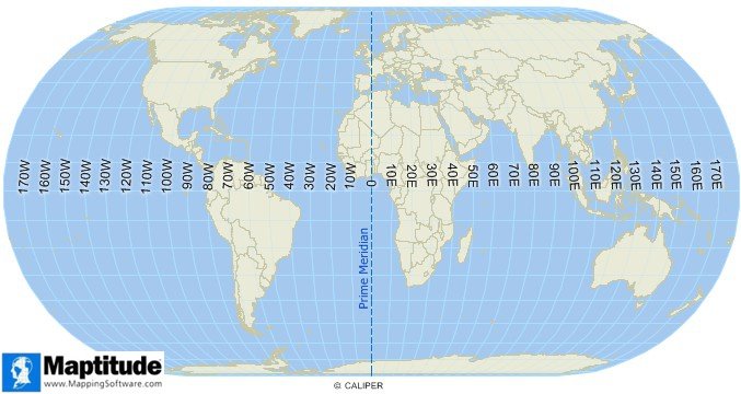
Longitude is expressed in degrees East or West of the Prime Meridian.
Maptitude Mapping Software gives you all of the tools, maps, and data you need to analyze and understand how geography affects you and your business. Maptitude includes tools for locating your data using latitude and logitude coordinates, address, postal code, and more.
Learn More Free Trial Free for Students/Teachers
Home | Products | Contact | Secure Store
