Topology refers to the spatial relationships and connectivity between geographic features. It defines how features are related to each other in terms of adjacency, containment, and connectivity. Topological relationships are essential for maintaining data integrity and accuracy. Topological data models allow GIS users to conduct network analysis, route finding, and geometry validation, ensuring that geographic features behave realistically and consistently in spatial analysis.
Maptitude has Active Topology™ map editing, a feature that helps you get the result you want when you edit a map. For example, suppose you are editing a road layer and move an intersection. As shown below, Maptitude automatically adjusts all of the streets that meet at the intersection
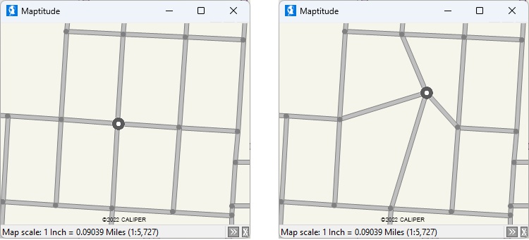
With a topological street layer, if you move the highlighted intersection, all of the connected streets are updated as well
Maptitude geographic file formats enforce topology by default. This avoids the issues common to formats such as Shapefiles, that include slivers, overlaps, and open polygons. Through export or import, Maptitude can create the topology for non-topological area and line layers, including Esri Shapefile, MapInfo TAB, Oracle Spatial, SQL Server Spatial geographic files.
Maptitude Mapping Software gives you all of the tools, maps, and data you need to analyze and understand how geography affects you and your business. Maptitude supports many file formats, both topological and non-topological.
Learn More Free Trial Free for Students/Teachers
1 Gimond, Manuel. n.d. Chapter 3 GIS Data Management | Intro to GIS and Spatial Analysis. Mgimond.github.io. https://mgimond.github.io/Spatial/gis-data-management.html.
Home | Products | Contact | Secure Store
