Maptitude Geographic Information System (GIS) software is the intelligent mapping solution for business, government, and education. Maptitude is a powerful combination of software and geographic data that provides everything you need to realize the benefits of desktop mapping and spatial analysis with a single, easy-to-use package. Priced at only US$795, Maptitude is the best buy for those looking for mapping software.
In addition, Maptitude includes one FREE Country Package of your choice (a US$695 value). Choose the Australia Country Package to get Australia maps and detailed demographic data for postal areas, suburbs, and statistical areas.
Maptitude mapping software for Australia.
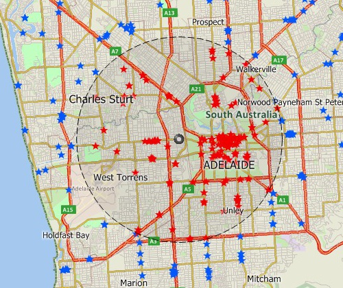
Locate your customers with Maptitude Australia mapping software
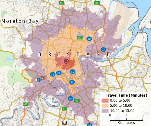
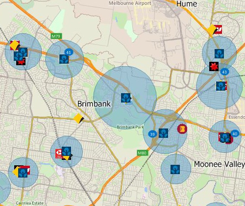
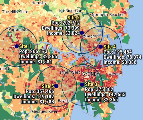
Perform drive-time analysis
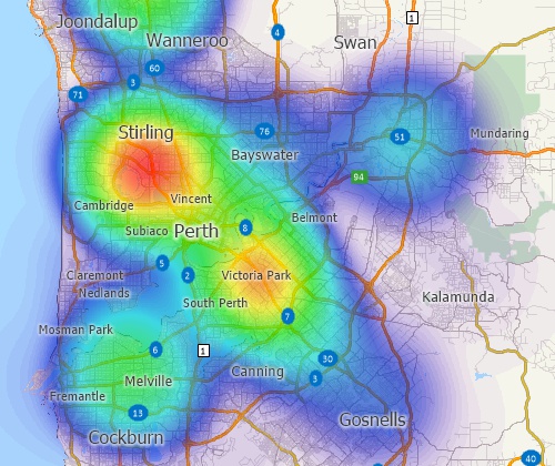
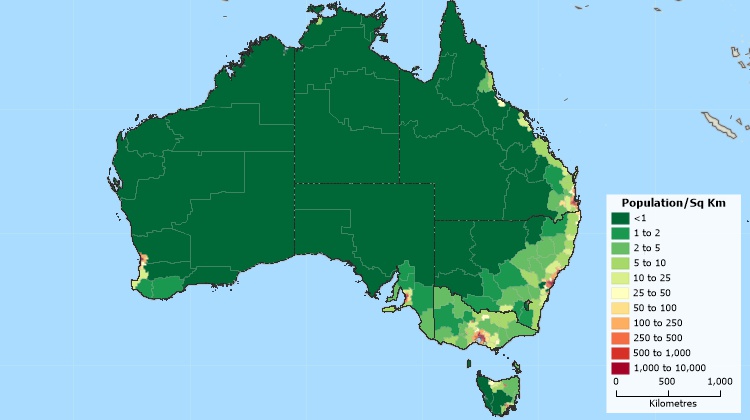
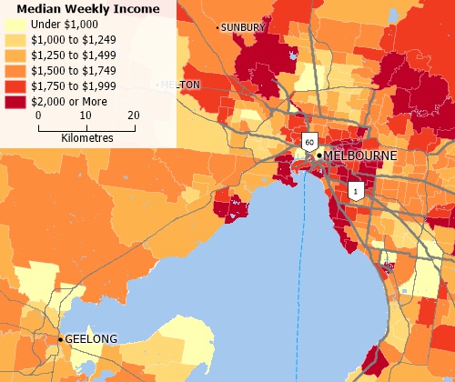
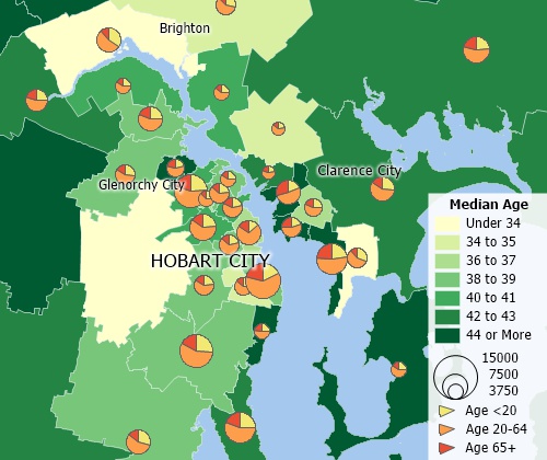
Visualise spatial patterns
The 2026 Australia Country Package requires Maptitude 2026 or later and it is available to existing Maptitude users for US$695.

|
“Our applications to government healthcare authorities need to show locations of proposed equipment or practices, proximity to other healthcare organisations, patient catchment areas, incidence of illness by statistical local area and much more. Prior to MAPTITUDE our submission was based on WORDS rather than VISUALS. Maptitude has made it easier for us to build submissions and easier for healthcare authorities to review and approve.”
|
The Australia Country Package for Maptitude includes extensive geographic and demographic data so that you can get started as soon as you install the software. The following geographic files are included:
| Nationwide HERE Australia Geographic Data Layers |
|---|
|
| Other Included Australia Data |
|---|
|
Create balanced territories
Australia map tools
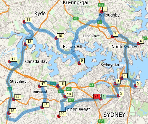
Find optimised routes serving multiple stops
 |
“Maptitude is a versatile easy to use GIS platform. It's good value for money and easy to use. [My favorite aspect of the software is the] incorporation of key census data into the platform, drive time, and districting functionality.”
|
Over 700 fields of 2021 Census data describing population, age distribution, birthplace, citizenship, education, ancestry, religious affiliation, housing costs (mortgage, rent), income, marital status, dwellings, employment, vehicle accessibility, and method of travel to work are included for the following geographic layers:
The following layers also contain more limited demographic data:
Includes demographics for states down to level 1 statistical areas
Analyse locations with Maptitude Australia map software
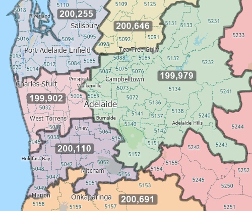
Create many types of thematic maps

|
“Maptitude helped me to quickly locate and exhibit post code hot spots across the country in an effective and attractive way - it's turned my extensive datasets into compelling stories, and helped build credibility with my clients and the wider community.”
|
Banking Map Software Australia
Business Mapping Software Australia
Enterprise GIS Software Australia
Franchise Mapping Software Australia
GIS Mapping Software Australia
Health Care Mapping Software Australia
For more information on Maptitude please visit the Maptitude
Overview Page or request
a
live demo now.
Home | Products | Contact | Secure Store
