Maptitude Geographic Information System (GIS) software is the intelligent mapping solution for business, government, and education. Maptitude is a powerful combination of software and geographic data that provides everything you need to realize the benefits of desktop mapping and spatial analysis with a single, easy-to-use package. Maptitude includes one free Country Package of your choice (a US$595 value).
Priced at only US$695, Maptitude with the Argentina Country Package is the best buy for those looking for Argentina and world mapping software.
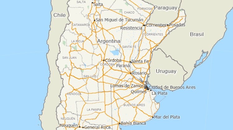
Maptitude mapping software for Argentina.
Locate your customers with Maptitude Argentina mapping software
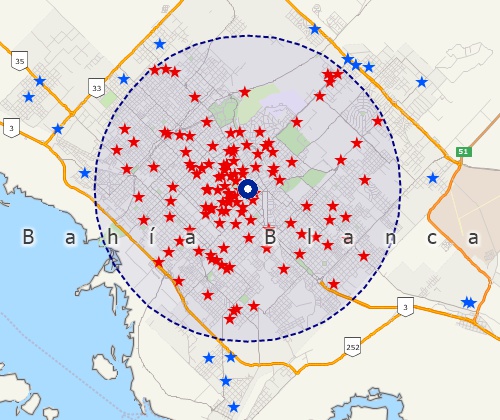
Perform drive-time analysis
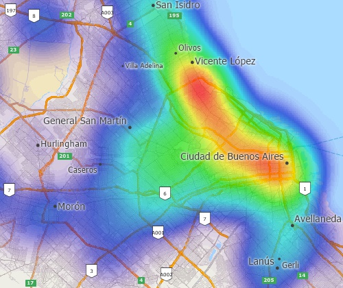
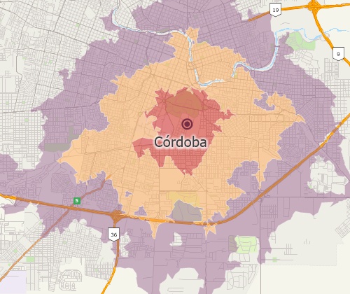
Visualise spatial patterns
The Argentina Country Package requires Maptitude 2020 or later and it is available to existing Maptitude users for US$595.
 |
“I had the wonderful opportunity to study Urban Economics in Buenos Aires, Argentina. This opportunity taught me how to use a very important mapping software, Maptitude. I used the skills I had learned to create a report on the rise in mixed-use development in Buenos Aires. I was also able to map ammenities in different parts of Buenos Aires and draw comparisons. This was an unforgettable experience and I hope to continue learn more skills and topics in this fascinating world of Economics.”
|
The Argentina Country Package includes extensive geographic data so that you can get started as soon as you install the software. The following geographic files are included with the Maptitude Argentina Country Package:
| Nationwide HERE Argentina Geographic Data Layers |
|---|
HERE data are from October
2019. |
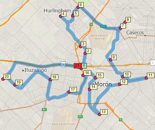
Find optimised routes serving multiple stops
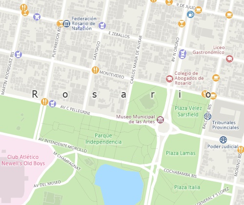
Create Argentina maps at any scale
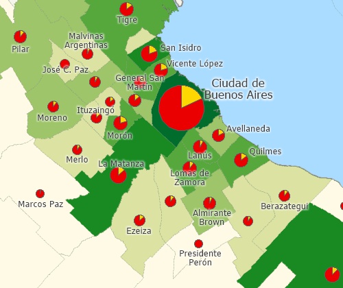
Create many types of thematic maps
For more information on Maptitude please visit the Maptitude Overview Page (English or Español) or email a request for a live demo now.
Home | Products | Contact | Secure Store
