Maptitude is leading location intelligence software that helps businesses transform complex geographic data into actionable insights. By integrating GIS mapping, business analytics, and location-based visualization, Maptitude supports faster planning, reveals high-value opportunities, and improves decisions across every department.
Whether you're identifying new markets, analyzing customer behavior, or optimizing distribution routes, Maptitude reveals hidden opportunities and drives growth. For just $795, get a complete professional solution: extensive demographics, geocoding, and analytics included. Easy to learn, powerful enough to handle billions of records, and integrates seamlessly with Excel, Access, and any CRM.
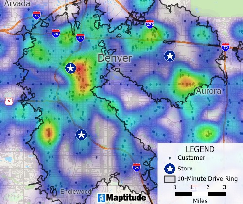
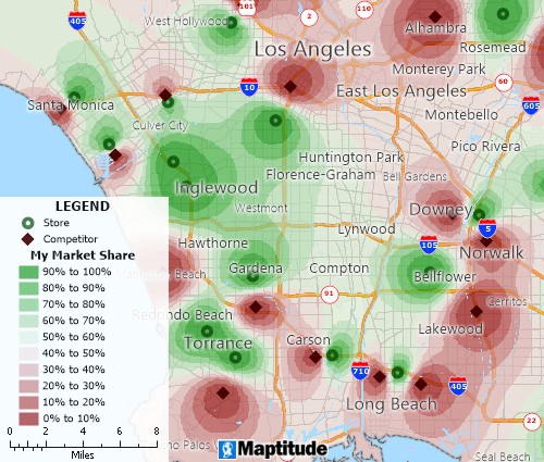
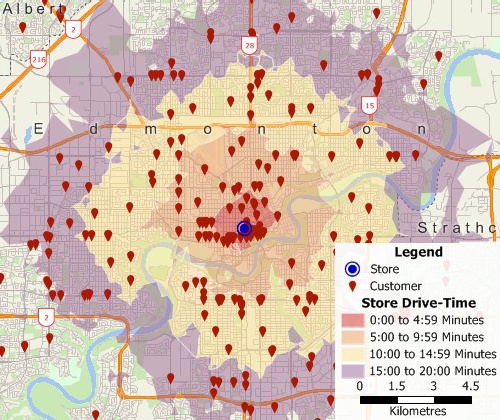
Location intelligence software combines geographic and GIS data with business information to uncover meaningful patterns. By visualizing data on maps and using spatial analysis (such as clustering, territory management, and proximity calculations) organizations identify trends that traditional analytics often overlook, helping teams act with greater accuracy.
Key capabilities include:
Businesses across retail, logistics, finance, real estate, and government use location intelligence software to make smarter decisions, improve operational efficiency, and identify growth opportunities. Analysts and managers map customer locations, analyze sales territories, and track market trends—turning spatial data into competitive advantage.
Maptitude Location Intelligence Software merges geographic analysis with business data to support smarter, faster decisions. Its professional-strength platform handles massive datasets, connects with BI tools, and transforms detailed spatial information into visual intelligence that any team member can use immediately.
Key Features:
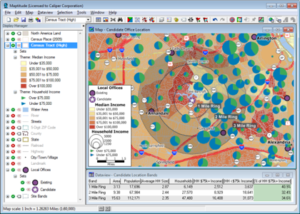
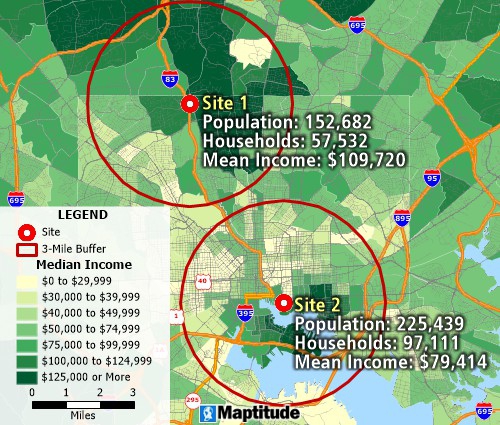
Use Maptitude business location software to map your customer data, determine accessibility, and more.
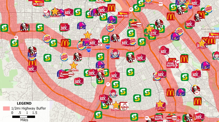
Make informed business decisions with Maptitude business intelligence GIS.
Location intelligence software turns geographic data into practical guidance that strengthens planning and operational efficiency. By analyzing spatial patterns and visualizing data on maps, organizations uncover market trends, pinpoint growth potential, and prioritize regions that offer the highest return.
Key Benefits:
By integrating location intelligence into business operations, companies make faster, more informed decisions and drive measurable growth through better use of geographic data.
Location analytics
Location based analysis of your region or custom territories
Location intelligence software supports a wide range of industries by connecting geographic data with business context. Organizations use location analytics to refine strategies, streamline operations, improve customer insight, and uncover new opportunities that drive measurable outcomes.

|
“Pros: Cost. Much easier to reach a purchasing decision. I loved the integrated country data package so I didn't have to download census layers and other info - it was all built in.”
|
Maptitude mapping software is a robust and easy-to-use professional LI tool. Maptitude provides all the features that your organization requires in order to take advantage of the geographic elements of your data, and to effectively explore information.
Maptitude costs only US$795 and is packaged as a one-stop-solution, shipping with all the tools and data required to investigate business performance to gain insight and drive business planning. These include extensive demographics, consumer segmentation data, and address/postal geocoding and validation.
Since 1995, Maptitude has provided cost-effective location intelligence solutions to businesses of all sizes, enabling them to realize the benefits of location based analysis, a technology usually restricted to large corporations. Maptitude provides a way to extend the capabilities of all business analysts. With a focus on usability, Maptitude has consistently been labeled as the easiest-to-use professional mapping software (read reviews here).
Maptitude has a variety of licensing models ranging from single usage to Cloud access. Maptitude can be used as a desktop application whether or not you are connected to the Internet, which reduces the risk of exposing your databases and allows use in the field. As an Enterprise GIS (Geographic Information System), Maptitude allows widespread use of mapping software throughout an organization, where multiple users can manage, share, and use geographic data for analysis and presentation (More...). Also, Maptitude Online maps are accessible via browser-based interfaces on mobile devices.
Maptitude allows you to directly utilize your corporate data via extensive file format support, which includes Microsoft Office (Excel and Access) and any CRM database via ODBC. You also have complete control over the way your maps look, and can customize them in any way that you require.
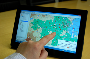
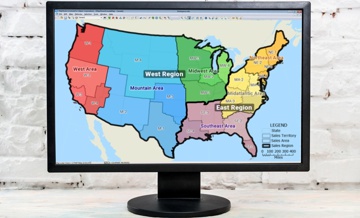
Maptitude location intelligence map on a mobile tablet device
The Maptitude product suite is not limited to the USA. There are now 24 Country Packages available covering: 3 of the 5 fast-growing BRICS economies (Brazil, South Africa, and India); 6 of the Group of Seven (G7) nations (including the USA); and 12 of the Group of Twenty major economies (including Australia).
Maptitude remains the most competitively priced professional location intelligence software available and is unique in the marketplace for the provision of comprehensive data and functionality in a single product for a single low price.
Contact Maptitude Sales today at: sales@caliper.com.

|
“As a GIS professional I have used Caliper products for 20 years. Maptitude is the GIS software I recommend to my clients, because of its perfect balance between ease of use, analytic power and wealth of geographical data bundled with each new release. With Maptitude, uses both seasoned and beginners can start creating meaningful, informative maps in a couple of days. Despite its smooth learning curve, it has powerful resources for developing complex spatial applications. I have used Maptitude in business intelligence, academic research, environmental consulting, land management and GIS education. In all cases, Maptitude allowed me to develop my projects efficiently and at a low cost.”
|
 Check out our G2 Reviews
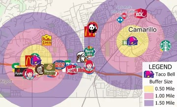

Home | Products | Contact | Secure Store