Maptitude Geographic Information System (GIS) software is the intelligent mapping solution for business, government, and education. Maptitude is a powerful combination of softwa re and geographic data that provides everything you need to realize the benefits of desktop mapping and spatial analysis with a single, easy-to-use package. Maptitude includes one free Country Package of your choice (a US$695 value).
Priced at only US$795, Maptitude with the Mexico Country Package is the best buy for those looking for Mexico and world mapping software.
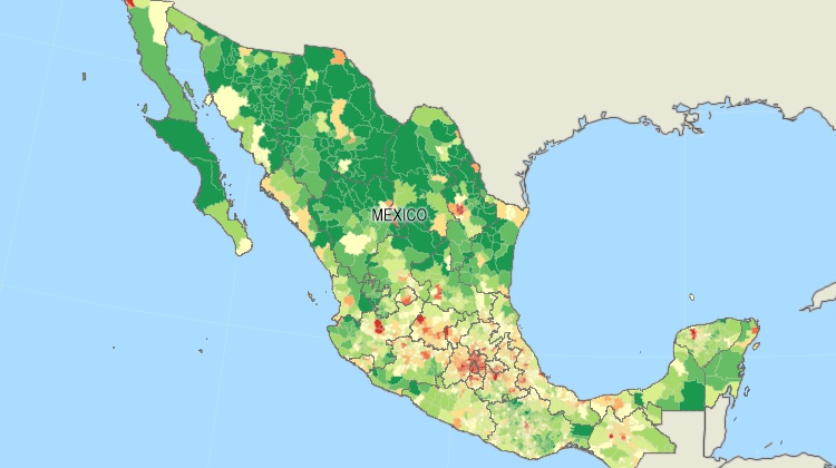
Maptitude mapping software for Mexico.
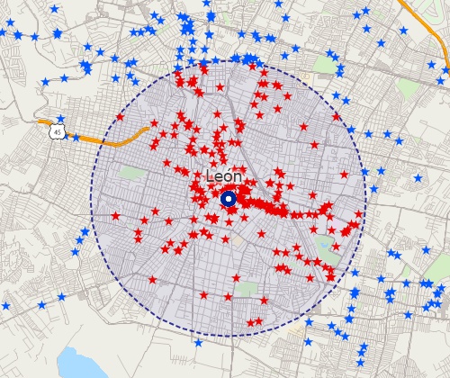
Locate your customers with Maptitude Mexico mapping software
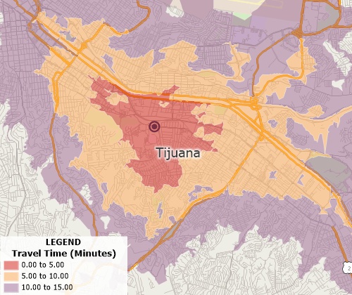
Perform drive-time analysis
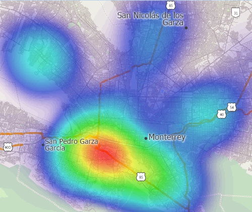
Visualise spatial patterns
The 2026 Mexico Country Package requires Maptitude 2026 or later and it is available to existing Maptitude users for US$695.

|
“I used Maptitude and the Mexico map database to create maps for inclusion in my dissertation. The world-class professors on my committee asked me to make hundreds of changes, which took me about a year. Amazingly, not one complaint about the maps, they were stunningly beautiful and I was even able to successfully include 1-hour drive-rings in the extremely rural and isolated huasteca veracruzana.”
|
The Mexico Country Package includes extensive geographic data so that you can get started as soon as you install the software. The following geographic files are included with the Maptitude Mexico Country Package:
| Nationwide HERE Mexico Geographic Data Layers |
|---|
HERE data are from October 2025. |
| Other Included Mexico Data |
|---|
|
316 fields of demographic data describing population, age, gender, employment, schooling, literacy, disability, households, language spoken, nativity, healthcare, marital status, and housing units for the following geographic layers:
223 fields of demographic data describing population, age, gender, employment, schooling, literacy, households, language spoken, nativity, healthcare, marital status, and housing units for the following geographic layer:
255 fields of demographic data describing population, age, gender, disability, employment, schooling, literacy, households, language spoken, nativity, healthcare, marital status, and housing units for the following geographic layer:
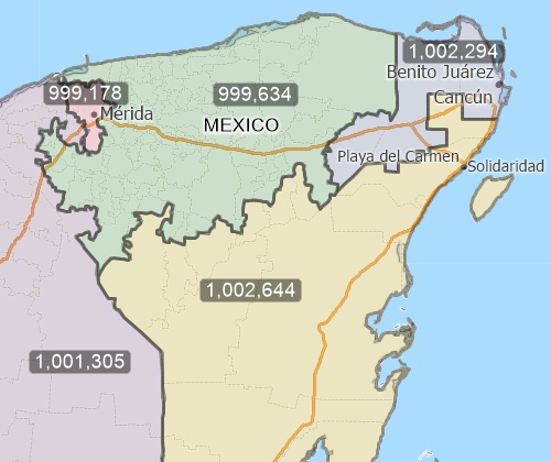
Create balanced territories
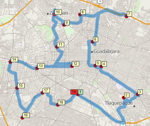
Find optimized routes serving multiple stops
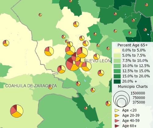
Create many types of thematic maps
For more information on Maptitude please visit the Maptitude Overview Page (English or Español) or email a request for a live demo now.
Home | Products | Contact | Secure Store
