NEWTON, MASSACHUSETTS (USA) - Maptitude 2018 dominates the space vacated
by MapPoint, supporting Microsoft MapPoint-like tools & queries. With
enhanced versions of the features that MapPoint users are familiar with,
Maptitude retains the ease-of-use of MapPoint while providing
functionality that Microsoft MapPoint users could only wish for.
The new and improved tools include:
- The ability to link to external data such as an Excel
spreadsheet and to update your map layer based on changes in
your table without having to reimport your data from scratch
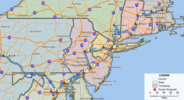
- Support for waypoints from MapPoint and Streets & Trips
(.PTM, .EST, .AXE) that further helps Maptitude to fill the void
since the discontinuation of Microsoft MapPoint
- An updated Create-a-Map Wizard™ that allows you to add
shaded boundaries to an existing map
- Improved design for the
one-click export to Excel reports
Maptitude 2018 also includes tools that were never available in
MapPoint:
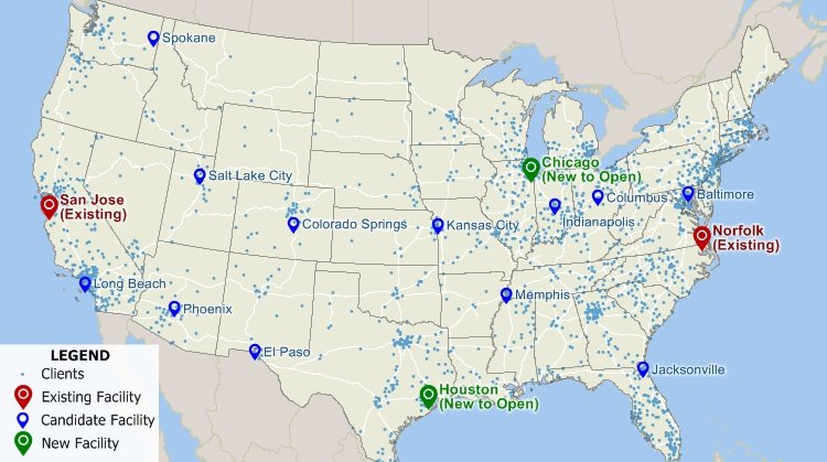
- A
Facility Location wizard for site selection analysis that
helps you to identify the best locations for servicing your
customers or target market.
- A
3-D theme tool that supports the visualization of two
columns of data rather than just one, via choices for both color
and height, for layers such as postal/ZIP Codes or sales
territories.
- A
distance calculator that can create travel time or
distance tables between ZIP Codes or any other layer.
About Caliper
Caliper Corporation
develops state-of-the-art
Geographic Information Systems (GIS) software. With a focus on
usability,
Maptitude is designed to be a cost-effective, professional
mapping software product. Maptitude enables organizations to
leverage their location-based data to improve decision making and
planning, while minimizing expenditure through competitively priced
solutions.
Caliper is a privately held corporation and is a leading developer
of mapping,
redistricting,
transportation, and
GIS software.
Maptitude and Caliper are registered trademarks of Caliper Corporation. MapPoint
and Streets & Trips are registered trademarks of Microsoft. All other brand or product names are trademarks or registered trademarks of their respective holders.