| Mapping, GIS, & Transportation Software Solutions |
| Mapping, GIS, & Transportation Software Solutions |
NEWTON, MA (USA) - Maptitude 2020, a major release of the popular GIS (Geographic Information System) and mapping software, is available now. Maptitude provides a comprehensive solution for operations and market research analysts in sectors ranging from health, banking, franchising, business, education, military, and government.
Maptitude 2020 includes the most up-to-date and accurate data available that encompasses expenditure, geodemographic segments, gross domestic product, medical and banking locations, branded business locations, traffic counts, and the tools to leverage this information to improve the location intelligence of any organization.
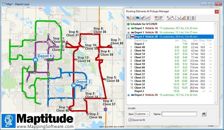
Maptitude 2020 allows you to model multiple-vehicle fleets for routing deliveries and pickups, automatically create balanced territories, and cluster locations based on travel costs and attributes.
The Facility Location tool supports “What if?” analyses (where the placement of new facilities is unknown) by allowing an unlimited number of target sites to be analyzed.
When modeling routes, you can set the Automatic Rest setting to be any value, and with no overnight break, allowing you to model long-haul routes while adhering to government rules such as those for interstate truck drivers in the USA.
Tutorial files now provide sheets for sample clients, sites, and depots to allow you to quickly familiarize yourself with the analytical capabilities of Maptitude.
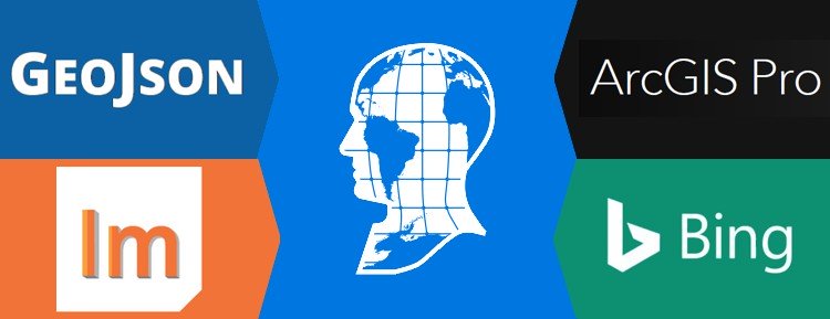
Data scientists can access their favorite data sources in their preferred file formats. Interoperability with external data has been expanded with support for GeoJSON files and for Esri ArcGIS® Pro. In addition, you can connect to external services such as Microsoft Bing™ to analyze driving, public transportation, or walking travel times, or real-time travel by arrival time, departure time, and date.
Interoperability with the Maptitude API has been expanded with PostgreSQL functions and support for Intellisense in our Microsoft Visual Studio add-on.
Caliper Corporation develops state-of-the-art Geographic Information Systems (GIS) software. With a focus on usability, Maptitude is designed to be a cost-effective, professional mapping software product. Maptitude enables organizations to leverage their location-based data to improve decision making and planning, while minimizing expenditure through competitively priced solutions.
Caliper is a privately held corporation and is a leading developer of mapping, redistricting, transportation, and GIS software.

|
“We cannot recommend Maptitude enough! The software offers a number of different features and is packed full of free data. It's cost effective as well. The platform is very easy to navigate and there are many options for in-person trainings, webinars, and tutorials to further your knowledge of the software. Maptitude Customer Service deserves an A+.” Chelsey Pousland |

|
“Overall, this product makes it incredibly simple to visualize and map both customer & company specific data. It is very intuitive and easy to pickup from the get go. I highly suggest utilizing a quick training video or session as it will improve your usability 10 fold with just a few tips & tricks. This product is incredible for what it was built for.” Matt Rosenfield |
Home | Products | Contact | Secure Store