Maptitude Geographic Information System (GIS) software is the intelligent mapping solution for business, government, and education. Maptitude is a powerful combination of software and geographic data that provides everything you need to realize the benefits of desktop mapping and spatial analysis with a single, easy-to-use package. Priced at only US$795, Maptitude is the best buy for those looking for mapping software.
In addition, Maptitude includes one FREE Country Package of your choice (a US$695 value). Choose the New Zealand Country Package to get New Zealand maps and detailed demographic data for mesh blocks and regions.
Maptitude mapping software for New Zealand.
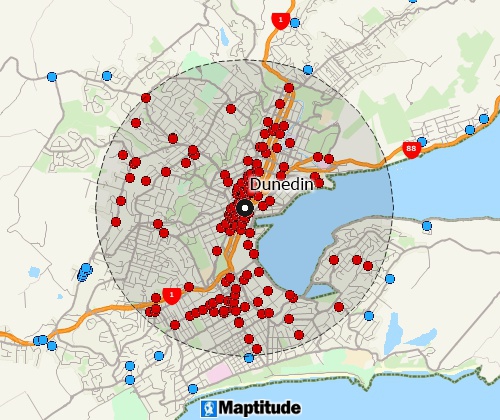
Locate your customers with Maptitude New Zealand mapping software
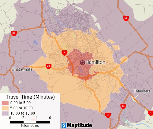
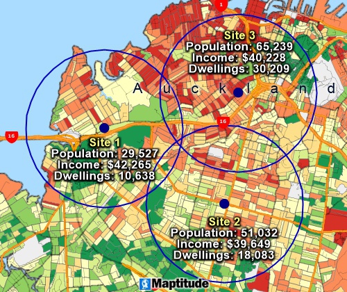
Perform drive-time analysis
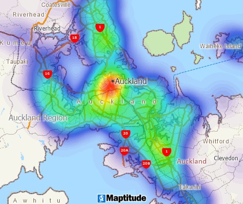
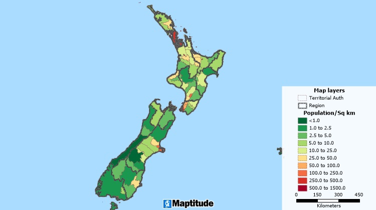
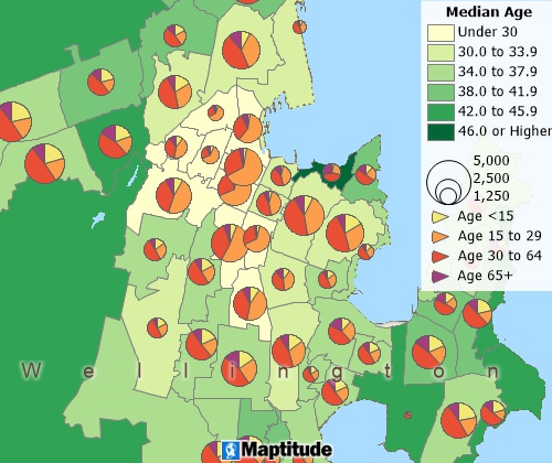
Visualise spatial patterns
The 2025 New Zealand Country Package requires Maptitude 2025 or later and it is available to existing Maptitude users for US$695.
 |
“No other product I looked at provided such a simple means to defining and communicating regional boundaries. The level of data that sits behind this tool set is the most comprehensive I have seen to date. I didn't want to have to manually draw lines and, except for a few remote geographical instances, I didn't have to.”
|
The New Zealand Country Package for Maptitude includes extensive geographic and demographic data so that you can get started as soon as you install the software. The following geographic files are included:
| Nationwide HERE New Zealand Geographic Data Layers |
|---|
HERE data are from October 2024. |
| Other Included New Zealand Data |
|---|
|
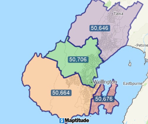
Create balanced territories
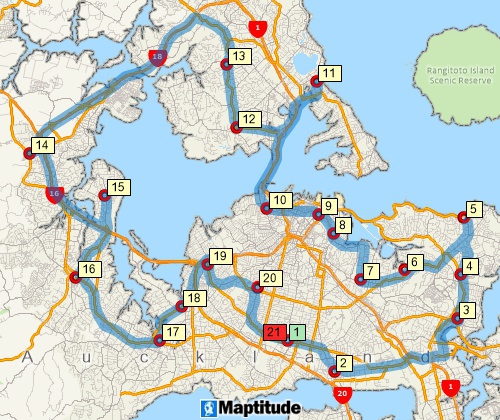
Find optimised routes serving multiple stops
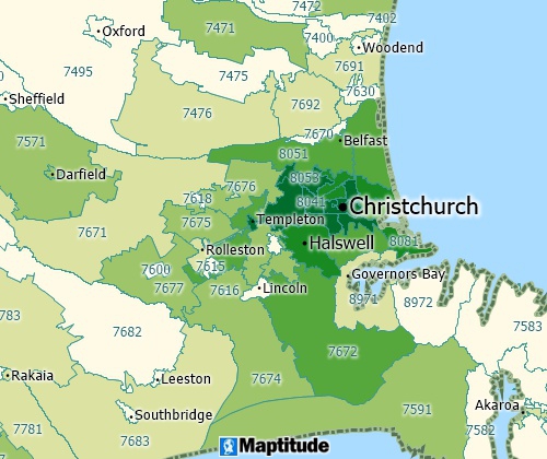
Visualise your data by attaching it to postal code areas
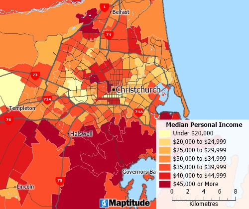
Over 450 fields of 2018 Census demographics describing population, age, gender, birthplace, ethnicity, language spoken, marital status, education, income, employment, dwellings vehicles, and rent for the following geographic layers:
Includes demographics for regions down to statistical areas
Analyse locations with Maptitude New Zealand map software
Create many types of thematic maps
Banking Map Software New Zealand
Business Mapping Software New Zealand
Census Data Mapping New Zealand
Enterprise GIS Software New Zealand
Franchise Mapping Software New Zealand
GIS Mapping Software New Zealand
Health Care Mapping Software New Zealand
Marketing & Sales GIS Software New Zealand
Postcode Mapping Software New Zealand
Real Estate Mapping Software New Zealand
Route Planning Software New Zealand
Site & Facility Location Map Software New Zealand
Street Mapping Software New Zealand
Territory Mapping Software New Zealand
For more information on Maptitude please visit the Maptitude Overview Page or email a request for a live demo now.
Home | Products | Contact | Secure Store
